Land Survey Cost Explained: What You Need to Know Now Lakeville, MA
Did you know over 70% of real estate disputes in Lakeville, MA, begin with unclear property lines? Whether you’re a homeowner considering a property improvement, a developer aiming to break ground, or an architect preparing a site plan, understanding land survey cost in Massachusetts is not optional—it’s essential for project approval, legal security, and avoiding expensive setbacks. This comprehensive guide breaks down what impacts survey costs, what Lakeville and MA regulations demand, and exactly how to avoid hidden pitfalls in your next real estate project.
Startling Facts About Land Survey Cost in Massachusetts
- Why land survey cost surprises so many MA property owners: Many underestimate the complexity, legal stakes, and regulatory layers involved—until a dispute or permit denial happens.
- Statistic: Over 70% of Lakeville, MA real estate disputes start with unclear property lines, often when professional land surveyors weren’t used or proper surveys weren’t obtained.
- How survey cost connects to legal and financial risk: In Massachusetts, a proper survey isn’t just about money—it’s the key to protecting your investment, enabling construction, and preventing fines or lawsuits. Homeowners, developers, and realtors all face major risks if survey costs are skipped or underestimated.

“Precision in land surveying isn’t just best practice—it’s required for project approval throughout Massachusetts.” — Prime Engineering Senior Surveyor
What You’ll Learn About Land Survey Cost in Lakeville, MA
- The average land survey cost in Massachusetts—and what drives that price
- Types of land surveys mandated for construction, purchase, and permit applications
- How to choose a professional land surveyor for compliance and accuracy
- Common mistakes (and hidden costs) to avoid in Lakeville
- Real examples and case studies from successful (and costly) Lakeville, MA projects
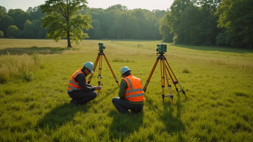
Understanding Land Survey Cost: The Foundation for Every Project
Why Land Survey Cost Matters for Massachusetts Projects
- Project approvals: Every major construction or improvement in Lakeville must pass the zoning, conservation, and building department review. A land survey is the first—and most scrutinized—requirement.
- Property line protection: Your land’s boundaries, corners, and rights are only as reliable as the land survey establishing them. Disputes over boundary lines can stall or stop projects—and quickly snowball into legal battles.
- Preventing project delays, fines, and legal disputes: The right land surveyor shortens permit timelines, resolves boundary issues early, and keeps costs predictable. Missing or bad surveys can cause rework, penalties, and permit denials costing thousands (or halting sales and construction entirely).

Regulatory Landscape: Local and State Laws Impacting Land Survey Cost
- Lakeville permitting requirements: Local bylaws define what survey type is needed—for everything from decks, sheds, pools, and additions to full site development.
- Massachusetts Wetlands Protection Act: Projects near water or in designated areas demand additional survey detail and regulatory filings, adding complexity and cost.
- Conservation Commission approvals: Precise survey documentation is mandatory if your land borders wetlands, floodplains, or conservation lands—each layer adds deliverables and affects the land survey cost.
Video:What Drives Land Survey Cost in Massachusetts?(Short animated overview—available at Prime Engineering)
Land Survey Cost in Lakeville, MA: Average Prices and Influencing Factors
Average Land Survey Cost in Lakeville and Massachusetts
| Type of Survey | Typical MA Cost (2024) | Factors Affecting Cost |
|---|---|---|
| Boundary survey | $850–$2,400 | Parcel size, history, terrain |
| Topographic survey | $1,200–$3,500 | Elevation changes, site complexity |
| Mortgage survey | $600–$1,200 | Timing, lender scope |
| ALTA/NSPS survey | $2,500–$6,000 | Commercial standards, title demands |
The average land survey cost in Lakeville, MA, reflects both the size and complexity of your project. For a standard residential plot plan or boundary survey, expect a baseline of $850–$2,400. Larger lots, wooded terrain, or properties with ambiguous boundary lines or outdated records naturally increase the price. Adding topographic detail, wetlands studies, or full ALTA/NSPS standards (common for larger real estate deals) can more than double typical survey costs. Speed, local zoning overlays, and the need for digital files or stamped plans will also influence your final bill.
When considering which type of survey best fits your project, it’s helpful to understand the specific requirements and deliverables for each. For a deeper dive into the differences between boundary, mortgage, and topographic surveys—and how each impacts your budget—explore the comprehensive land surveying services overview from Prime Engineering.
Primary Factors That Impact Your Land Survey Cost
- Parcel size and dimensions: More acreage or irregular shapes require more time and fieldwork.
- Boundary complexity (old deeds, multiple owners): Title issues, disputed corners, or missing markers can demand hours of research and field validation.
- Required deliverables (plot plan, CAD files, legal docs): Lenders and town boards often require digital plans, stamped maps, or special addenda that increase survey costs.
- Site conditions (wooded, wetlands, sloped, built-up): Heavily treed or wetland parcels make boundary surveys harder and more time-intensive.
- Project scope—new build, sale, development, dispute: Subdivisions, major site plans, or project site developments will require more extensive survey types and reporting.
- Municipal/MA permit and regulatory layers: Lakeville permits, conservation approvals, and state overlays add reporting steps and review fees.
“No two parcels or survey costs are alike—the right professional land surveyor will give you a precise, up-front estimate.” — Prime Engineering
Types of Land Surveys and How They Affect Land Survey Cost
Boundary Survey vs. Mortgage Survey vs. Topographic Survey vs. ALTA
- Boundary survey: Establishes exact legal property lines and corners; required for most permits and property line disputes.
- Mortgage survey: Typically needed for real estate closings in Lakeville; limited in scope but required by lenders or title companies to satisfy loan and land title association requirements.
- Topographic survey: Maps ground elevations, contours, and utility locations; critical for engineering, drainage plans, and new construction projects.
- ALTA/NSPS survey: The gold standard for commercial and real estate transactions, verifying boundaries, improvements, easements, and title clean-up for American Land Title Association compliance.

Choosing the right survey type will directly influence your land survey cost. For standard home improvements, a boundary or plot plan survey might suffice. Major real estate deals, subdivisions, or properties impacted by conservation or wetland overlays may require an ALTA, topographic, or even construction survey. Knowing which survey type to request ensures you don’t overpay—or run into compliance issues—midway through your project.
Choosing the Right Survey Type for Your Project in Lakeville
- When do you need a boundary survey? Before building fences, additions, or resolving disputes—any time your property line is involved or questioned.
- When does the town require topographic/plot plan? For new builds, additions, or when grading changes, drainage, or stormwater plans are submitted to the building department.
- What triggers a mortgage survey for real estate? Sales, refinancing, or title transfers nearly always require a lender’s mortgage survey; higher-value or complex transactions might require ALTA/NSPS level detail for the title association.
Video:Site walkthrough—What Happens On Your Lakeville Property During a Land Survey?(See Prime Engineering for walkthrough)
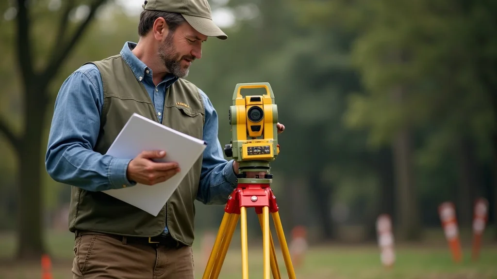
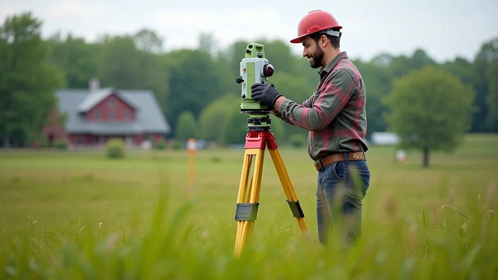
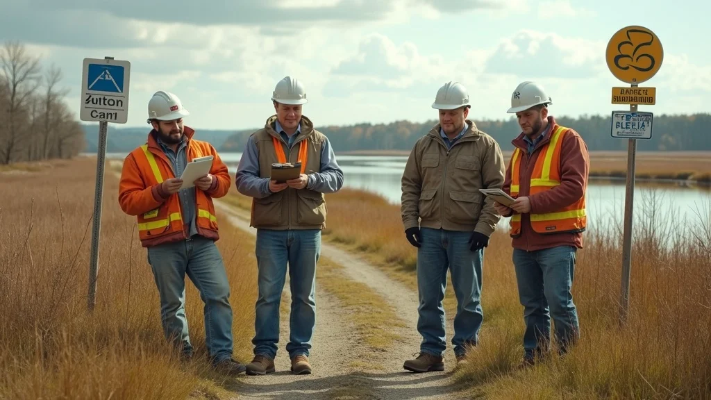
Hiring a Professional Land Surveyor—What It Means for Land Survey Cost and Compliance
The Professional Land Surveyor Advantage
- Licensed in Massachusetts: Only a licensed professional land surveyor can produce a legal, defensible map or plot plan that will satisfy permit boards and lenders in Lakeville.
- Up-to-date on local zoning, wetlands, and permitting: Massachusetts regulations change frequently—your surveyor must know Lakeville’s specific standards for zoning, wetlands, and approval timelines.
- Provides deliverables needed for engineering, building, and legal: From digital CAD files for your architect, to stamped plans for the town, to plot plans for your permit, the right land surveyor delivers what your project and the authorities demand.

How to Vet a Land Surveyor for Massachusetts Projects
- Questions to ask about technique and technology: Do they use GPS, total stations, or CAD? Are their survey records and accuracy standards current?
- Compliance with MASurvey Board: Ensure their licensing and insurance are up-to-date and check for any public regulatory or insurance issues.
- Review of references, insurance, and regulatory history: Secure reviews from recent Lakeville projects; verify they carry professional liability insurance and have a good standing record on compliance and legal matters.
“A professional land survey enables your architect, engineer, and builder to start right and finish fast—with no legal snags.” — Prime Engineering
Land Survey Cost Breakdown: What’s Included (and What’s Not)
Standard Deliverables in a Lakeville, MA Land Survey Cost Quote
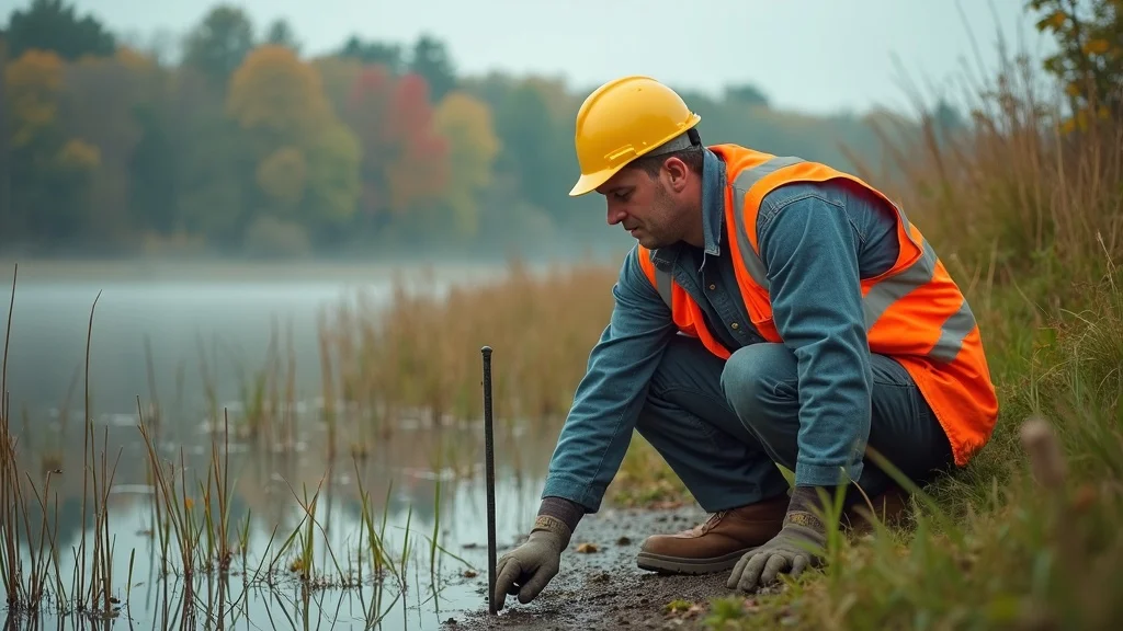
- Field crew visit, records research, boundary marking: On-site staff and extensive deed/title research to locate and confirm your property lines.
- CAD drawings, digital files, plot plans: Digitally prepared drawings, as required by most architects, engineers, and permitting authorities in Massachusetts.
- Signed/sealed survey map by a professional land surveyor: This certified document is essential for legal and zoning compliance.

Potential Add-On Fees in Land Survey Cost
- Additional monumentation (installing extra boundary markers)
- Old/degraded deeds or missing legal records (more research time)
- Wetland line flagging
- Emergency/expedited service (faster turnaround at a premium)
- Town re-review or peer review fee for permits, especially in complex or high-value projects
Hidden Costs Homeowners and Developers Should Expect in Real Estate Projects
- Title insurance or legal review (common for sales and refinancing)
- Zoning appeals or Conservation Commission filings (extra reports, hearings, or documentation)
- Specialist reports—wetlands, stormwater, or septic studies
Always request a detailed quote and project scope from your surveyor; ensure you understand what your land survey cost covers and what could trigger additional costs.
Local Regulations That Affect Your Land Survey Cost in Lakeville, MA
- Lakeville Zoning Bylaws: Regulations covering lot size, allowed uses, and minimum frontage.
- Conservation Commission: Strict controls for wetlands, floodplains, and protected buffers; survey maps often need wetland boundaries clearly shown.
- Building department: Demands for pre-construction, plot plan, and as-built surveys as part of permit applications.
| Permit/Requirement | Survey Type Needed | Typical Added Cost |
|---|---|---|
| Wetland delineation | Boundary/topographic | $450–$850 |
| Building addition | Mortgage/plot plan | $300–$1,200 |
| Subdivision | Full ALTA/topographic | $3,000–$7,000+ |
Not complying with these regulations will almost always inflate your survey cost by requiring subsequent corrections or extra site visits—another reason to hire a Massachusetts-savvy surveyor from the start.
How Land Survey Cost Prevents Real Estate and Construction Headaches
Land Survey Cost and Property Line Disputes
- Real MA case: In one Lakeville neighborhood, a fence was built over a disputed line. Only after a professional boundary survey confirmed both owners’ limits was the conflict resolved—saving both parties from an expensive legal fight.
- Time and money saved: Proactively getting a survey before site work, fencing, or additions will often resolve issues sitting dormant in unexamined deeds or outdated plot plans.

Land Survey Cost for Developers and Contractors: Budgeting and Scheduling
- Survey cost as part of project pro forma: Developers include land survey cost alongside engineering, architectural, and legal fees to reduce risk and secure predictable project timelines.
- Delays from missing or faulty survey: If permits or plot plans are kicked back for errors, penalties and redesign can delay sitework for weeks—costing thousands in labor and lost construction time.
“Solid data on Day 1 means no site shutdowns on Day 101.” — Project Manager, Prime Engineering
Comparing Land Survey Costs: Lakeville, MA vs. National Averages
| Region | Typical Range (Boundary) | Why Higher/Lower |
|---|---|---|
| Lakeville, MA | $850–$2,400 | State regulations, wetlands, developed parcels |
| Southern US | $500–$1,200 | Larger lot size, fewer regulatory layers |
| Urban Northeast | $1,100–$3,200 | Title issues, multi-owner parcels |
Why Is Lakeville’s Land Survey Cost Higher/Lower Than the US Average?
- Massachusetts permitting: More stringent engineering, plot plan, and wetland standards compared to other states.
- Wetlands/regulatory overlays: Proximity to water or protected land adds complexity and cost tiers not present in much of the Midwest or South.
- Lot size and development density: Denser, smaller lots cost more per square foot; historical subdivisions and overlapping or ancient title records add more hours for records research.

Land Survey Cost Savings—Practical Tips for Your Budget
- Gather all deeds and records—save surveyor research time (and fees)
- Ask your engineer/surveyor if you really need a commercial/ALTA survey—don’t pay for more than your lender or town requires
- Combine property line and topographic needs—many firms offer bundled pricing for multiple survey types
- Plan surveys at the permit application phase—not at the last minute to avoid rush/jump-the-line charges
Video:Interview—Tips from a Massachusetts Surveyor on Saving Time and Money(View on Prime Engineering website)
People Also Ask: Land Survey Cost Questions for Massachusetts Projects
How much does it cost for someone to survey land?
- For Lakeville, MA, expect $850–$2,400 for a typical boundary survey. Final land survey cost varies by parcel size, boundary complexity, and necessary deliverables such as plot plans or digital files.
How much does it cost to survey land in KY?
- In Kentucky, basic boundary surveys often cost $500–$1,200, largely due to fewer regulatory requirements and typically larger parcel sizes compared to Massachusetts. This leads to a lower overall land survey cost in KY.
What is the difference between a boundary survey and a survey?
- “Survey” is a general term for any mapping or boundary marking task. A “boundary survey” is a specialized service that identifies and marks legal property lines, monuments, or markers—essential for secure real estate transactions and resolving property line disputes.
How much does a survey cost in MO?
- Missouri boundary survey cost is typically $600–$1,400—generally lower than Massachusetts thanks to less regulatory burden and different site conditions impacting overall land survey cost.
Frequently Asked Questions on Land Survey Cost in Lakeville, MA
- How long does a land survey take?
Residential surveys can take one to three weeks from first contact—longer if records are missing or regulatory reviews are needed for wetlands or conservation. - What documents should I give my land surveyor?
Deeds, previous surveys, any plot plan or site improvement plans, legal descriptions, and information on easements or encroachments. - What if my neighbor disagrees with the survey?
A Massachusetts-licensed surveyor can defend their work at municipal boards or in court. Disputes are rare when the boundaries are mapped to state standards. - Will I get a digital map and CAD file?
Most professional land surveyors in Lakeville provide digital files and signed paper copies; verify deliverables in your cost quote.

Summary: What Every Lakeville, MA Stakeholder Should Remember about Land Survey Cost
- Land survey cost is a vital budget item for compliance, prevention, and project enablement.
- Partner with a MA-licensed professional land surveyor to ensure precision and approve your permit/application smoothly.
- Preparing documentation, understanding survey types, and knowing local regulations reduce your risk and total survey cost.
If you’re ready to take the next step in your project or want to ensure your investment is fully protected, consider exploring the full range of land surveying and civil engineering solutions available from Prime Engineering. Their expertise extends beyond just surveys—they offer strategic guidance for site development, permitting, and compliance across Massachusetts. By leveraging a team that understands both the technical and regulatory landscape, you can streamline your project and avoid costly surprises. Discover how a comprehensive approach to land surveying and engineering can set your Lakeville project up for long-term success by visiting Prime Engineering’s Massachusetts land surveying and civil engineering resource hub.
Ready for Precision? Get Your Land Survey Today
- Don’t leave permit approvals, real estate, or construction to chance—book a local Lakeville, MA expert
- Contact Prime Engineering for a no-surprise survey cost and local compliance support: https://primeengineering.org
Sources
- https://www.mass.gov/orgs/board-of-registration-of-professional-engineers-and-professional-land-surveyors – MA Board of Registration
- https://www.lakevillema.org/conservation-commission – Lakeville Conservation Commission
- https://www.alta.org/ – American Land Title Association
- https://primeengineering.org/ – Prime Engineering
Understanding the costs associated with land surveys is crucial for property owners and developers in Lakeville, MA. Factors such as property size, terrain complexity, and the specific type of survey required can significantly influence the overall expense. For a comprehensive breakdown of land survey costs, including average prices by survey type and factors affecting these costs, consider consulting the article “How Much Does a Land Survey Cost? [2025 Data]” available at HomeAdvisor. This resource provides detailed insights into the various elements that contribute to land survey expenses. Additionally, “How Much Does a Land Survey Cost in 2025? Real Prices by State, Type, and Acreage” from The Land Geek offers an in-depth analysis of survey costs across different states and property types, which can help you better understand the financial considerations specific to your project. By exploring these resources, you can gain a clearer understanding of the potential costs involved in land surveying, enabling you to budget effectively and make informed decisions for your property in Lakeville, MA.