

Find the Best Land Surveyor Near Me—Fast & Reliable Lakeville, MA
Did you know? In Massachusetts, a single surveying mistake can stall a project for weeks, derail real estate closings, or lead to costly land dispute litigation—sometimes adding $10,000 or more to your budget. Whether building, buying, or securing compliance, hiring a land surveyor near me isn’t just a checkbox—it’s the make-or-break step for your entire project in Lakeville, MA.
Why Accuracy, Compliance, and Speed Matter When Hiring a Land Surveyor Near Me
When searching for a land surveyor near me, every property owner, developer, and architect wants assurance that the work will be accurate, fully compliant with Massachusetts standards, and delivered on a timely schedule. Massachusetts permitting and property transactions demand precision; a delay or miscalculation in a land survey can halt construction, invalidate boundary lines, and unravel weeks of progress. This isn’t just a formality—local municipalities, banks, and legal counsel all require stamped survey deliverables to move forward with closings, site development, and conservation reviews. That means a reputable land surveyor will have deep local compliance knowledge and the right tools, from modern GPS technology to MA-certified staff, ensuring every boundary marker and data point stands up to regulatory scrutiny. By choosing the right firm in Lakeville, you protect your investment, avoid legal headaches, and keep your timeline on track.
“A single surveying error can halt development, delay permits, and cost thousands—precision and Massachusetts compliance aren’t just technicalities, they’re your project’s foundation.” – Senior Surveyor, Prime Engineering
What You’ll Learn When Choosing a Land Surveyor Near Me in Lakeville, MA
-
How to select a licensed land surveyor who meets Massachusetts standards
-
What types of land surveys you might need and why they matter
-
Transparent pricing and what factors affect your costs
-
Red flags to avoid when choosing land surveying services near you
-
Key deliverables and how to interpret your survey results

Fast Facts: Land Surveyor Near Me—A Critical Step for Massachusetts Projects
In the world of Massachusetts development and real estate, the benefits of engaging a local land surveyor near me are clear and immediate. Whether working with architects, civil engineers, or town boards, clients need to know what surveys cost, which type of land survey fits their needs, and who requires the documentation. The table below summarizes the costs, timelines, and typical use cases for the most common surveys in Lakeville, MA. Familiarity with these can help property owners avoid delays and confusion when requesting a cost estimate or assessing what’s needed for their next project.
If you’re interested in a deeper dive into the specifics of boundary surveys and how they protect your property rights, you may find the Prime Engineering guide to Massachusetts boundary surveys especially helpful for understanding the process and legal standards involved.
|
Survey Type |
Average Cost (MA) |
Turnaround |
Best For |
Required By |
|---|---|---|---|---|
|
Boundary Survey |
$800–$1,800 |
2–3 weeks |
Property purchases, disputes |
Lenders, title companies, towns |
|
Topographic Survey |
$1,500–$3,500 |
2–4 weeks |
Site design, additions |
Architects, engineers |
|
ALTA/NSPS Survey |
$2,200–$5,000+ |
3–6 weeks |
Commercial, financing |
Banks, legal counsel |
|
Wetlands Delineation |
$800–$2,500+ |
1–3 weeks |
Conservation approvals |
MA Conservation Commission |
Understanding Land Survey Near Me: What Does a Land Surveyor Do?
A land surveyor near me is a technical expert responsible for mapping, measuring, and legally documenting the features and boundaries of a specific property. Land surveying services serve a wide range of property owners—from homeowners and contractors to real estate professionals and municipalities. By using advanced equipment like total stations, GPS technology, and CAD software, a professional land surveyor in Lakeville, MA ensures that every detail, from property markers to elevation contours, is recorded with accuracy. The survey deliverables produced are legally recognized and form an essential foundation for permits, sales, construction projects, and dispute resolution. Thorough understanding of Massachusetts-specific requirements, including wetlands protection and zoning, is crucial for zoning applications, site development, and property investment decisions.
Types of Land Surveys: Boundary, ALTA, Topographic, and More
Massachusetts property owners may need different surveys based on project needs and regulatory demands. The most common land surveys include:
-
Boundary survey
-
Land title survey
-
Topographic land survey
-
Subdivision survey
-
Construction staking
-
Flood elevation certificate
Each type of survey serves a unique role. Boundary and land title surveys are critical for real estate transactions and property line disputes, while topographic surveys provide crucial elevation and site data for architects and engineers. Construction staking supports building layout accuracy, and flood elevation certificates satisfy FEMA and insurance requirements. Choosing the correct service—guided by a licensed surveyor—keeps your project on track and your documentation compliant.
When You Need a Land Surveyor Near Me in Lakeville MA
The need for a land surveyor near me often arises during critical milestones. Here’s when it’s essential to engage a professional:
-
Buying or selling property
-
Building additions or new structures
-
Resolving property line disputes
-
Permitting with towns or conservation commissions
For homebuyers, a boundary or land title survey validates property lines and prevents costly surprises at closing. Builders and architects depend on topographic surveys for site layout and design while obtaining permits from the local conservation commission requires wetlands delineation to avoid regulatory pitfalls. Anyone facing conflicting deeds or neighbor disagreements should consult a professional land surveyor to secure reliable, Massachusetts-compliant results.
How to Choose the Right Land Surveyor Near Me in Lakeville, MA
Selecting the right land surveyor near me means more than finding the lowest bid. Massachusetts law requires all survey work be performed by a licensed surveyor—look for a provider with a strong record of compliance, experience in Lakeville, and positive reviews from both property owners and industry professionals. Quality firms provide clarity on their methodologies, timelines, and deliverables, empowering you to make informed decisions. Don’t hesitate to request references or review sample plans—the best surveying companies stand behind their work and welcome scrutiny. In Lakeville, understanding wetlands, stormwater, and zoning intricacies is as important as the survey itself. Always prioritize local expertise!
Licensed Surveyor Credentials and Massachusetts Regulatory Standards
-
Massachusetts license status and experience
-
Knowledge of Lakeville zoning & wetlands protection
-
Familiarity with local municipality requirements
Always verify that your land surveyor maintains current Massachusetts licensure through the Board of Registration of Professional Engineers and Land Surveyors. In addition to appropriate credentials, look for evidence of specialized training in wetlands delineation, stormwater management, and local subdivision regulations. Deep familiarity with both state and Lakeville ordinances gives you peace of mind that your deliverables will hold up under legal or regulatory review.

Reputation, Reviews, and Surveying Services Offered
-
How to check reviews/ratings online and with MA boards
-
Common surveying service options: boundary, title, topographic, construction
-
Turnaround times and reporting methods
Reputation matters—especially for technical work like land surveying. Check Google reviews, the Massachusetts Board of Registration records, and industry platforms for feedback. The breadth of surveying services offered signals the company’s capacity and experience: firms that handle both residential property lines and complex construction staking demonstrate versatility. Reliable surveyors communicate realistic turnaround times and deliver results via digital (CAD, GIS, PDF) as well as stamped paper plans, ensuring easy integration with your contractor, lender, or architect.
Land Surveyor Near Me Pricing in Lakeville, MA: What to Expect
Understanding pricing for a land surveyor near me can be challenging due to the variables unique to each property. However, credible firms transparently break down costs, providing written estimates that detail all project factors. Fees in Lakeville typically reflect property size, terrain difficulty, accessibility, and the level of local regulatory review required. Higher complexity projects—such as large-acreage sites or those near conservation land—will range toward the higher end. When shopping for a quote, always insist on itemized pricing and clear definitions of included deliverables.
Land Survey Cost Factors—How Much Should I Pay for a Surveyor Near Me?
-
Property size, terrain, and accessibility
-
Survey type: boundary, title, wetland, topographic
-
Historical records availability
-
Local permit/town requirements
Not all surveys are created equal—and neither are their costs. A straightforward suburban boundary survey can be completed quickly and at the lower end of the pricing spectrum, whereas surveys that require piecing together fragmented historic records, navigating steep woodland, or interpreting conservation overlays are more labor-intensive. The type of land survey—be it a land title, topographic, or wetlands delineation—also dictates price due to varying fieldwork, legal, and reporting demands. Discuss all project details for the most accurate cost estimate and avoid surprises later.

How to Get Transparent Pricing for Land Surveying Services
“A professional land surveyor will always provide a written estimate tied to your specific site conditions—demand clarity before you sign.” – Prime Engineering, Lakeville, MA
The key to fair pricing for land surveying services is transparency. Start by sharing any existing deeds, previous surveys, or plot plans you have. A reputable surveying company will review these, inspect your site, and then issue a written quote outlining anticipated costs. Make sure the quote specifies the type of survey, all regulatory steps, and details about deliverables like CAD files or stamped plans. Avoid firms that only offer “ballpark” figures or resist formal documentation—they often lack the accuracy or compliance discipline required in Massachusetts.
Land Surveyor Near Me: Secure Deliverables and Enable Your Project
Deliverables from your chosen land surveyor near me are not mere technicalities—they’re vital tools that clear project hurdles and unlock the next stage of site development, design, or permitting. High-caliber firms produce digital CAD files, GIS layers, and clear, easy-to-interpret paper plans. For architects and engineers, detailed site data eliminates ambiguity; for property owners and lenders, visible property markers and stamped documents establish confidence. In every case, trustworthy deliverables keep your project advancing smoothly.
Surveying Service Deliverables—What You Get and Why It Matters
-
Stamped survey plans
-
Digital deliverables (CAD, GIS, PDFs)
-
Clearly defined property lines, markers, and monuments
-
Detailed site/topo data for architects, engineers
Whether securing a permit, resolving a boundary dispute, or preparing for construction, your surveying service should provide a suite of deliverables tailored to the project’s needs. Modern land surveyors deliver layered digital files compatible with architectural and engineering software, alongside printed and stamped plans for regulatory compliance. Clear marking of property lines with durable monuments ensures that property owners and builders have reliable field references long after surveyors leave the site.

Project Enablement: How a Land Surveyor Near Me Keeps You Compliant and Moving Forward
-
Ensuring regulatory compliance with Massachusetts and Lakeville codes
-
Avoiding costly delays and non-compliance penalties
-
Supporting rapid permitting and construction
The best land surveyors near me don’t just measure boundaries—they empower project progress. By maintaining strict adherence to state and local codes, providing reliable documentation for regulatory boards, and acting quickly to turnaround site visits and plans, your land surveyor helps you navigate every approval checkpoint. This proactive approach limits risk of non-compliance (and its associated penalties), keeps contractors on schedule, and gets your design, financing, or construction efforts moving without delay.
People Also Ask: Land Surveyor Near Me
What’s the average cost of a land survey?
In Lakeville, MA, the average cost for a land surveyor near me ranges from $800 to $3,500, depending on parcel size, terrain, and type of land survey required. Specialty surveys, such as ALTA or wetlands delineation, may cost more.
How much does it cost to do a survey?
A professional land surveying service in Massachusetts typically costs $1,000–$2,500 for most residential properties, with commercial or complex properties usually higher. Always request a detailed, written quote from your land surveyor near me.
How much should I pay for a surveyor?
Expect to pay in line with Massachusetts averages: $1,500 for a standard boundary survey, $2,000–$3,500 for topographic or title surveys. Price variations depend on complexity, access, and regulatory demands.
How to get property line survey for free?
Free land surveys are rare. Local towns in Massachusetts might have GIS property data online, but it doesn’t hold legal weight for closings, design, or dispute resolution. Only a licensed land surveyor near me provides a compliant document recognized by authorities.
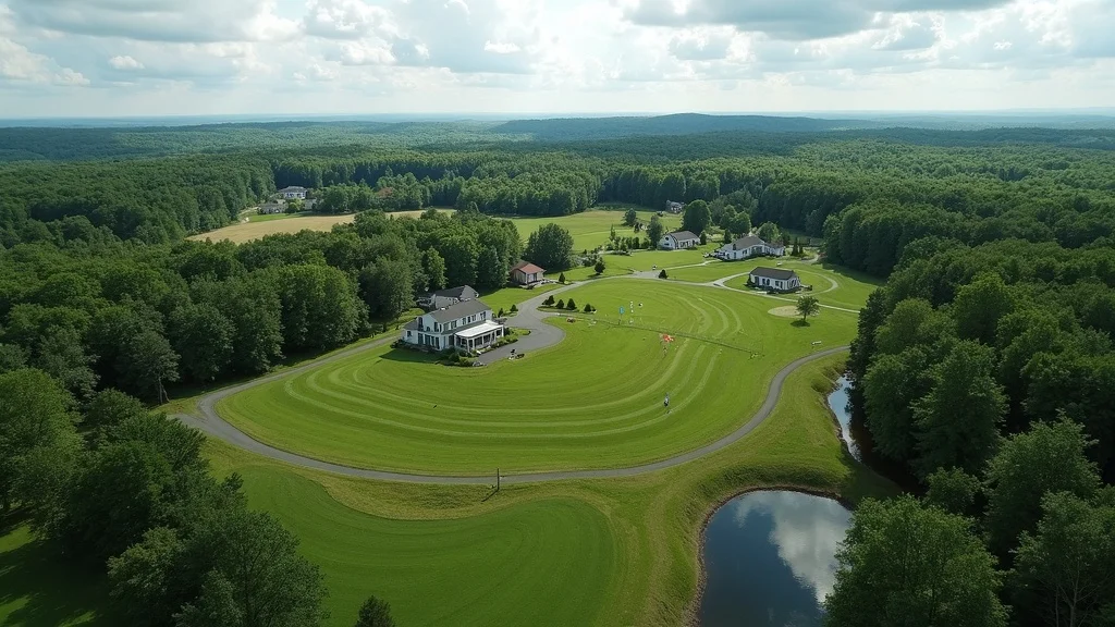
Watch as a Prime Engineering survey crew in Lakeville, MA conducts a professional boundary survey: from instrument setup, precise line marking, and digital data collection, to the critical explanation of process steps and visible markers—all in compliance with MA regulations. This clear, step-by-step visual reinforces why professional expertise and accurate field work matter.
FAQ About Land Surveyor Near Me in Lakeville, MA
-
What documents do I need to provide to the surveyor? – Deed, prior surveys, plot plans, and any existing map or title documents help accelerate survey work and accuracy.
-
How long does a survey typically take in Lakeville? – Most residential surveys require 2–4 weeks, while specialty work involving wetlands, large tracts, or complicated title issues may extend timelines.
-
What is a land title survey vs. boundary survey? – A boundary survey determines and marks property lines; a land title survey includes additional ALTA/NSPS requirements for commercial deals or lender standards.
-
Are all surveyors in Massachusetts required to be licensed? – Yes. All land surveying services must be performed by a licensed surveyor registered with the Massachusetts Board of Registration.
-
Can a surveyor help if there’s a land dispute? – Absolutely. A licensed surveyor’s plans and field evidence are admissible in court, supporting dispute resolution and property defense.
-
What do property corner stakes look like? – Property corners are typically marked by metal rods or pins driven into the ground, flagged with brightly colored tape or caps for visibility.

Key Takeaways: Why Prime Engineering Is Your Trusted Land Surveyor Near Me
-
Accuracy—Every measurement and marker meets or exceeds MA standards.
-
Compliance—We ensure regulatory peace of mind for your permits and design.
-
Project Enablement—Our deliverables, speed, and service keep you building, buying, or resolving—fast.
Ready to Start? Find a Qualified Land Surveyor Near Me in Lakeville, MA Today
“Don’t let confusion or errors threaten your site—start with Massachusetts’ trusted site authority and get your project moving!”
Get Your Land Survey Today https://primeengineering.org
Conclusion
For fast, compliant, and trusted land surveying in Lakeville, MA, choose a licensed expert focused on accuracy and project success—Prime Engineering delivers results you can build on.
If you’re looking to expand your understanding of land surveying and how it fits into the bigger picture of property development and civil engineering in Massachusetts, explore the full range of services and expertise offered by Prime Engineering’s Massachusetts land surveying and civil engineering team. Their comprehensive approach can help you navigate everything from initial site analysis to advanced engineering solutions, ensuring your project is set up for long-term success.
Sources
When seeking a reliable land surveyor in Lakeville, MA, it’s essential to choose professionals with proven expertise and a strong local presence. Here are some reputable land surveying firms in the area:
Prime Engineering Inc
Closed · Engineering consultant · 3.4 (10 reviews)
350 Bedford St # 2, Lakeville, MA 02347
Established in 1995, Prime Engineering offers comprehensive land surveying services, including boundary determination, topographic mapping, and construction layout. Their experienced team utilizes state-of-the-art equipment to ensure accurate and efficient results.
Selecting a licensed and experienced land surveyor is crucial for the success of your project. These firms have established reputations in the Lakeville area and can provide the professional services you require.