
Topographic Survey Near Me—Uncover Your Land’s Hidden Details Lakeville, MA
Did you know that over 70% of site development delays are caused by incomplete or inaccurate land data? When launching a real estate dream or development plan in Lakeville, MA, a topographic survey near me isn’t optional—it’s your first line of defense against costly surprises, delays, and regulatory headaches. In this guide, you’ll discover how Prime Engineering’s technical mastery, local expertise, and commitment to Massachusetts compliance empower you to make confident, risk-free decisions from day one.
Revealing the Land: Why a Topographic Survey Near Me Is Critical in Lakeville, MA
Every successful project in Lakeville, MA—from a backyard addition to a commercial site—relies on reliable land data. The topographic survey near me is not just about drawing lines on a map; it’s about translating the living landscape into actionable, regulatory-ready insight. Unlike a generic land survey, which primarily confirms boundaries, a topographic survey reveals the physical features—elevation changes, utility lines, wetlands, and even nuanced surface details that shape permit decisions and engineering designs.
This matters because in Lakeville, site permitting requires more than ownership documents. Conservation Commission reviews, zoning setbacks, and stormwater designs all depend on accurate, current topographic mapping. Without it, errors go undetected. A single missed wetland, misread property line, or unmapped grade can stall your permit for months, or force expensive mid-project redesigns—especially as Massachusetts regulations grow stricter each year. With Prime Engineering, you get both precision and peace of mind, knowing your project’s first step is backed by one of the region’s top land surveyor teams.
“Over 70% of site development delays are caused by incomplete or inaccurate land data. A topographic survey eliminates those risks at the start of your project.”

What You’ll Learn From This Guide to Topographic Survey Near Me
- The essentials of topographic survey near me in Massachusetts
- How topographic, boundary, and land survey services ensure regulatory compliance
- Why accurate land surveying supports faster project approvals
- Key deliverables and service outcomes homeowners, developers, and engineers should expect
For those interested in a deeper dive into the specific methods and deliverables of topographic mapping, Prime Engineering offers a comprehensive overview of topographic survey services and their real-world applications in Massachusetts. This resource can help clarify how advanced surveying techniques translate into actionable site data for your project.
What Is a Topographic Survey Near Me? Defining Land Survey and Its Real-World Value
A topographic survey near me provides a 3D map of your property’s features, including elevations, natural and manmade elements, and critical environmental details. Unlike standard land survey or boundary survey services—which mark property lines for ownership or real estate transfer—a topographic survey gives architects, engineers, and local officials the data they need to design site plans, manage grading, address stormwater, and ensure your project aligns with zoning, conservation, and wetland regulations.
For Lakeville, MA property owners, this means your topographic map becomes the baseline for everything from building permits to drainage calculations. The expertise of your land surveyor directly determines whether your project breezes through permitting, or hits roadblocks that cost time and money. Don’t risk your investment on incomplete map data—choose a service that excels at both precision and Massachusetts compliance.

How Topographic Surveys Differ From Typical Land Survey or Land Surveyor Services
What sets a topographic survey near me apart from the average land survey? While both aim to establish crucial site data, topographic mapping includes precise measurement of grades, slopes, features, and contours, while standard land surveying centers on boundary placement and legal property descriptions. The topographic map you receive will illustrate the lay of your land in three dimensions—showing how water flows, where fill will be needed, or whether a new home site sits above floodplain elevations. This detail isn’t just for engineers; it influences every design, from septic tank placement to stormwater management and architectural layouts.
In contrast, a basic land surveyor may only provide “metes and bounds,” confirming the boundaries of your property for deeds or title transfers. Without elevation data, utilities, or environmental controls marked, surprise issues pop up once excavation begins. For Massachusetts projects, where civil engineering standards and wetland delineations are strictly enforced, skipping a comprehensive topographic survey is a risk you simply can’t afford.
Massachusetts Standards for Land Surveyors: Compliance Is Key
Massachusetts has some of the most rigorous land surveying regulations in New England. State-accredited land surveyors must use approved benchmarks, employ calibrated digital total stations or RTK-GPS, and follow MassDEP and MassGIS protocols for mapping wetlands, waterways, and buildable uplands. Your final topographic map must be sealed, certified, and formatted for seamless use in CAD/GIS—meeting both state and municipal requirements for permit review.
Prime Engineering’s land surveyor specialists are deeply versed in these processes, offering unmatched local knowledge. We integrate updated sep regulations, overlay historical map and geologic map data, and ensure every deliverable is project-ready for architects, engineers, and municipal officials. This focus on compliance protects you from hold-ups and increases your odds of quick permit approval.
Land Surveyor Expertise: How a Topographic Survey Near Me Powers Your Project
Your project’s longevity and success depend on more than a “good enough” land survey. The right land surveyors bring technical excellence—through their technologies, field methods, and deliverables—and a uniquely local understanding of Lakeville’s permitting and environmental landscape.
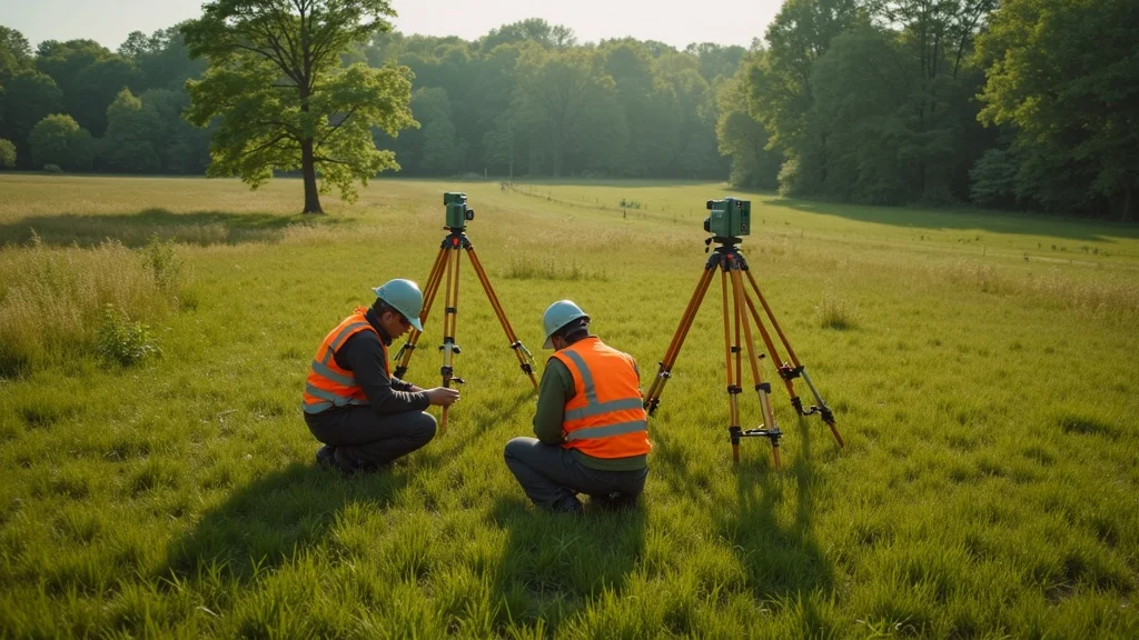
From 3D laser scanning to drone aerial mapping, today’s topographic survey near me uses tools once reserved for massive infrastructure projects, now available for single-lot homes and commercial sites. With digital map data integrated, you gain both precision and flexibility in your site planning.
Technical Excellence in Land Survey: Tools, Processes, and Deliverables
Modern land surveying for topographic projects encompasses high-accuracy GNSS (GPS), robotic total stations, and unmanned aerial vehicles (drones) for photogrammetry. The resulting deliverables include more than paper maps:
- 3D digital site maps for engineering and visualization
- Elevation contour mapping that shows slope, hill, and drainage changes
- Utility and easement identification for pre-construction planning
- CAD/GIS plan integration enabling seamless workflows for architects and civil engineers
Our land surveyors compile this map database using both modern and historical survey records, cross-checking all data against the latest version of topoview and national geologic map database. This layered approach ensures your topographic survey near me captures every regulated feature, reducing change orders, construction surprises, and costly rework.

Local Knowledge in Lakeville, MA: Town Zoning, Wetlands, and Site Permit Processes
Working with a topographic survey near me provider who knows Lakeville saves time and stress. Local expertise means your land surveyor is fluent in:
- Zoning overlays and special permit requirements unique to Lakeville
- Wetland and stormwater mapping as required by the Massachusetts Wetlands Protection Act
- Submission protocols for the Lakeville Conservation Commission and Board of Health
The land surveyors at Prime Engineering consistently integrate the most recent updates from MassDEP, local setback rules, and Lakeville-specific environmental overlays directly into your topographic mapping. Their experience means you steer clear of permit pushbacks, OOC (Order of Conditions) delays, and avoid common pitfalls that slow other Massachusetts projects.
| Topographic Survey | Basic Land Survey | |
|---|---|---|
| Elevation Data | ✔ | ✖ |
| Site Plan Use | Design, Engineering | Title/Ownership |
| Wetland/Regulatory Considerations | ✔ | ✖ |
| Construction Readiness | High | Moderate |
Land Surveyors in Lakeville: How to Choose the Right Team for Your Topographic Survey Near Me
The success of your topographic survey near me comes down to the caliber of your land surveyor team. In Lakeville, you need an expert group that not only commands advanced technology, but understands the nuances of local terrain, permitting, and regulatory compliance. Licensing, experience, and thorough service are non-negotiables, especially with Lakeville’s mix of wetlands, floodplain overlays, and rolling topography.
Essential Criteria: Licensing, Experience, and End-to-End Service
Always verify your land surveyor is fully licensed in Massachusetts and carries recent project experience relevant to your property type—be it a single-family home, subdivision parcel, or commercial lot. Ask for:
- Proof of Mass. licensing and insurance
- Detailed estimates with breakdown of deliverables
- Certain land surveyors will offer bundled services (topographic + boundary survey + staking)
- References from comparable Lakeville projects
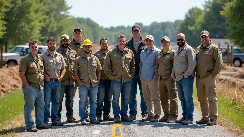
Prime Engineering is proud of a track record spanning hundreds of Massachusetts projects—with references, sample topographic map deliverables, and reviews available on request. End-to-end capability—from booking to regulatory-ready data—means you’re never left guessing, and your team is always one step ahead of approval agencies.
Spotting Red Flags: What Makes a Land Surveyor Stand Out (or Fall Short)?
It pays to be vigilant. Avoid land surveyors who provide vague cost estimates, fail to commit to sealed, CAD/GIS-ready maps, or lack recent project testimonials for Lakeville or Massachusetts. Warning signs include:
- Refusal to sign/seal plans as a licensed surveyor
- Limited or outdated experience with local permit agencies
- No clear workflow for integrating digital map data (e.g., ignoring latest version of topoview)
- Poor communication or “lowest bid” mentality with unclear scope
Choosing wrong can expose your investment to regulatory risk and project delays. Always select a surveying partner who prioritizes Massachusetts standards, thoroughness, and practical service delivery.
People Also Ask: Common Questions About Topographic Survey Near Me
How much does a topographic survey cost per acre?
Answer: Topographic survey near me in Massachusetts typically ranges from $1,000 to $2,500 per acre depending on site complexity, vegetation, accessibility, and local regulatory requirements.
How much is a topographical survey?
Answer: Most topographical surveys in Lakeville, MA start around $1,600 for small residential lots, with additional fees for steep terrain or multi-acre properties. Always request a customized quote from your land surveyor.
Where can I get topographic survey maps?
Answer: Certified topographic survey maps can only be produced by licensed Massachusetts land surveyors. Public map data, like USGS, can provide reference info, but only a professional service creates site-ready, regulatory-compliant deliverables.
What are the four requirements for topographical survey?
Answer: The four key requirements are: 1) Comprehensive site reconnaissance, 2) Use of Massachusetts-approved survey benchmarks, 3) Accurate elevation/feature measurement with licensed technology, and 4) Sealed CAD/GIS deliverables meeting regulatory standards.
The Topographic Survey Near Me Process: What to Expect in Lakeville, MA
Smooth, predictable project outcomes start with a surveying process tailored to Massachusetts needs. Here’s what to expect when choosing a topographic survey near me in Lakeville:
Booking and Planning Your Land Surveyor Site Visit
The journey begins with a free consultation to define your project needs—be it for site development, permitting, or boundary clarification. Your land surveyor will gather project details, review zoning/planning department records, and provide a clear cost estimate with a scope tailored to your timeline and compliance requirements. Once confirmed, your surveyor schedules a field visit, assembles digital base maps, and notifies Town Hall if needed.

How Long Does a Topographic Survey Near Me Take?
For an average Lakeville residential property, expect one to three days for on-site data collection, with another three to seven business days to process, draft, and QA maps for submittal. Larger or complex sites (wetlands, commercial, multi-acre) may extend the timeline, especially if geologic map data or multi-team reviews are needed. Your surveyor will keep you updated throughout—our commitment is minimal disruption, maximal clarity, and no surprises.
Video Example: Walkthrough of a Topographic Survey Near Me
A short video shows Prime Engineering’s team arriving in Lakeville, setting up advanced survey equipment, flying drones, collecting ground and aerial map data, then overlaid digital plans evaluated in a local office. It’s professionalism and precision—in action.
Key Outcomes: How Topographic Survey Near Me Reduces Risk and Accelerates Project Success
The true value of a topographic survey near me goes beyond paper maps. When performed by skilled land surveyors with Massachusetts expertise, you gain:

Compliance in Action: Approvals, Wetlands, Conservation, and Zoning in Massachusetts
Massachusetts permits are detail-driven, with Conservation, Zoning, and Board of Health reviews relying heavily on current, complete topographic survey deliverables. Our experts identify endangered wetlands, setback violations, and utility conflicts before Town Hall does, supporting clean applications and rapid “yes” decisions. The right survey data helps you avoid ANRAD/NOI delays and triggers project momentum—instead of red tape.
Accuracy and Project Enablement: The Core Value of Land Surveyors
With land surveying from Prime Engineering, every elevation, utility, and lot line is captured with digital precision and Massachusetts-standard compliance. Your engineer, architect, or construction manager receives instantly usable data. No manual redrawing, no regulatory second-guessing. This is project enablement in its purest form—and why more Lakeville projects start, and finish, on time with our team on board.
FAQs About Topographic Survey Near Me in Lakeville, MA
- Can a topographic survey near me be bundled with a boundary survey?
- Is drone mapping used for topographic survey near me?
- Can my architect/engineer use the map for site design approval?
Video Explainer: Land Surveyor Tools & Deliverables in a Topographic Survey Near Me
Watch as our licensed surveyors demonstrate total stations, GPS, drone mapping, and the digital files you’ll receive—all explained in plain English for Lakeville property owners and professionals.
Key Takeaways for Homeowners, Developers, and Architects Seeking a Topographic Survey Near Me
- Topographic survey near me eliminates costly surprises by mapping every relevant feature.
- Regulatory compliance, Massachusetts-specific standards, and precision are non-negotiable.
- Choosing a qualified land surveyor in Lakeville, MA ensures your project approval and protects your investment.
If you’re ready to take the next step in your project journey, consider exploring the full spectrum of land surveying and civil engineering solutions available from Prime Engineering. Their Massachusetts land surveying and civil engineering expertise extends far beyond topographic surveys, offering strategic guidance for site development, permitting, and long-term property value. By leveraging a team that understands both the technical and regulatory landscape, you position your project for success from the ground up. Discover how a holistic approach to land data and engineering can unlock new opportunities and ensure your investment is protected at every stage.
Ready to Discover Your Land’s Details? Get Your Land Survey Today
Don’t let gaps in land data stall your dream. Get Your Land Survey Today with Lakeville’s trusted experts and move your project forward—accurately, compliantly, and on schedule.
Sources
- https://www.mass.gov/orgs/board-of-registration-of-professional-engineers-and-land-surveyors – Massachusetts Board of Registration of Professional Engineers and Land Surveyors
- https://www.mass.gov/service-details/surveying-standards-and-guidelines – Surveying Standards & Guidelines, MassDEP
- https://primeengineering.org/topographic-survey – Prime Engineering, Land Surveyor Services
- https://www.usgs.gov/national-geospatial-program/national-map – USGS National Map
- https://www.lakevillema.org/conservation-commission – Lakeville Conservation Commission
When planning a development project in Lakeville, MA, obtaining a precise topographic survey is essential to avoid costly delays and ensure compliance with local regulations. A topographic survey provides a detailed 3D map of your property’s features, including elevations, natural and man-made elements, and critical environmental details. This information is crucial for architects, engineers, and local officials to design site plans, manage grading, address stormwater, and ensure your project aligns with zoning, conservation, and wetland regulations.
For a comprehensive understanding of topographic surveys and their importance, the United States Geological Survey (USGS) offers extensive resources on topographic mapping and its applications. Their insights can help you grasp how detailed land data supports successful project planning and execution.
Additionally, the Massachusetts Board of Registration of Professional Engineers and Land Surveyors provides guidelines and standards for conducting topographic surveys in the state. Familiarizing yourself with these standards ensures that your survey meets all necessary compliance requirements.
If you’re serious about ensuring the success of your project in Lakeville, MA, these resources will provide you with the knowledge and standards necessary for accurate and compliant topographic surveys.