Opening Times:

8.00 AM - 5.00 PM

Two surveyors wearing caps and backpacks use yellow theodolites on tripods in a grassy field at sunrise, with trees and hills in the background.

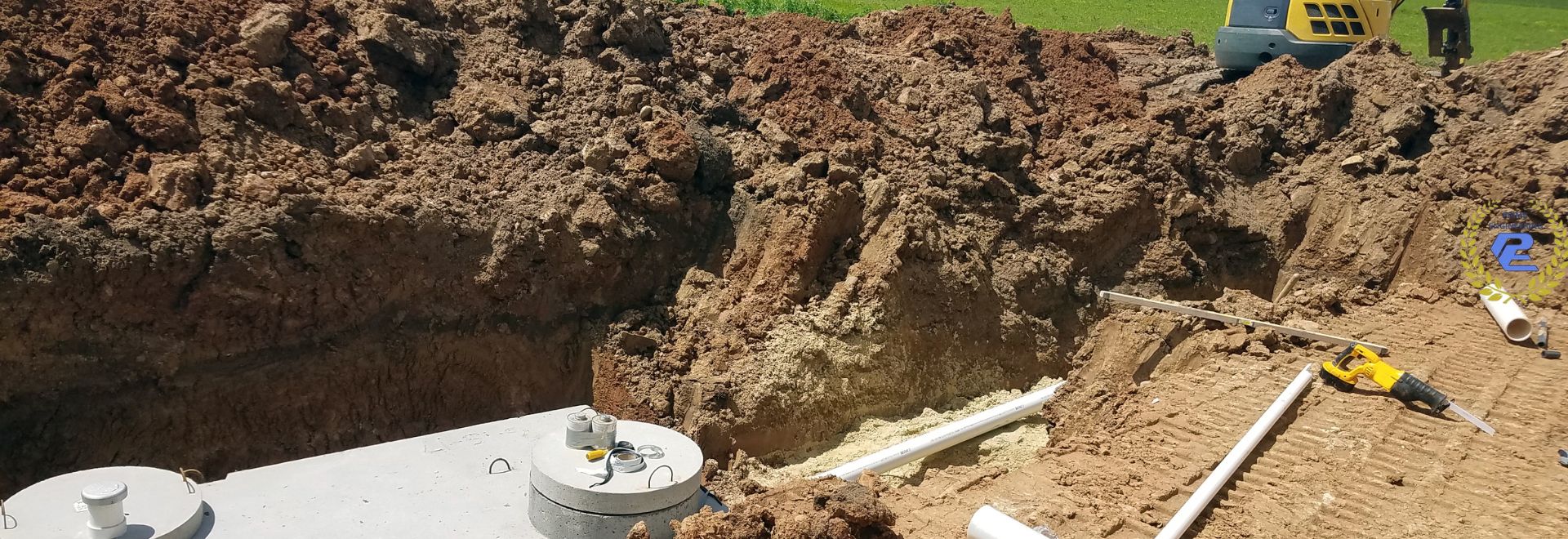
Inside Look at Land Survey Equipment Revolutionizing Accuracy Lakeville, MA

Did you know? A single misplaced boundary marker in Massachusetts can cost homeowners and developers tens of thousands of dollars in legal fees or project delays. Today, land survey equipment delivers precision measured in millimeters, virtually eliminating these expensive setbacks. Discover the game-changing technology and expert insights enabling Lakeville, MA projects to meet the state’s strict regulatory standards—while staying on time and under budget.

Cutting-edge land survey team using total station and GNSS receiver in Lakeville MA, demonstrating advanced survey equipment accuracy in a rural Massachusetts landscape under soft morning light

Startling Advancements in Land Survey Equipment: A Data-Driven Look

A decade ago, most surveying equipment could measure distances to the nearest inch, but required hours in the field, manual data entry, and left room for human error. Today, robotic total stations, satellite-connected GNSS receivers, and touchscreen data collectors have transformed the industry. According to recent statistics, adopting these tools in Massachusetts has reduced survey turnaround times by up to 40% and boosted boundary survey accuracy to sub-centimeter levels—a standard now demanded by local boards and Conservation Commissions.

Smart automation is now core: modern survey equipment integrates directly with CAD/GIS software, allowing data to move seamlessly from the field to design teams. Advanced electronic distance meters and real-time GNSS receivers ensure surveys meet the elevation, boundary, and wetland proximity requirements unique to the Lakeville area. Whether you’re a homeowner considering an addition or a developer planning a subdivision, staying ahead with these technologies is no longer optional—it’s a necessity for compliance and cost control.

For those interested in a deeper dive into how these technologies are applied in real-world scenarios, you can explore a comprehensive overview of Massachusetts land surveying practices and equipment selection to see how local experts leverage these tools for maximum accuracy and regulatory compliance.

“Today’s land survey equipment delivers precision measured in millimeters—a leap that minimizes costly project errors.” —Prime Engineering Team

What You’ll Learn About Land Survey Equipment in Lakeville, MA

  • Which survey equipment and surveying equipment achieves the highest accuracy per Massachusetts standards
  • How total station, GNSS receiver, and data collector revolutionize site surveys
  • Key benefits of modern land survey technology for compliance and project approvals
  • How to select the best land survey equipment for your Lakeville-based project
  • Comparative insights for homeowners, architects, and developers needing survey equipment

Why Accuracy in Land Survey Equipment Matters for Lakeville, MA Projects

In Lakeville, the difference between passing an inspection and starting over often comes down to the accuracy of your land survey equipment. Massachusetts building codes, Conservation Regulations, and local wetland standards require pinpoint precision. Choosing equipment like a highly accurate total station or a calibrated GNSS receiver can mean the difference between fast project approvals or lengthy, costly, unexpected delays.

Technical mastery isn’t just for contractors. For homeowners, the right surveying equipment protects you from unwanted property disputes and ensures new buildings or additions don’t trespass protected wetlands or buffer zones. Developers and architects depend on reliable data collection for design and permitting—accuracy is not just a technical requirement, but a critical risk control for every Lakeville project.

From Zoning to Wetlands: Regulatory Precision with Modern Surveying Equipment

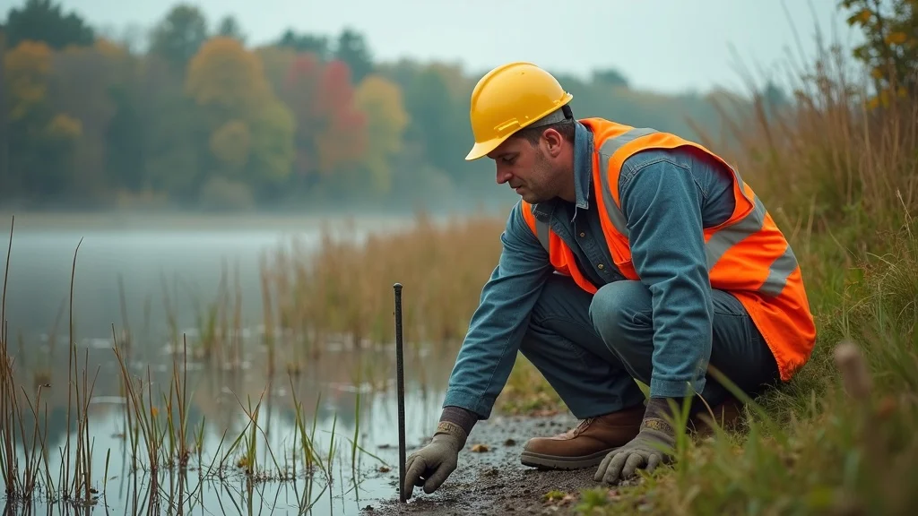
Lakeville, MA, like much of the state, is governed by strict environmental and zoning laws. Boundaries and setbacks must be certified with high precision to comply with conservation commission requirements and the Massachusetts Wetlands Protection Act. Instruments like total stations and GNSS receivers have made it possible to meet these demands, mapping out irregular lots, wetlands, and floodplain boundaries down to a few millimeters. This level of precision dramatically de-risks projects, reducing the potential for failed permits, Conservation Commission denials, or neighborhood disputes over property lines.

Did you know that Lakeville’s Conservation Commission often requires full digital documentation and periodic re-surveys for projects near wetlands? Modern survey equipment enables surveyors to deliver these required formats directly, cutting weeks from approval cycles and assuring compliance—even as regulations evolve.

Professional surveyor using advanced GNSS receiver by Lakeville wetland boundary, illustrating regulatory-compliant land survey equipment in Massachusetts wetlands

Impact of Land Survey Equipment on Site Development and Project Timelines

The role of advanced land survey equipment extends beyond compliance. For contractors and developers, accurate initial surveys speed up construction planning, staking, and site layout. Robotic total stations automate point collection, minimizing human error and enabling just one surveyor to cover large areas that used to require a full crew. Meanwhile, integrated data collectors and GNSS receivers feed results directly into digital site plans, accelerating approvals and handoffs between field and office.

When timelines shrink, so does cost exposure. One missed boundary marker or poorly aligned foundation can result in expensive rework. Using state-of-the-art surveying equipment in Lakeville ensures your project hits every milestone without expensive setbacks—whether you’re breaking ground on a subdivision or simply fencing your backyard.

Land Survey Equipment: Core Technologies Shaping the Industry

Behind every approved project in Lakeville is a suite of advanced surveying equipment—purpose-built for Massachusetts’ demanding terrain and regulatory needs. Here’s a look at how core technologies like total stations, GNSS receivers, and modern data collectors revolutionize accuracy, efficiency, and compliance for Lakeville land surveys.

From the robust durability required for unpredictable New England weather to the seamless integration with GIS/CAD systems, these tools ensure that every project, no matter the scale, stands on a foundation of measurable precision.

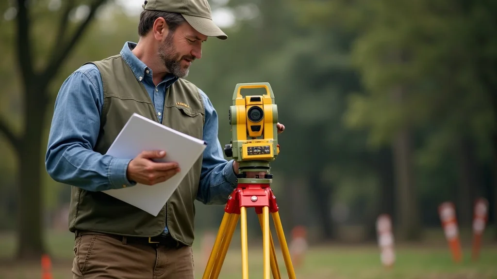
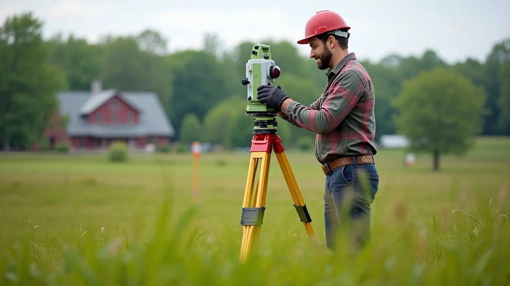
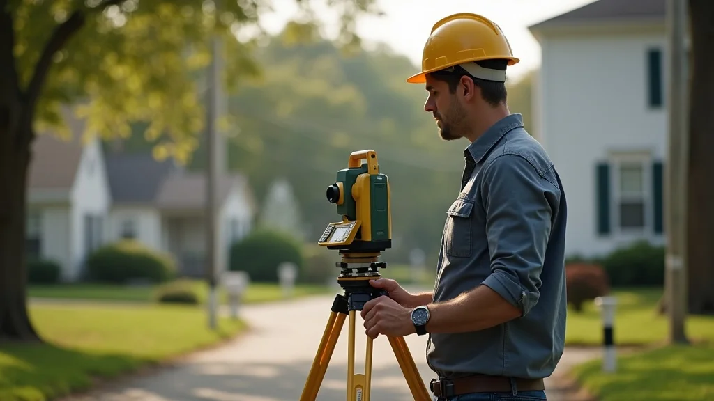
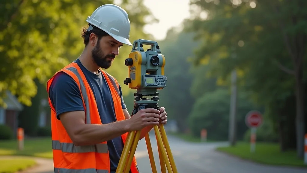
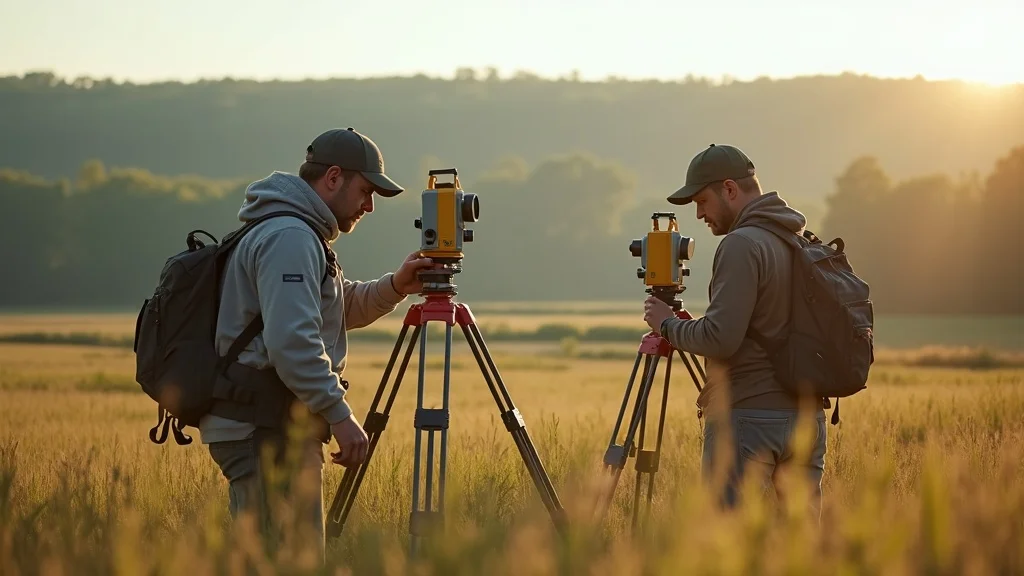
Total Station Innovations in Land Survey Equipment

Robotic total stations are at the forefront of modern surveying equipment. Unlike traditional instruments, they automate angle and distance measurement, track a surveyor’s prism, and wirelessly transmit data to field devices. For Massachusetts projects, particularly those in Lakeville with complex topography, total stations enable boundary surveys with sub-millimeter precision—making them indispensable for architects and engineers responsible for construction layout and as-built documentation.

Innovations such as integrated laser scanners and hybrid “one-man” operation give total stations unmatched site flexibility. Surveyors can now quickly and accurately measure distances, plot elevation, and log every detail—from utility easements to subtle grade changes. This is vital for both new builds and historic renovations where precision is key to regulatory approval and long-term property value.

Modern robotic total station mounted on tripod with detailed engineering site background, showcasing accurate land survey equipment for Massachusetts projects

GNSS Receivers: Enhancing Survey Equipment for Real-Time Data

Global Navigation Satellite System (GNSS receivers) represent a leap in survey equipment accuracy and speed. For land surveys in Lakeville, GNSS receivers can acquire real-time, centimeter-level position data—critical for property boundary surveys, grading plans, and FEMA floodplain determinations. Unlike older GPS units, advanced GNSS systems support Massachusetts coordinate systems and can maintain accuracy even under thick canopy cover or near wetlands.

In addition, features like RTK (Real-Time Kinematic) corrections and network integration make these units highly responsive. With multiple satellite constellations, surveyors can work in challenging Lakeville terrain, minimizing downtime and ensuring that site information flows instantly into planning and engineering workflows. This capability enables rapid project startup and consistent compliance with evolving state and local regulations.

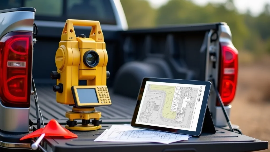
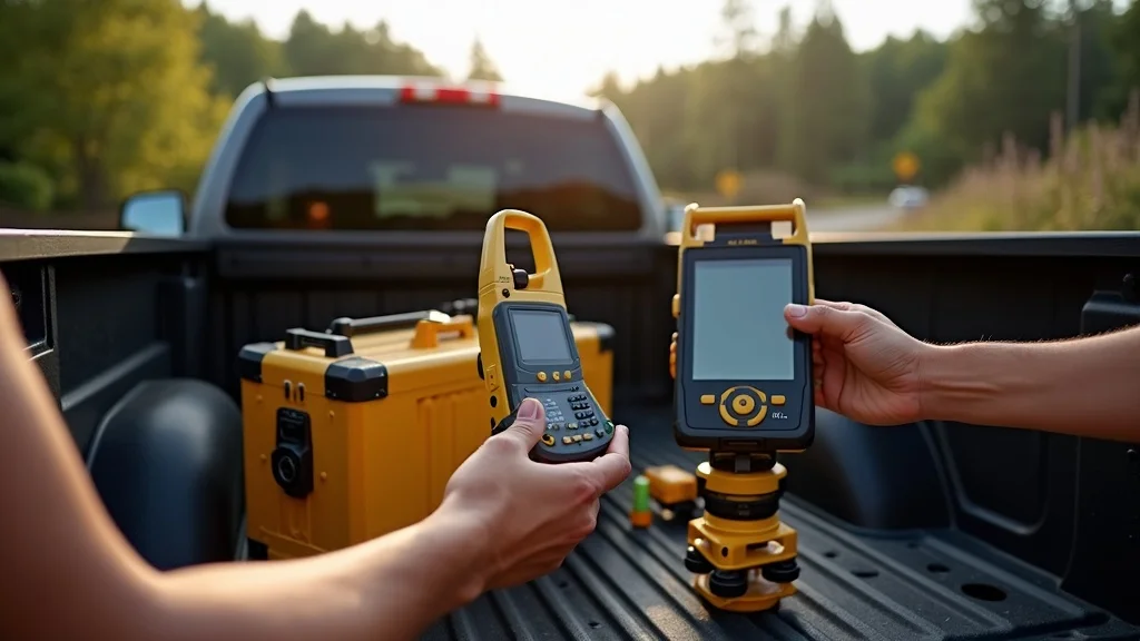
Data Collectors: Streamlining Survey Equipment Workflow

A modern data collector is the nerve center of every survey team. These rugged, touchscreen devices integrate with total stations and GNSS receivers, running specialized software to support digital mapping, stakeout, and automated data logging onsite. For Lakeville surveys, a robust data collector ensures all field data is instantly uploaded to project files, reducing the risk of transcription errors and speeding data integration into CAD or GIS environments.

Newer models offer wireless data sync, integrated cameras, and geo-tagging, further enabling regulatory reporting. Their intuitive interfaces require minimal training, allowing surveyors (and even non-experts) to verify critical benchmarks for zoning, wetlands protection, and construction staking directly from the field in weather-resistant hardware.
Key features to compare:

  • Accuracy ratings
  • Field durability
  • Data integration benefits

Comparing the Best Land Survey Equipment for Lakeville, MA

Selecting the right land survey equipment is both a technical and a regulatory decision in Massachusetts. The following comparison highlights the primary options used in Lakeville, considering cost, compliance, and field accuracy:

Surveying Equipment Key Features Compliance (MA) Cost Accuracy
Total Station Robotics, Laser Yes $$$ <1mm
GNSS Receiver RTK, Durable Yes $$ 1-2cm
Data Collector Touchscreen, Wireless Yes $ Data quality

How Modern Surveying Equipment Ensures Massachusetts Compliance

Lakeville projects face some of the most stringent environmental and zoning requirements in the state. Modern land survey equipment is engineered to support automated reporting, direct data upload into mandated formats, and seamless integration with state coordinate grids. With total stations, GNSS receivers, and digital data collectors, surveyors guarantee deliverables that meet or exceed every point of compliance required by the Lakeville Planning Board and Conservation Commission.

These technologies de-risk permit applications, avoid costly survey redos, and ensure timelines are met—whether for a single-family home near wetlands or a major infrastructure development. Selecting compliant survey equipment is not just about accuracy, but about enabling your project to move smoothly from planning to approval and beyond.

Land Survey Equipment and Local Regulations

In Massachusetts, regulatory bodies demand survey deliverables in formats compatible with MassGIS, MassDEP, and Conservation Commission records. Only advanced survey equipment—integrated total stations, GNSS receivers, and certified data collectors—can reliably create the topographic maps, boundary documentation, and wetland delineations needed for a successful Lakeville project.

For wetlands and buffer zones, Lakeville inspectors may require annual recertification using compliant equipment. This underscores the need for specialized accuracy, robust data logging, and hardware built for MA regulatory workflows. By working with a team—like Prime Engineering—that leverages the best technology, you ensure permits are streamlined, documentation is accurate, and legal risks are fully minimized.

“Compliant land survey equipment helps avoid legal setbacks and ensures seamless permit approvals for Lakeville, MA sites.” —Massachusetts Civil Engineer

Essential Features to Look for in Survey Equipment

Not all surveying equipment can withstand the rigors of Massachusetts weather or meet local compliance requirements. When choosing technology for a Lakeville project, consider these must-have features:

Open survey equipment case with GNSS receiver and data collector, illustrating key survey equipment choices for compliance in Lakeville Massachusetts

  • Integrated data collector functionality
  • Precision GNSS receiver compatibility
  • User-friendly interfaces for field crews
  • Durability for Massachusetts weather

Ruggedness ensures your equipment won’t fail mid-survey, while intuitive design guarantees even non-engineers can avoid costly mistakes. Compatibility with digital platforms accelerates data transfer to architects, site planners, or regulatory agencies—delivering the speed and confidence required for successful, fully compliant projects.

Land Survey Equipment Reviews: Field Experience in Lakeville

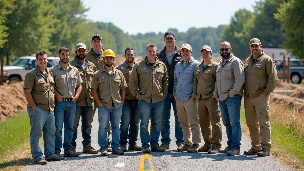
What are Lakeville’s top surveyors saying about their equipment? Across dozens of local projects, Prime Engineering field teams have validated that investing in the right land survey equipment pays off in both compliance and time savings. Surveyors consistently note that robust total stations capture more data points with less effort, while modern GNSS receivers maintain their accuracy even near Lakeville’s dense tree lines and variable terrain.

Touchscreen data collectors have been especially praised by field crews, streamlining everything from stakeouts to digital mapping with just a few taps. The consensus: for Lakeville’s mix of open farmland, wetlands, and historic neighborhoods, only fully integrated, Massachusetts-compliant equipment ensures error-free deliverables and smoother approval processes.

Surveyors Assess Total Stations, GNSS Receivers, and Data Collectors

Lakeville field teams frequently report that advanced total stations and GNSS receivers make the biggest difference when it comes to tricky boundary survey work and topographic mapping. “One-person robotic total stations cut our field time in half,” notes a Prime Engineering project manager, “and GNSS receivers let us work even under heavy tree cover without losing accuracy.” Data collectors that sync wirelessly to the office reduce project turnaround by an average of three business days—a difference felt especially during tight permitting windows.

This synergy between devices is what truly defines the next generation of surveying equipment. Whether you’re a homeowner verifying a property line or a developer mapping a multi-lot subdivision, the feedback from Lakeville’s seasoned pros is clear: combining these high-tech tools makes every project more efficient, accurate, and regulation-ready.

Lakeville, MA surveyor team reviewing digital results on data collector onsite, demonstrating field-tested survey equipment effectiveness

Land Survey Equipment Pitfalls: What Local Professionals Say

Despite these advances, not all equipment is created equal. Some surveyors warn against using outdated or under-calibrated tools—especially imported models not built for Massachusetts conditions. These can cause errors in boundary surveys or fail to meet Conservation Commission data requirements, resulting in avoidable delays. Others cite data collectors with limited battery life or subpar software integration as common pain points in the field.

The lesson? For Lakeville projects, invest in devices specifically vetted for MA regulatory workflows—and insist on a team that maintains and calibrates each unit to state standards. Doing so dramatically reduces risk and ensures all project data stands up to both permitting scrutiny and the timelines of demanding construction projects.

People Also Ask: Common Questions About Land Survey Equipment in Lakeville, MA

What is the most accurate type of land survey equipment?

Answer: The total station is often considered the most accurate land survey equipment, offering sub-millimeter precision ideal for detailed boundary surveys and site layouts in Massachusetts.

How does modern survey equipment handle Massachusetts-specific regulations?

Answer: Leading land survey equipment is designed to meet or exceed Massachusetts compliance standards, supporting automated data collection and reporting formats required for local permitting and wetlands protection.

Are all GNSS receivers suitable for surveying in Lakeville’s terrain?

Answer: Not all GNSS receivers are equal—select models that explicitly support Massachusetts coordinate systems and provide reliable accuracy even under canopy cover typical in Lakeville.

FAQs About Land Survey Equipment in Lakeville, MA

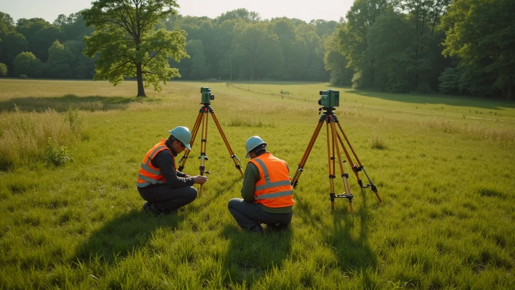
Scene demonstrating a modern land survey in progress in Lakeville, MA — field crew using a mix of total station, GNSS receiver, and wireless data collector, showing equipment setup, real-time data checking, and environmental challenges like light wind, shifting clouds, and diverse terrain; professional, educational tone, steady video with smooth pans, shots transition from equipment setup to digital mapping display.

  • Can I rent or lease land survey equipment in Lakeville?
    Yes, several equipment vendors and engineering firms in the Lakeville area provide flexible rental or leasing options for total stations, GNSS receivers, and data collectors. This can be ideal for short-term projects or infrequent survey needs.
  • What certifications do survey equipment need to meet for MA compliance?
    Massachusetts requirements include accuracy certifications for boundary and wetland surveys, typically tied to MassDOT, MassDEP, and ANSI/NSPS industry standards. Work with a survey provider that regularly calibrates and certifies their equipment.
  • How quickly can survey equipment data be integrated into CAD or GIS deliverables?
    With modern digital survey equipment, field data can often be uploaded and integrated with CAD or GIS platforms the same day—dramatically speeding up project timelines and review cycles in Lakeville.

Key Takeaways: Why Advanced Survey Equipment is Essential for Lakeville Projects

Modern land survey equipment used in Massachusetts land surveys displayed on site plans, including total station, GNSS receiver, and data collector for Lakeville MA

  • Modern land survey equipment maximizes project accuracy and compliance
  • Choosing the right survey equipment reduces delays and legal risks in Massachusetts
  • User-friendly interfaces and real-time data features improve efficiency on every project

Next Steps: Get Your Land Survey Today for Precision and Compliance in Lakeville

Ready to take the next step?Get Your Land Survey Today with Prime Engineeringfor accuracy, compliance, and local expertise.

If you’re looking to further expand your understanding of how land surveying fits into the bigger picture of site development and civil engineering in Massachusetts, Prime Engineering offers a wealth of resources and expert guidance. Their team not only utilizes the latest survey equipment but also provides strategic insight into regulatory trends, permitting, and project management across the state. By exploring their comprehensive Massachusetts land surveying and civil engineering solutions, you can discover advanced strategies to streamline your next project, avoid common pitfalls, and ensure long-term success from planning through construction.

Sources

To further enhance your understanding of modern land survey equipment and its applications, consider exploring the following resources:

  • “Total station”: This comprehensive article provides an in-depth look at total stations, detailing their functions, applications, and technological advancements that have revolutionized surveying accuracy. (en.wikipedia.org)

  • “Ground-penetrating radar”: This resource delves into the principles and uses of ground-penetrating radar, a non-intrusive method that employs radar pulses to image subsurface structures, enhancing the detection of underground utilities and geological features. (en.wikipedia.org)

By exploring these resources, you’ll gain valuable insights into the cutting-edge technologies that are transforming land surveying practices, ensuring precision and efficiency in various projects.

A surveyor wearing a white hard hat and orange safety vest operates a total station on a tripod, standing on a residential street lined with trees and houses in the background.

Licensed Land Surveyor: Why You Can’t Afford to Skip One Lakeville, MA

Did you know nearly 30% of all land disputes in Massachusetts result from missing or incorrect surveys? For homeowners, builders, and developers in Lakeville, MA, skipping a licensed land surveyor can expose you to legal disasters, permit nightmares, and costly surprises. From boundary errors to failed inspections, bypassing this crucial step threatens not only your wallet, but also your property’s future. This comprehensive guide breaks down why a licensed land surveyor is your frontline defense against bad data, noncompliance, and construction setbacks—and how hiring the right professional ensures your project’s success.

Professional land surveyor using modern GPS equipment on a suburban Lakeville, MA property, operating total station equipment with surveyed boundary markers, bright survey vests, and technical gear under midday natural lighting

Unveiling the True Value of a Licensed Land Surveyor: A Startling Look at Land Surveying Realities

In today’s fast-paced world of property development, accuracy isn’t just a preference—it’s a legal requirement. In Lakeville, MA, engaging a licensed land surveyor early on can make the difference between a smooth project and a costly legal battle. The intricate process of land surveying demands professional expertise to avoid: boundary disputes, title issues, survey errors, and construction delays. Whether you’re planning a home addition, subdivision, or wetlands permit, a certified survey is often required by local officials and lenders.

A licensed land surveyor brings technical mastery, regulatory knowledge, and state-issued credentials. Massachusetts’s rigorous standards mean only licensed surveyors can produce legally-defensible property line documents. Relying on “cheap” or non-credentialed surveyors nearly always leads to downstream headaches: rejected permit applications, lawsuits with neighbors, and difficulties securing insurance or financing. In short—if you’re building, buying, or developing in Lakeville, a professional land surveyor isn’t just helpful. They’re essential.

According to the Massachusetts Board of Registration of Professional Engineers and Land Surveyors, nearly 30% of land disputes stem from inaccurate or missing surveys — and most could have been prevented by hiring a licensed land surveyor.

For those interested in the specific steps and documentation involved in a Massachusetts boundary survey, you can explore a detailed breakdown of the boundary survey process and requirements to better understand what to expect and how to prepare for your project.

What You’ll Learn: The Essential Role of a Licensed Land Surveyor in Lakeville, MA

  • Why accuracy and compliance are non-negotiable for any land survey
  • How Massachusetts regulations impact your project
  • What a licensed land surveyor delivers that others can’t
  • Risk factors and hidden costs of skipping a licensed survey
  • How to select the right professional land surveyor or professional engineer for your needs

Understanding the Licensed Land Surveyor: Definitions, Credentials, and Massachusetts Standards

What is a Licensed Land Surveyor? Responsibilities, Legal Authority, and Professional Land Expertise

A licensed land surveyor is a highly trained professional registered with the Commonwealth of Massachusetts, authorized to establish legal property boundaries, conduct topographical analyses, and certify survey documents. Their expertise extends far beyond “measuring land”; they interpret legal documents, perform detailed records and deed review, and apply advanced technology like GPS, total stations, and Computer-Aided Drafting (CAD). Only those who pass rigorous surveying exams and maintain continuing education can legally offer these services—underscoring the critical difference between credentialed and non-credentialed providers.

Massachusetts law restricts the practice of land surveying to licensed professionals, ensuring that land surveys are accurate, defensible, and integrated with local regulations. Licensed land surveyors bear the responsibility not just for technical accuracy, but also for protecting clients’ investment and legal standing. They are the only professionals who can deliver the certified surveys required for legal filings, building permits, and real estate transactions in Lakeville, MA.

Confident licensed land surveyor holding official certification, standing near survey maps and technical equipment in a modern Massachusetts office

Land Survey vs. Land Surveyor: Know the Difference Before You Build

A land survey is the end product—a detailed map or document defining property lines, contours, easements, and site features. In contrast, a land surveyor is the licensed expert responsible for collecting field data and making sense of complex site conditions using advanced methods and technology. Land surveying incorporates computer-aided mapping, legal research, fieldwork, and quality control to deliver trustworthy results. Only a licensed land surveyor can produce official documents recognized for permitting, property transactions, and design.

This distinction is crucial. DIY or unlicensed surveys, or low-cost alternatives, often lack legal standing and the technical rigor required for municipal approval. Relying on anything less than a professional can expose you to disputes, failed projects, or legal challenges. In Massachusetts, only a survey signed and sealed by a licensed professional meets the state’s exacting standards. Your project, permit, and property line are only as safe as the credentials of the land surveyor you hire.

Professional Land Surveyor vs. Professional Engineer: Who Does What?

While both professional engineers and professional land surveyors hold Massachusetts licenses and are integral to construction and site development, their responsibilities are distinctly separate. A professional land surveyor specializes in the principles and practice of land surveying: they measure, analyze, and certify site boundaries, topography, and compliance with property regulations. Engineers, on the other hand, focus on design—structural, civil, and environmental—using survey data as the foundation for their work.

Although coordination between these experts is essential, only a licensed land surveyor can produce the certified site plan or boundary survey necessary for legal documentation, title transfers, or building permits. Understanding who does what helps you assemble the right team for your project—and ensures uninterrupted progress from concept through completion.

Why Every Landowner, Developer, and Builder Needs a Licensed Land Surveyor

  • Prevent boundary disputes and title issues
  • Ensure compliance with zoning, wetlands, and stormwater regulations
  • Enable accurate design, permitting, and construction
  • Help secure financing, insurance, or legal signoff

For Lakeville homeowners, builders, and developers, the decision to hire a licensed land surveyor goes far beyond required paperwork—it’s a critical investment in risk prevention and project success. Accurate surveys are the backbone of site development. They allow architects to design to scale, engineers to plan stormwater management, and municipalities to ensure compliance with zoning, Board of Health, and conservation rules. Without current, certified documentation, projects face everything from costly stop-work orders and fines to litigation and draining delays.

In fact, insurers, banks, and local agencies usually demand a certified land survey before approving loans, policies, or permits. The work of a professional surveyor protects property value, secures entitlements, and de-risks major investments. For those tempted to cut corners here, the hidden price can be years of legal battles or forced tear-downs if a survey later proves invalid. The licensed land surveyor is not a bureaucratic requirement: they’re your project’s insurance policy against expensive, project-stopping surprises.

“Without a current and certified land survey, your entire project could be at risk — from stop-work orders to failed inspections,” warns a local professional surveyor.

Worried homeowners and builder consulting with a land surveyor, reviewing survey maps at Lakeville property boundary with wooded lot and partially built home

Key Land Survey Types Offered by Licensed Land Surveyors in Lakeville, MA

Boundary Surveys: Foundation of Every Successful Project

The boundary survey is the most crucial document in any property transaction, addition, or new build. A licensed land surveyor conducts extensive research in public records, physically locates or sets monument markers, and produces a certified map establishing the precise location of all property lines, easements, and adjacent sites. In Lakeville, this type of survey is often required for permit applications, property sales, fence installations, or to resolve disputes with neighbors.

What sets a boundary survey apart is its legal defensibility. Should a title or fence dispute escalate to court, a certified boundary survey prepared by a Massachusetts licensed surveyor becomes the trusted, preferred evidence. Relying on outdated plot plans, unofficial site sketches, or unlicensed surveyors exposes you to legal risks and challenges. Only a properly stamped, up-to-date boundary survey—aligned with town and state requirements—guarantees recognition in real estate and regulatory arenas.

Topographic Mapping: Enabling Engineering, Architecture, and Permitting

If you’re planning site work—grading, driveway installation, new construction, or subdivision—you’ll need a detailed topographic survey (aka “topo map”). Licensed land surveyors capture data on “features of the earth”—elevations, contours, drainage areas, utilities, and significant trees or wetlands—using a mix of field measurement, GIS, and computer-aided data processing. These topo surveys form the backbone for site engineering, architectural design, and stormwater plans—essential for securing Lakeville permits and complying with state regulations.

Lakeville and Plymouth County officials increasingly require digital topographic mapping submitted in CAD or GIS formats. Professional surveyors not only provide field data, but deliver files seamlessly to architects and engineers, supporting integrated design, conservation filings, and accurate construction layout. In an era of climate resilience and zero-tolerance for stormwater mistakes, data accuracy is paramount; only a licensed land surveyor can offer the precision municipalities demand.

Surveyor reviewing digital topographic survey map showing Lakeville, MA terrain on large office monitor, with GIS and contour lines visible

Wetland & Floodplain Mapping: Protecting Your Site and Meeting Massachusetts Compliance

Wetlands and floodplain rules are among the strictest in Massachusetts—especially in regions like Lakeville that are home to critical habitats, drinking water wells, and conservation areas. A licensed land surveyor uses a blend of fieldwork, regulatory mapping, and collaboration with wetland scientists to determine jurisdictional boundaries, buffer zones, and flood risk on your property. These maps are not only required for Conservation Commission permits (ANRAD, NOI) but can mean the difference between project approval and outright denial.

By hiring a surveyor versed in local, state, and federal government wetland regulations, you ensure your engineering team can design within allowed limits, avoid costly redesigns, and mitigate environmental and legal risks. High-resolution wetland and elevation mapping also supports FEMA floodplain certification—critical for homebuyers, lenders, and insurers. The nuances and stakes in this arena are too great for DIY work; only a licensed land surveyor’s deliverables will satisfy Massachusetts law and protect your project.

Construction Layout & As-Built Surveys: Securing Accuracy From Start to Finish

During site development, a construction layout survey guides the exact placement of structures, utilities, and infrastructure—ensuring the engineer’s and architect’s plans are brought to life with accuracy. Only a licensed surveyor has the experience to translate digital plans into real-world coordinates using total stations, GPS, and high-precision equipment. This eliminates guesswork and prevents costly mistakes, safeguarding your investment throughout every project phase.

After work is completed, an as-built survey documents what has actually been constructed. Developers, building officials, and lenders rely on these as-built records to confirm compliance, occupancy, and warranty conditions. Missing or unreliable as-built data can stall approvals, hold up closings, or even force expensive revisions if infrastructure is misaligned. From initial stake-out to final certification, the licensed land surveyor is the ringmaster of construction accuracy and accountability in Lakeville, MA.

Lakeville, MA Compliance: Why a Licensed Land Surveyor Is Required by Law

Critical Massachusetts Regulations: Zoning, Wetlands, Board of Health & Permitting

Massachusetts doesn’t leave land development to chance—especially when water, health, and land-use issues are involved. State statutes and local ordinances strictly require certified site plans and surveys for virtually every major project: subdivisions, home additions, septic systems, wetland impacts, and commercial construction. Lakeville’s bylaws echo this, mandating licensed land surveyor oversight for projects involving new boundaries, site work, or environmental review.

The Lakeville Board of Health, Conservation Commission, and Zoning Board will not accept permit applications supported by uncertified or unofficial plans. Only surveys signed and sealed by a Massachusetts professional land surveyor meet the municipality’s compliance standards. This isn’t just bureaucratic: it’s about public safety, property rights, and environmental protection. Skipping this requirement doesn’t “save money”—it puts your entire project, investment, and timeline at risk.

Official Lakeville, MA town hall exterior with regulatory signage and a surveyor working nearby, under diffused sunlight

Continuing Education for Licensed Land Surveyors: Staying Ahead of Evolving Standards

Rapid advances in technology and evolving Massachusetts land use rules demand that all licensed land surveyors maintain continuing education to keep their credentials. State law requires regular professional development—ranging from emerging GPS and GIS technologies to legal updates on boundary law, stormwater standards, and digital mapping protocols. Surveyors must document this ongoing learning as a condition of license renewal, ensuring that clients in Lakeville always benefit from the most current, reliable, and legally-defensible survey data.

This commitment to continuing education separates the true professionals from occasional or “off-the-books” operators. It means the features of the earth are mapped with modern accuracy, and clients receive deliverables that work for permits, design, and resale for years to come. Don’t leave your largest investment to a provider who may be out-of-date—always check that your surveyor meets or exceeds Massachusetts’s robust educational standards.

Common Massachusetts Projects & Required Land Survey Services
Project Type Required Survey Service Agency or Permit Tied To
Home Addition / Garage Boundary Survey, Site Plan Zoning Board, Building Permit
New Septic System Topographic Survey, Wetland Mapping Board of Health
Commercial Building ALTA/NSPS Survey, Construction Layout Building Dept, Bank, Insurance
Wetland Development Wetland & Floodplain Mapping Conservation Commission, DEP

The Risks of Skipping a Licensed Land Surveyor: Legal, Financial, and Project Setbacks

  • Survey errors leading to lawsuits
  • Rejected permits or cost overruns
  • Encroachments onto neighboring land
  • Delays due to missing compliance documentation

The consequences of skipping a licensed land surveyor are often far more severe—and expensive—than most property owners realize. Errors in property lines or elevations can trigger a cascade of problems: rejection of your building permit, construction over someone else’s land, or legal claims that stop your project cold. Fixing a boundary error typically costs ten times more than doing the survey right the first time—not to mention delays and negative impacts on resale or insurance eligibility.

Unlicensed or “discount” survey providers often lack the credentials, insurance, and regulatory know-how needed for Massachusetts compliance. Their deliverables may fail in court, be rejected by lenders, or leave you with unresolved regulatory red flags. In Lakeville, strict enforcement by town officials and conservation staff ensures there are no shortcuts to legal site development. For anyone serious about their investment, hiring a licensed land surveyor isn’t a checkbox—it’s your shield against project-derailing surprises.

How Much Do Land Surveyors Charge? Understanding Land Surveyor Pricing in Lakeville, MA

Standard Fee Ranges: Residential, Subdivision, Topographic, FEMA, Wetlands

Land surveyor pricing in Lakeville, MA varies depending on the type and scope of services. For a typical residential boundary survey, expect fees of $1,000–$2,500; more complex services such as topographic mapping, FEMA elevation certificates, or wetland delineations can range from $2,000–$5,000 or more. Subdivision surveys, with their stringent regulatory requirements and need for multiple iterations, often start at $4,000 and go higher. These investments may seem steep, but pale in comparison to the costs of fixing a failed permit or lawsuit.

Licensed surveyors also typically offer fixed-fee pricing for defined scope work, or hourly rates (ranging from $100–$250/hour in Massachusetts) for research-intensive, complex, or time-sensitive projects. Be wary of unusually low quotes; these often indicate unlicensed providers or non-compliant deliverables that can jeopardize your project. Always request a detailed breakdown of what’s included—especially digital files, regulatory signoff, and post-survey support—before making your selection.

Stack of survey invoices and calculator with surveyor’s scale, illustrating land surveyor pricing for Lakeville, MA properties

How Pricing Is Determined: Site Complexity, Research, and Delays

Land survey costs are influenced by several factors. Highly wooded, irregular, or large parcels require more field effort. Unclear property lines or outdated deed records mean the surveyor must invest more time in research. Regulatory environments—such as those involving wetlands, flood zones, or subdivision approval—add necessary complexity and administrative work. If your site is “easy”—open, with well-established boundaries—a survey may cost less; tricky terrain or legal issues raise prices.

Survey firms also price based on required deliverables: is only a paper plan needed, or does your project need full CAD, digital GIS, or formal FEMA certifications? Delays often result from missing documentation, difficult title histories, or weather disruptions. Make sure you select a licensed land surveyor who is transparent about their pricing structure and offers a formal contract covering scope, deliverables, and timelines—this protects you from surprise fees and unfinished work.

“A properly scoped land survey pays for itself by eliminating risk — the cost to fix a boundary error is often 10x the price of the survey,” says a seasoned professional land surveyor.

Sample Land Survey Pricing in Lakeville, MA
Survey Type Typical Price Range Description
Residential Boundary Survey $1,000–$2,500 Establishes property lines for fence/building permits or title needs
Topographic Survey (per acre) $1,500–$3,500 Maps elevations/features for engineering, design, stormwater
FEMA Elevation Certificate $700–$1,500 Documents base flood elevation for insurance/permits
Subdivision Survey (Minor) $4,000–$8,000 Full platting, lot creation, and town approval

How to Choose the Right Licensed Land Surveyor in Lakeville, MA

  • Credentials (MA licensure, continuing education, professional affiliations)
  • Local experience (Lakeville, Plymouth County, Cape Cod)
  • Technology and deliverables (CAD, GIS, site plans)
  • Reputation and reviews

Choosing a licensed land surveyor is as important as selecting your architect or builder. Verify that any surveyor you consider holds current Massachusetts licensure and is in good standing with the Board of Registration. Ask about their ongoing professional development and membership in organizations like the Massachusetts Association of Land Surveyors and Civil Engineers. Experience in Lakeville or Plymouth County is invaluable—local surveyors are more familiar with town bylaws, permitting processes, and site-specific challenges.

Also, review their technical capabilities. Do they provide digital CAD/GIS files and interactive site plans, or only paper copies? Ask for references or reviews from previous clients in your area and check how clearly the surveyor explains processes and deliverables. Remember: your surveyor should be your advocate, guiding you through regulations and safeguarding your interests every step of the way.

“Your licensed land surveyor should be your project’s advocate, not just a box-checker on a permit form”

Step-by-Step: The Land Survey Process With a Licensed Professional

  1. Project scoping and regulatory research: Discuss your project goals with your surveyor, who identifies applicable regulations and required services.
  2. Records and deed review: The surveyor investigates town and registry archives to clarify boundaries, easements, and site history.
  3. Field data collection with GPS/total station: Technicians measure and mark the property using advanced equipment.
  4. CAD/GIS drafting and quality control: Data is processed, mapped, and reviewed to ensure accuracy and compliance.
  5. Stamped deliverables and client explanation: The final, certified plans are issued with a thorough walk-through for the client.
  6. Supporting permit applications or construction: The surveyor collaborates with engineers, architects, and officials to integrate data into the next project phase.
  7. Record keeping and support post-survey: All documentation is archived, with the surveyor available for questions, updates, or legal proceedings as needed.
Land Survey Process Timeline in Lakeville, MA
Step Timeframe Notes
Scoping & Regulatory Review 1–2 Days Depends on project size and regulatory complexity
Records/Deed Research 2–4 Days Longer if historic or clouded title
Field Data Collection 1–3 Days Site type and weather may affect timing
Drafting & Quality Control 2–5 Days Includes CAD/GIS work and regulatory review
Deliverable & Client Meeting 1 Day Possible revisions or clarifications
Total Typical Duration 7–15 Days Complex or multi-phase projects may require more time

People Also Ask: Top Questions About Licensed Land Surveyors in Lakeville, MA

What is a licensed land surveyor?

  • A licensed land surveyor is a professional who is registered and credentialed by the state to provide certified land survey services, ensuring accuracy, legal standing, and compliance with Massachusetts regulations. Only a licensed land surveyor can legally define property boundaries for title, permitting, or design purposes.

How much do land surveyors charge per hour?

  • Land surveyors typically charge between $100 and $250 per hour in Lakeville, MA. The rate depends on the survey complexity, site conditions, and required deliverables. For fixed-scope projects, most surveyors offer flat fees based on estimated hours and task complexity.

How much does a land surveyor make in Ohio?

  • In Ohio, the average land surveyor earns between $55,000 and $75,000 annually, according to recent industry data. This figure varies by experience, licensure, and specialization.

What is a surveyor’s top salary?

  • Top licensed land surveyors in specialized or management roles can make over $100,000 annually, particularly when leading large infrastructure projects or firms.

Key Takeaways: Why a Licensed Land Surveyor Is Critical for Your Lakeville, MA Project

  • Only licensed land surveyors offer legal, defensible, and compliant property surveys in Massachusetts
  • Accurate surveys prevent costly legal and construction mishaps
  • Regulatory knowledge and local experience are crucial for smooth projects
  • Choosing the right professional helps deliver your project—on time, on budget, and on spec

Frequently Asked Questions About Licensed Land Surveyors in Lakeville, MA

  • When is a land survey required in Massachusetts?
  • Can a civil engineer or architect substitute for a licensed surveyor?
  • What’s included in a certified survey deliverable?
  • How are site constraints handled during land surveying?
  • What permits typically require a professional land survey?

Get Your Project Started Right: Speak to a Licensed Land Surveyor in Lakeville, MA

  • Don’t put your investment at risk. Contact Prime Engineering for a comprehensive, compliant, and project-enabling land survey in Lakeville, MA. Get Your Land Survey Today

Conclusion

Investing in a licensed land surveyor in Lakeville, MA is the single most effective way to protect your property and enable a smooth, successful project from day one.

If you’re ready to take the next step in safeguarding your property and ensuring regulatory compliance, consider exploring the broader landscape of land surveying and civil engineering services available in Massachusetts. By understanding how integrated site planning, engineering, and surveying work together, you can unlock even greater value and efficiency for your project. Discover how a full-service approach from a trusted local firm can streamline your experience and help you navigate every phase of development with confidence—visit Prime Engineering’s Massachusetts land surveying and civil engineering resource for advanced insights and tailored solutions.

Sources

Engaging a licensed land surveyor is crucial for ensuring accurate property boundaries and compliance with local regulations. The Massachusetts Association of Land Surveyors and Civil Engineers (MALSCE) provides a comprehensive resource titled “Find a Surveyor,” which outlines the qualifications and services offered by professional land surveyors in the state. This guide emphasizes the importance of hiring a licensed professional to prevent legal disputes and ensure precise measurements. (malsce.org)

Additionally, the New York State Education Department offers a detailed overview in their “NYS Land Surveying: Consumer Information” page. This resource explains the roles and responsibilities of licensed land surveyors, the scenarios necessitating their services, and the credentials required for licensure. It serves as a valuable reference for understanding the critical role these professionals play in property transactions and development projects. (op.nysed.gov)

For those seeking to hire a qualified land surveyor, the Massachusetts Association of Land Surveyors and Civil Engineers (MALSCE) offers a “Find a Surveyor” tool. This resource allows users to locate licensed professionals in their area, ensuring that they engage individuals who meet the state’s stringent standards for land surveying. (malsce.org)

If you’re serious about safeguarding your property interests and ensuring compliance with local regulations, these resources will provide you with the necessary information to make informed decisions when hiring a licensed land surveyor.

Two people sit at a desk between two monitors, looking at each other and discussing architectural blueprints spread out in front of them in a modern office setting.

Land Survey Cost Explained: What You Need to Know Now Lakeville, MA

Did you know over 70% of real estate disputes in Lakeville, MA, begin with unclear property lines? Whether you’re a homeowner considering a property improvement, a developer aiming to break ground, or an architect preparing a site plan, understanding land survey cost in Massachusetts is not optional—it’s essential for project approval, legal security, and avoiding expensive setbacks. This comprehensive guide breaks down what impacts survey costs, what Lakeville and MA regulations demand, and exactly how to avoid hidden pitfalls in your next real estate project.

Startling Facts About Land Survey Cost in Massachusetts

  • Why land survey cost surprises so many MA property owners: Many underestimate the complexity, legal stakes, and regulatory layers involved—until a dispute or permit denial happens.
  • Statistic: Over 70% of Lakeville, MA real estate disputes start with unclear property lines, often when professional land surveyors weren’t used or proper surveys weren’t obtained.
  • How survey cost connects to legal and financial risk: In Massachusetts, a proper survey isn’t just about money—it’s the key to protecting your investment, enabling construction, and preventing fines or lawsuits. Homeowners, developers, and realtors all face major risks if survey costs are skipped or underestimated.

Insightful Massachusetts homeowners studying property maps focused on land survey cost and property boundaries in Lakeville, MA

“Precision in land surveying isn’t just best practice—it’s required for project approval throughout Massachusetts.” — Prime Engineering Senior Surveyor

What You’ll Learn About Land Survey Cost in Lakeville, MA

  • The average land survey cost in Massachusetts—and what drives that price
  • Types of land surveys mandated for construction, purchase, and permit applications
  • How to choose a professional land surveyor for compliance and accuracy
  • Common mistakes (and hidden costs) to avoid in Lakeville
  • Real examples and case studies from successful (and costly) Lakeville, MA projects

Understanding Land Survey Cost: The Foundation for Every Project

Why Land Survey Cost Matters for Massachusetts Projects

  • Project approvals: Every major construction or improvement in Lakeville must pass the zoning, conservation, and building department review. A land survey is the first—and most scrutinized—requirement.
  • Property line protection: Your land’s boundaries, corners, and rights are only as reliable as the land survey establishing them. Disputes over boundary lines can stall or stop projects—and quickly snowball into legal battles.
  • Preventing project delays, fines, and legal disputes: The right land surveyor shortens permit timelines, resolves boundary issues early, and keeps costs predictable. Missing or bad surveys can cause rework, penalties, and permit denials costing thousands (or halting sales and construction entirely).

Professional land surveyor marking a property boundary in Lakeville, MA, ensuring survey cost accuracy and compliance

Regulatory Landscape: Local and State Laws Impacting Land Survey Cost

  • Lakeville permitting requirements: Local bylaws define what survey type is needed—for everything from decks, sheds, pools, and additions to full site development.
  • Massachusetts Wetlands Protection Act: Projects near water or in designated areas demand additional survey detail and regulatory filings, adding complexity and cost.
  • Conservation Commission approvals: Precise survey documentation is mandatory if your land borders wetlands, floodplains, or conservation lands—each layer adds deliverables and affects the land survey cost.

Video:What Drives Land Survey Cost in Massachusetts?(Short animated overview—available at Prime Engineering)

Land Survey Cost in Lakeville, MA: Average Prices and Influencing Factors

Average Land Survey Cost in Lakeville and Massachusetts

Type of Survey Typical MA Cost (2024) Factors Affecting Cost
Boundary survey $850–$2,400 Parcel size, history, terrain
Topographic survey $1,200–$3,500 Elevation changes, site complexity
Mortgage survey $600–$1,200 Timing, lender scope
ALTA/NSPS survey $2,500–$6,000 Commercial standards, title demands

The average land survey cost in Lakeville, MA, reflects both the size and complexity of your project. For a standard residential plot plan or boundary survey, expect a baseline of $850–$2,400. Larger lots, wooded terrain, or properties with ambiguous boundary lines or outdated records naturally increase the price. Adding topographic detail, wetlands studies, or full ALTA/NSPS standards (common for larger real estate deals) can more than double typical survey costs. Speed, local zoning overlays, and the need for digital files or stamped plans will also influence your final bill.

When considering which type of survey best fits your project, it’s helpful to understand the specific requirements and deliverables for each. For a deeper dive into the differences between boundary, mortgage, and topographic surveys—and how each impacts your budget—explore the comprehensive land surveying services overview from Prime Engineering.

Primary Factors That Impact Your Land Survey Cost

  • Parcel size and dimensions: More acreage or irregular shapes require more time and fieldwork.
  • Boundary complexity (old deeds, multiple owners): Title issues, disputed corners, or missing markers can demand hours of research and field validation.
  • Required deliverables (plot plan, CAD files, legal docs): Lenders and town boards often require digital plans, stamped maps, or special addenda that increase survey costs.
  • Site conditions (wooded, wetlands, sloped, built-up): Heavily treed or wetland parcels make boundary surveys harder and more time-intensive.
  • Project scope—new build, sale, development, dispute: Subdivisions, major site plans, or project site developments will require more extensive survey types and reporting.
  • Municipal/MA permit and regulatory layers: Lakeville permits, conservation approvals, and state overlays add reporting steps and review fees.

“No two parcels or survey costs are alike—the right professional land surveyor will give you a precise, up-front estimate.” — Prime Engineering

Types of Land Surveys and How They Affect Land Survey Cost

Boundary Survey vs. Mortgage Survey vs. Topographic Survey vs. ALTA

  • Boundary survey: Establishes exact legal property lines and corners; required for most permits and property line disputes.
  • Mortgage survey: Typically needed for real estate closings in Lakeville; limited in scope but required by lenders or title companies to satisfy loan and land title association requirements.
  • Topographic survey: Maps ground elevations, contours, and utility locations; critical for engineering, drainage plans, and new construction projects.
  • ALTA/NSPS survey: The gold standard for commercial and real estate transactions, verifying boundaries, improvements, easements, and title clean-up for American Land Title Association compliance.

Variety of land survey tools and maps related to boundary survey, mortgage survey, and topographic survey cost in Lakeville

Choosing the right survey type will directly influence your land survey cost. For standard home improvements, a boundary or plot plan survey might suffice. Major real estate deals, subdivisions, or properties impacted by conservation or wetland overlays may require an ALTA, topographic, or even construction survey. Knowing which survey type to request ensures you don’t overpay—or run into compliance issues—midway through your project.

Choosing the Right Survey Type for Your Project in Lakeville

  • When do you need a boundary survey? Before building fences, additions, or resolving disputes—any time your property line is involved or questioned.
  • When does the town require topographic/plot plan? For new builds, additions, or when grading changes, drainage, or stormwater plans are submitted to the building department.
  • What triggers a mortgage survey for real estate? Sales, refinancing, or title transfers nearly always require a lender’s mortgage survey; higher-value or complex transactions might require ALTA/NSPS level detail for the title association.

Video:Site walkthrough—What Happens On Your Lakeville Property During a Land Survey?(See Prime Engineering for walkthrough)

Hiring a Professional Land Surveyor—What It Means for Land Survey Cost and Compliance

The Professional Land Surveyor Advantage

  • Licensed in Massachusetts: Only a licensed professional land surveyor can produce a legal, defensible map or plot plan that will satisfy permit boards and lenders in Lakeville.
  • Up-to-date on local zoning, wetlands, and permitting: Massachusetts regulations change frequently—your surveyor must know Lakeville’s specific standards for zoning, wetlands, and approval timelines.
  • Provides deliverables needed for engineering, building, and legal: From digital CAD files for your architect, to stamped plans for the town, to plot plans for your permit, the right land surveyor delivers what your project and the authorities demand.

Professional land surveyor and Lakeville homeowner agree on land survey cost and project boundaries

How to Vet a Land Surveyor for Massachusetts Projects

  • Questions to ask about technique and technology: Do they use GPS, total stations, or CAD? Are their survey records and accuracy standards current?
  • Compliance with MASurvey Board: Ensure their licensing and insurance are up-to-date and check for any public regulatory or insurance issues.
  • Review of references, insurance, and regulatory history: Secure reviews from recent Lakeville projects; verify they carry professional liability insurance and have a good standing record on compliance and legal matters.

“A professional land survey enables your architect, engineer, and builder to start right and finish fast—with no legal snags.” — Prime Engineering

Land Survey Cost Breakdown: What’s Included (and What’s Not)

Standard Deliverables in a Lakeville, MA Land Survey Cost Quote

  • Field crew visit, records research, boundary marking: On-site staff and extensive deed/title research to locate and confirm your property lines.
  • CAD drawings, digital files, plot plans: Digitally prepared drawings, as required by most architects, engineers, and permitting authorities in Massachusetts.
  • Signed/sealed survey map by a professional land surveyor: This certified document is essential for legal and zoning compliance.

Digital land survey map and plans—essential deliverables included in Lakeville land survey cost

Potential Add-On Fees in Land Survey Cost

  • Additional monumentation (installing extra boundary markers)
  • Old/degraded deeds or missing legal records (more research time)
  • Wetland line flagging
  • Emergency/expedited service (faster turnaround at a premium)
  • Town re-review or peer review fee for permits, especially in complex or high-value projects

Hidden Costs Homeowners and Developers Should Expect in Real Estate Projects

  • Title insurance or legal review (common for sales and refinancing)
  • Zoning appeals or Conservation Commission filings (extra reports, hearings, or documentation)
  • Specialist reports—wetlands, stormwater, or septic studies

Always request a detailed quote and project scope from your surveyor; ensure you understand what your land survey cost covers and what could trigger additional costs.

Local Regulations That Affect Your Land Survey Cost in Lakeville, MA

  • Lakeville Zoning Bylaws: Regulations covering lot size, allowed uses, and minimum frontage.
  • Conservation Commission: Strict controls for wetlands, floodplains, and protected buffers; survey maps often need wetland boundaries clearly shown.
  • Building department: Demands for pre-construction, plot plan, and as-built surveys as part of permit applications.
Permit/Requirement Survey Type Needed Typical Added Cost
Wetland delineation Boundary/topographic $450–$850
Building addition Mortgage/plot plan $300–$1,200
Subdivision Full ALTA/topographic $3,000–$7,000+

Not complying with these regulations will almost always inflate your survey cost by requiring subsequent corrections or extra site visits—another reason to hire a Massachusetts-savvy surveyor from the start.

How Land Survey Cost Prevents Real Estate and Construction Headaches

Land Survey Cost and Property Line Disputes

  • Real MA case: In one Lakeville neighborhood, a fence was built over a disputed line. Only after a professional boundary survey confirmed both owners’ limits was the conflict resolved—saving both parties from an expensive legal fight.
  • Time and money saved: Proactively getting a survey before site work, fencing, or additions will often resolve issues sitting dormant in unexamined deeds or outdated plot plans.

Lakeville neighbors resolving property line dispute with help of professional land surveyor and boundary survey cost transparency

Land Survey Cost for Developers and Contractors: Budgeting and Scheduling

  • Survey cost as part of project pro forma: Developers include land survey cost alongside engineering, architectural, and legal fees to reduce risk and secure predictable project timelines.
  • Delays from missing or faulty survey: If permits or plot plans are kicked back for errors, penalties and redesign can delay sitework for weeks—costing thousands in labor and lost construction time.

“Solid data on Day 1 means no site shutdowns on Day 101.” — Project Manager, Prime Engineering

Comparing Land Survey Costs: Lakeville, MA vs. National Averages

Region Typical Range (Boundary) Why Higher/Lower
Lakeville, MA $850–$2,400 State regulations, wetlands, developed parcels
Southern US $500–$1,200 Larger lot size, fewer regulatory layers
Urban Northeast $1,100–$3,200 Title issues, multi-owner parcels

Why Is Lakeville’s Land Survey Cost Higher/Lower Than the US Average?

  • Massachusetts permitting: More stringent engineering, plot plan, and wetland standards compared to other states.
  • Wetlands/regulatory overlays: Proximity to water or protected land adds complexity and cost tiers not present in much of the Midwest or South.
  • Lot size and development density: Denser, smaller lots cost more per square foot; historical subdivisions and overlapping or ancient title records add more hours for records research.

US map highlighting regional differences in boundary survey cost, with Lakeville, MA and regulatory regions emphasized

Land Survey Cost Savings—Practical Tips for Your Budget

  • Gather all deeds and records—save surveyor research time (and fees)
  • Ask your engineer/surveyor if you really need a commercial/ALTA survey—don’t pay for more than your lender or town requires
  • Combine property line and topographic needs—many firms offer bundled pricing for multiple survey types
  • Plan surveys at the permit application phase—not at the last minute to avoid rush/jump-the-line charges

Video:Interview—Tips from a Massachusetts Surveyor on Saving Time and Money(View on Prime Engineering website)

People Also Ask: Land Survey Cost Questions for Massachusetts Projects

How much does it cost for someone to survey land?

  • For Lakeville, MA, expect $850–$2,400 for a typical boundary survey. Final land survey cost varies by parcel size, boundary complexity, and necessary deliverables such as plot plans or digital files.

How much does it cost to survey land in KY?

  • In Kentucky, basic boundary surveys often cost $500–$1,200, largely due to fewer regulatory requirements and typically larger parcel sizes compared to Massachusetts. This leads to a lower overall land survey cost in KY.

What is the difference between a boundary survey and a survey?

  • “Survey” is a general term for any mapping or boundary marking task. A “boundary survey” is a specialized service that identifies and marks legal property lines, monuments, or markers—essential for secure real estate transactions and resolving property line disputes.

How much does a survey cost in MO?

  • Missouri boundary survey cost is typically $600–$1,400—generally lower than Massachusetts thanks to less regulatory burden and different site conditions impacting overall land survey cost.

Frequently Asked Questions on Land Survey Cost in Lakeville, MA

  • How long does a land survey take?
    Residential surveys can take one to three weeks from first contact—longer if records are missing or regulatory reviews are needed for wetlands or conservation.
  • What documents should I give my land surveyor?
    Deeds, previous surveys, any plot plan or site improvement plans, legal descriptions, and information on easements or encroachments.
  • What if my neighbor disagrees with the survey?
    A Massachusetts-licensed surveyor can defend their work at municipal boards or in court. Disputes are rare when the boundaries are mapped to state standards.
  • Will I get a digital map and CAD file?
    Most professional land surveyors in Lakeville provide digital files and signed paper copies; verify deliverables in your cost quote.

Architect and homeowner reviewing land survey documentation checklist for successful survey cost management in Lakeville MA

Summary: What Every Lakeville, MA Stakeholder Should Remember about Land Survey Cost

  • Land survey cost is a vital budget item for compliance, prevention, and project enablement.
  • Partner with a MA-licensed professional land surveyor to ensure precision and approve your permit/application smoothly.
  • Preparing documentation, understanding survey types, and knowing local regulations reduce your risk and total survey cost.

If you’re ready to take the next step in your project or want to ensure your investment is fully protected, consider exploring the full range of land surveying and civil engineering solutions available from Prime Engineering. Their expertise extends beyond just surveys—they offer strategic guidance for site development, permitting, and compliance across Massachusetts. By leveraging a team that understands both the technical and regulatory landscape, you can streamline your project and avoid costly surprises. Discover how a comprehensive approach to land surveying and engineering can set your Lakeville project up for long-term success by visiting Prime Engineering’s Massachusetts land surveying and civil engineering resource hub.

Ready for Precision? Get Your Land Survey Today

Sources

Understanding the costs associated with land surveys is crucial for property owners and developers in Lakeville, MA. Factors such as property size, terrain complexity, and the specific type of survey required can significantly influence the overall expense. For a comprehensive breakdown of land survey costs, including average prices by survey type and factors affecting these costs, consider consulting the article “How Much Does a Land Survey Cost? [2025 Data]” available at HomeAdvisor. This resource provides detailed insights into the various elements that contribute to land survey expenses. Additionally, “How Much Does a Land Survey Cost in 2025? Real Prices by State, Type, and Acreage” from The Land Geek offers an in-depth analysis of survey costs across different states and property types, which can help you better understand the financial considerations specific to your project. By exploring these resources, you can gain a clearer understanding of the potential costs involved in land surveying, enabling you to budget effectively and make informed decisions for your property in Lakeville, MA.

Two workers in safety vests and helmets kneel in a grassy field, operating surveying equipment mounted on tripods, with trees and sunlight in the background.

Topographic Survey Near Me—Uncover Your Land’s Hidden Details Lakeville, MA

Did you know that over 70% of site development delays are caused by incomplete or inaccurate land data? When launching a real estate dream or development plan in Lakeville, MA, a topographic survey near me isn’t optional—it’s your first line of defense against costly surprises, delays, and regulatory headaches. In this guide, you’ll discover how Prime Engineering’s technical mastery, local expertise, and commitment to Massachusetts compliance empower you to make confident, risk-free decisions from day one.

Revealing the Land: Why a Topographic Survey Near Me Is Critical in Lakeville, MA

Every successful project in Lakeville, MA—from a backyard addition to a commercial site—relies on reliable land data. The topographic survey near me is not just about drawing lines on a map; it’s about translating the living landscape into actionable, regulatory-ready insight. Unlike a generic land survey, which primarily confirms boundaries, a topographic survey reveals the physical features—elevation changes, utility lines, wetlands, and even nuanced surface details that shape permit decisions and engineering designs.

This matters because in Lakeville, site permitting requires more than ownership documents. Conservation Commission reviews, zoning setbacks, and stormwater designs all depend on accurate, current topographic mapping. Without it, errors go undetected. A single missed wetland, misread property line, or unmapped grade can stall your permit for months, or force expensive mid-project redesigns—especially as Massachusetts regulations grow stricter each year. With Prime Engineering, you get both precision and peace of mind, knowing your project’s first step is backed by one of the region’s top land surveyor teams.

“Over 70% of site development delays are caused by incomplete or inaccurate land data. A topographic survey eliminates those risks at the start of your project.”

Topographic survey near me: Surveying crew using total stations in Lakeville, MA, on grassy landscape with measuring rods and vests under clear daylight.

What You’ll Learn From This Guide to Topographic Survey Near Me

  • The essentials of topographic survey near me in Massachusetts
  • How topographic, boundary, and land survey services ensure regulatory compliance
  • Why accurate land surveying supports faster project approvals
  • Key deliverables and service outcomes homeowners, developers, and engineers should expect

For those interested in a deeper dive into the specific methods and deliverables of topographic mapping, Prime Engineering offers a comprehensive overview of topographic survey services and their real-world applications in Massachusetts. This resource can help clarify how advanced surveying techniques translate into actionable site data for your project.

What Is a Topographic Survey Near Me? Defining Land Survey and Its Real-World Value

A topographic survey near me provides a 3D map of your property’s features, including elevations, natural and manmade elements, and critical environmental details. Unlike standard land survey or boundary survey services—which mark property lines for ownership or real estate transfer—a topographic survey gives architects, engineers, and local officials the data they need to design site plans, manage grading, address stormwater, and ensure your project aligns with zoning, conservation, and wetland regulations.

For Lakeville, MA property owners, this means your topographic map becomes the baseline for everything from building permits to drainage calculations. The expertise of your land surveyor directly determines whether your project breezes through permitting, or hits roadblocks that cost time and money. Don’t risk your investment on incomplete map data—choose a service that excels at both precision and Massachusetts compliance.

Topographic survey near me: Landowner and surveyor review a detailed topographic map with technical tools in a Lakeville office overlooking the lake.

How Topographic Surveys Differ From Typical Land Survey or Land Surveyor Services

What sets a topographic survey near me apart from the average land survey? While both aim to establish crucial site data, topographic mapping includes precise measurement of grades, slopes, features, and contours, while standard land surveying centers on boundary placement and legal property descriptions. The topographic map you receive will illustrate the lay of your land in three dimensions—showing how water flows, where fill will be needed, or whether a new home site sits above floodplain elevations. This detail isn’t just for engineers; it influences every design, from septic tank placement to stormwater management and architectural layouts.

In contrast, a basic land surveyor may only provide “metes and bounds,” confirming the boundaries of your property for deeds or title transfers. Without elevation data, utilities, or environmental controls marked, surprise issues pop up once excavation begins. For Massachusetts projects, where civil engineering standards and wetland delineations are strictly enforced, skipping a comprehensive topographic survey is a risk you simply can’t afford.

Massachusetts Standards for Land Surveyors: Compliance Is Key

Massachusetts has some of the most rigorous land surveying regulations in New England. State-accredited land surveyors must use approved benchmarks, employ calibrated digital total stations or RTK-GPS, and follow MassDEP and MassGIS protocols for mapping wetlands, waterways, and buildable uplands. Your final topographic map must be sealed, certified, and formatted for seamless use in CAD/GIS—meeting both state and municipal requirements for permit review.

Prime Engineering’s land surveyor specialists are deeply versed in these processes, offering unmatched local knowledge. We integrate updated sep regulations, overlay historical map and geologic map data, and ensure every deliverable is project-ready for architects, engineers, and municipal officials. This focus on compliance protects you from hold-ups and increases your odds of quick permit approval.

Land Surveyor Expertise: How a Topographic Survey Near Me Powers Your Project

Your project’s longevity and success depend on more than a “good enough” land survey. The right land surveyors bring technical excellence—through their technologies, field methods, and deliverables—and a uniquely local understanding of Lakeville’s permitting and environmental landscape.

From 3D laser scanning to drone aerial mapping, today’s topographic survey near me uses tools once reserved for massive infrastructure projects, now available for single-lot homes and commercial sites. With digital map data integrated, you gain both precision and flexibility in your site planning.

Technical Excellence in Land Survey: Tools, Processes, and Deliverables

Modern land surveying for topographic projects encompasses high-accuracy GNSS (GPS), robotic total stations, and unmanned aerial vehicles (drones) for photogrammetry. The resulting deliverables include more than paper maps:

  • 3D digital site maps for engineering and visualization
  • Elevation contour mapping that shows slope, hill, and drainage changes
  • Utility and easement identification for pre-construction planning
  • CAD/GIS plan integration enabling seamless workflows for architects and civil engineers

Our land surveyors compile this map database using both modern and historical survey records, cross-checking all data against the latest version of topoview and national geologic map database. This layered approach ensures your topographic survey near me captures every regulated feature, reducing change orders, construction surprises, and costly rework.

Topographic survey near me: Technician with rugged tablet, drone mapping a Lakeville site, showing live digital overlays and survey lines.

Local Knowledge in Lakeville, MA: Town Zoning, Wetlands, and Site Permit Processes

Working with a topographic survey near me provider who knows Lakeville saves time and stress. Local expertise means your land surveyor is fluent in:

  • Zoning overlays and special permit requirements unique to Lakeville
  • Wetland and stormwater mapping as required by the Massachusetts Wetlands Protection Act
  • Submission protocols for the Lakeville Conservation Commission and Board of Health

The land surveyors at Prime Engineering consistently integrate the most recent updates from MassDEP, local setback rules, and Lakeville-specific environmental overlays directly into your topographic mapping. Their experience means you steer clear of permit pushbacks, OOC (Order of Conditions) delays, and avoid common pitfalls that slow other Massachusetts projects.

Topographic Survey Near Me vs. Basic Land Survey: Key Differences for Your Massachusetts Project
Topographic Survey Basic Land Survey
Elevation Data
Site Plan Use Design, Engineering Title/Ownership
Wetland/Regulatory Considerations
Construction Readiness High Moderate

Land Surveyors in Lakeville: How to Choose the Right Team for Your Topographic Survey Near Me

The success of your topographic survey near me comes down to the caliber of your land surveyor team. In Lakeville, you need an expert group that not only commands advanced technology, but understands the nuances of local terrain, permitting, and regulatory compliance. Licensing, experience, and thorough service are non-negotiables, especially with Lakeville’s mix of wetlands, floodplain overlays, and rolling topography.

Land surveyors near me: Friendly licensed land survey team on a Lakeville project site with branded trucks, survey flags, and construction in background.

Essential Criteria: Licensing, Experience, and End-to-End Service

Always verify your land surveyor is fully licensed in Massachusetts and carries recent project experience relevant to your property type—be it a single-family home, subdivision parcel, or commercial lot. Ask for:

  • Proof of Mass. licensing and insurance
  • Detailed estimates with breakdown of deliverables
  • Certain land surveyors will offer bundled services (topographic + boundary survey + staking)
  • References from comparable Lakeville projects

Prime Engineering is proud of a track record spanning hundreds of Massachusetts projects—with references, sample topographic map deliverables, and reviews available on request. End-to-end capability—from booking to regulatory-ready data—means you’re never left guessing, and your team is always one step ahead of approval agencies.

Spotting Red Flags: What Makes a Land Surveyor Stand Out (or Fall Short)?

It pays to be vigilant. Avoid land surveyors who provide vague cost estimates, fail to commit to sealed, CAD/GIS-ready maps, or lack recent project testimonials for Lakeville or Massachusetts. Warning signs include:

  • Refusal to sign/seal plans as a licensed surveyor
  • Limited or outdated experience with local permit agencies
  • No clear workflow for integrating digital map data (e.g., ignoring latest version of topoview)
  • Poor communication or “lowest bid” mentality with unclear scope

Choosing wrong can expose your investment to regulatory risk and project delays. Always select a surveying partner who prioritizes Massachusetts standards, thoroughness, and practical service delivery.

People Also Ask: Common Questions About Topographic Survey Near Me

How much does a topographic survey cost per acre?

Answer: Topographic survey near me in Massachusetts typically ranges from $1,000 to $2,500 per acre depending on site complexity, vegetation, accessibility, and local regulatory requirements.

How much is a topographical survey?

Answer: Most topographical surveys in Lakeville, MA start around $1,600 for small residential lots, with additional fees for steep terrain or multi-acre properties. Always request a customized quote from your land surveyor.

Where can I get topographic survey maps?

Answer: Certified topographic survey maps can only be produced by licensed Massachusetts land surveyors. Public map data, like USGS, can provide reference info, but only a professional service creates site-ready, regulatory-compliant deliverables.

What are the four requirements for topographical survey?

Answer: The four key requirements are: 1) Comprehensive site reconnaissance, 2) Use of Massachusetts-approved survey benchmarks, 3) Accurate elevation/feature measurement with licensed technology, and 4) Sealed CAD/GIS deliverables meeting regulatory standards.

The Topographic Survey Near Me Process: What to Expect in Lakeville, MA

Smooth, predictable project outcomes start with a surveying process tailored to Massachusetts needs. Here’s what to expect when choosing a topographic survey near me in Lakeville:

Booking and Planning Your Land Surveyor Site Visit

The journey begins with a free consultation to define your project needs—be it for site development, permitting, or boundary clarification. Your land surveyor will gather project details, review zoning/planning department records, and provide a clear cost estimate with a scope tailored to your timeline and compliance requirements. Once confirmed, your surveyor schedules a field visit, assembles digital base maps, and notifies Town Hall if needed.

Topographic survey near me: Homeowner books a land survey online from a tidy, sunlit home office in Lakeville, MA.

How Long Does a Topographic Survey Near Me Take?

For an average Lakeville residential property, expect one to three days for on-site data collection, with another three to seven business days to process, draft, and QA maps for submittal. Larger or complex sites (wetlands, commercial, multi-acre) may extend the timeline, especially if geologic map data or multi-team reviews are needed. Your surveyor will keep you updated throughout—our commitment is minimal disruption, maximal clarity, and no surprises.

Video Example: Walkthrough of a Topographic Survey Near Me

A short video shows Prime Engineering’s team arriving in Lakeville, setting up advanced survey equipment, flying drones, collecting ground and aerial map data, then overlaid digital plans evaluated in a local office. It’s professionalism and precision—in action.

Key Outcomes: How Topographic Survey Near Me Reduces Risk and Accelerates Project Success

The true value of a topographic survey near me goes beyond paper maps. When performed by skilled land surveyors with Massachusetts expertise, you gain:

Topographic survey near me: Civil engineer and manager review an overlaid topographic map amid colorful design and construction features at a Lakeville building site.

Compliance in Action: Approvals, Wetlands, Conservation, and Zoning in Massachusetts

Massachusetts permits are detail-driven, with Conservation, Zoning, and Board of Health reviews relying heavily on current, complete topographic survey deliverables. Our experts identify endangered wetlands, setback violations, and utility conflicts before Town Hall does, supporting clean applications and rapid “yes” decisions. The right survey data helps you avoid ANRAD/NOI delays and triggers project momentum—instead of red tape.

Accuracy and Project Enablement: The Core Value of Land Surveyors

With land surveying from Prime Engineering, every elevation, utility, and lot line is captured with digital precision and Massachusetts-standard compliance. Your engineer, architect, or construction manager receives instantly usable data. No manual redrawing, no regulatory second-guessing. This is project enablement in its purest form—and why more Lakeville projects start, and finish, on time with our team on board.

FAQs About Topographic Survey Near Me in Lakeville, MA

  • Can a topographic survey near me be bundled with a boundary survey?
  • Is drone mapping used for topographic survey near me?
  • Can my architect/engineer use the map for site design approval?

Video Explainer: Land Surveyor Tools & Deliverables in a Topographic Survey Near Me

Watch as our licensed surveyors demonstrate total stations, GPS, drone mapping, and the digital files you’ll receive—all explained in plain English for Lakeville property owners and professionals.

Key Takeaways for Homeowners, Developers, and Architects Seeking a Topographic Survey Near Me

  1. Topographic survey near me eliminates costly surprises by mapping every relevant feature.
  2. Regulatory compliance, Massachusetts-specific standards, and precision are non-negotiable.
  3. Choosing a qualified land surveyor in Lakeville, MA ensures your project approval and protects your investment.

If you’re ready to take the next step in your project journey, consider exploring the full spectrum of land surveying and civil engineering solutions available from Prime Engineering. Their Massachusetts land surveying and civil engineering expertise extends far beyond topographic surveys, offering strategic guidance for site development, permitting, and long-term property value. By leveraging a team that understands both the technical and regulatory landscape, you position your project for success from the ground up. Discover how a holistic approach to land data and engineering can unlock new opportunities and ensure your investment is protected at every stage.

Ready to Discover Your Land’s Details? Get Your Land Survey Today

Don’t let gaps in land data stall your dream. Get Your Land Survey Today with Lakeville’s trusted experts and move your project forward—accurately, compliantly, and on schedule.

Sources

When planning a development project in Lakeville, MA, obtaining a precise topographic survey is essential to avoid costly delays and ensure compliance with local regulations. A topographic survey provides a detailed 3D map of your property’s features, including elevations, natural and man-made elements, and critical environmental details. This information is crucial for architects, engineers, and local officials to design site plans, manage grading, address stormwater, and ensure your project aligns with zoning, conservation, and wetland regulations.

For a comprehensive understanding of topographic surveys and their importance, the United States Geological Survey (USGS) offers extensive resources on topographic mapping and its applications. Their insights can help you grasp how detailed land data supports successful project planning and execution.

Additionally, the Massachusetts Board of Registration of Professional Engineers and Land Surveyors provides guidelines and standards for conducting topographic surveys in the state. Familiarizing yourself with these standards ensures that your survey meets all necessary compliance requirements.

If you’re serious about ensuring the success of your project in Lakeville, MA, these resources will provide you with the knowledge and standards necessary for accurate and compliant topographic surveys.

Aerial view of a suburban neighborhood with two-story houses, neatly trimmed lawns, and a winding road lined with trees on both sides. Dense forest surrounds the neighborhood in the background.

Property Boundary Survey: Avoid Costly Land Disputes Today Lakeville, MA

Have you ever wondered if a simple property boundary survey could save you from a legal nightmare over a few inches of land? In busy Lakeville, MA, where real estate values are rising and properties sit side-by-side, even minor errors in property lines can explode into costly disputes and construction delays. This expert guide explores why property boundary surveys are an essential safeguard for every Lakeville homeowner, developer, or architect, and how adhering to Massachusetts’ strict surveying standards can future-proof your property investment. Whether you plan to build, refinance, or simply protect your land title, read on for clarity and proven local insight.

What You’ll Learn About Property Boundary Survey and Land Survey in Massachusetts

  • Why a property boundary survey is essential for Lakeville, MA property owners
  • How boundary surveys differ from other types of land survey
  • The regulatory standards and compliance requirements in Massachusetts
  • How property line disputes are avoided with expert surveys
  • What the property boundary survey process looks like—from start to finish
  • Estimated costs and ways to save money on your next land survey

Aerial view of residential neighborhood in Lakeville, MA with faintly highlighted property boundaries, trees, and clear distinctions between properties - property boundary survey

Why Property Boundary Survey is Crucial in Lakeville, MA

Opening Inquiry: Can a Property Boundary Survey Really Prevent Costly Land Disputes?

Lakeville, with its vibrant growth and mix of historic and new construction homes, is no stranger to property questions. In reality, the property boundary survey is one of the few tools that can definitively prevent expensive legal battles, unwanted structure removals, or stalled improvements. Without accurate documentation of your property lines, even small additions—like fences or sheds—can trigger neighbor stress and real estate transaction headaches. Professional boundary surveys provide objective, court-recognized proof of legal boundaries, protecting your investment for the lifetime of your property.

“A single error in defining property lines can cost homeowners tens of thousands in legal fees—a property boundary survey prevents such risks before they arise.”

Common Property Line Issues and Legal Challenges in Massachusetts

Massachusetts property owners routinely face several real-world property line challenges. Encroachment—when a neighbor’s fence, driveway, or landscaping crosses into your lot—tops the list. Other frequent triggers are title snafus during real estate transactions, confusion surrounding easements or rights-of-way, and disputes over the placement of buildings or additions. These problems can come to a head during property sale, refinancing, or major improvement permitting. Lakeville property owners are especially at risk in neighborhoods with small lots or older, ambiguous deeds.

  • Encroachment by neighbors
  • Fence and structure placement disputes
  • Title transfer headaches
  • Easement and right-of-way confusion

Concerned Lakeville, MA neighbors discussing property markers over a yard fence during boundary survey with visible survey equipment

Case Study: Recent Boundary Survey Success in Lakeville

Consider a recent scenario: Two Lakeville households began clashing over a mature maple tree they both claimed. The potential for litigation loomed, with boundary lines blurred by outdated records. Engaging a local land surveyor, both parties agreed to a boundary survey. The surveyor referenced public records, conducted on-site measurements, and delivered a certified survey plan that clearly showed the tree’s true location—without bias. This professional documentation resolved the standoff, clarified who was responsible for tree upkeep, and prevented a court battle. Such real-life examples underline the enormous practical value a professionally conducted property boundary survey brings to Lakeville homeowners.

When considering a property boundary survey, it’s also helpful to understand the broader scope of land surveying services available in Massachusetts. For a deeper look at the different types of land surveys and how they support property development, you can explore the full range of land surveying solutions offered by Prime Engineering.

Understanding the Basics: What Is a Property Boundary Survey?

Property Boundary Survey vs. Land Survey: Key Definitions

Not all land surveys serve the same purpose. The property boundary survey is a specific type of survey focused solely on establishing precise property lines and marking property corners with legal clarity. In contrast, a general property survey may include mapping of buildings, topographic data, and utility locations. Understanding this distinction is critical: If your goal is to resolve legal boundary questions, only a formal property boundary survey—conducted by a Massachusetts-licensed professional surveyor—will satisfy town building departments, title companies, and courts.

Survey Type Purpose Typical Uses Deliverable
Property Boundary Survey Establish official property lines Residential and commercial transactions Staked markers, survey plan, legal description
Topographic Survey Map land features and elevations Design & engineering Contours, spot elevations, site map

The Role of the Land Surveyor in Massachusetts

In Massachusetts, only a licensed land surveyor can conduct and certify a property boundary survey. These trained professionals interpret title documents, evaluate land title association standards, and use advanced technology such as GPS, total stations, and CAD drafting to ensure accuracy. In Lakeville and across the state, surveyors must comply with rigorous state standards—documented by the Massachusetts Board of Registration of Professional Engineers and Land Surveyors—and provide detailed legal descriptions that hold up in municipal hearings or courtrooms. Selecting a knowledgeable surveyor is critical: accuracy and documentation quality can directly impact your property rights, zoning approvals, and re-sale value.

Professional land surveyor in Massachusetts using surveying equipment at property boundary site

What Can a Boundary Survey Show?

A completed boundary survey is both a visual and legal record. On-site, surveyors mark property corners and boundary lines with stakes or monumentation visible to homeowners and contractors. A certified survey plan—usually delivered as a CAD-generated map—shows these lines relative to features like streets, fences, and buildings. The surveyor also investigates title and easement issues per Massachusetts standards, ensuring setbacks and zoning ordinances are satisfied. This documentation, accepted by building officials and title companies, simplifies future transactions, permitting, and neighbor relations.

  • Corners and lines marked on-site
  • Title and easement research
  • Setback and zoning compliance

Types of Land Surveys Relevant to Massachusetts Projects

While the property boundary survey is pivotal for most homeowners, other types of land surveys support Massachusetts projects. Topographic surveys detail contours, vegetation, and site elevations, assisting architects and engineers with site planning. ALTA/NSPS (American Land Title Association/National Society of Professional Surveyors) surveys are end-to-end commercial surveys tailored for complex real estate deals. Wetlands and environmental mapping are vital for construction near sensitive zones. Understanding which type of survey applies protects you from expensive rework and ensures regulatory compliance in Lakeville’s dynamic development landscape.

“Accurate survey records are the backbone of every successful project—especially in rapidly growing towns like Lakeville.”

Regulatory Compliance: Massachusetts Standards for Boundary Surveys

State and Local Regulations Impacting Property Boundary Survey

Massachusetts enforces stringent requirements for boundary surveys to protect property owners and public interests. State law mandates proper licensing, minimum standards of accuracy, and official plan documentation. In Lakeville, local zoning policies and permit conditions may add further restrictions—especially in neighborhoods with wetlands, historical sites, or sub-division overlays. The town frequently requires survey plans for all new construction, substantial additions, or fence installations near property boundaries. Ensuring your property boundary survey meets or exceeds these standards keeps your project moving forward and guards against zoning, conservation, or legal challenges down the road.

Permitting, Zoning, and Conservation Considerations

Lakeville projects often intersect with complex environmental and municipal regulations—including Massachusetts’ Wetlands Protection Act and local conservation bylaws. The permitting process typically requires your survey deliverables to indicate setbacks, wetlands buffers, and other compliance information. Zoning boards, Conservation Commissions, and engineering departments may request additional documentation to verify that new buildings or improvements respect the correct property boundaries. Proper survey records are your proof of compliance, helping you avoid project-stalling “red flags” or costly rework.

  • Wetlands Protection Act compliance
  • Zoning board requirements
  • Conservation Commission review

Massachusetts town hall officials and residents review property maps and land survey plans for regulatory compliance

Working with Town of Lakeville Officials and Public Record Research

For every boundary survey in Lakeville, public record research is a crucial first step. Surveyors and property owners must review plat maps, historical deeds, easements, and past surveys recorded at the Lakeville town clerk’s office or Registry of Deeds. This information uncovers prior land divisions, determines if old monuments are still valid, and identifies potential title issues. Surveyors coordinate closely with town officials—not only to obtain necessary permits but also to ensure the survey outcome is accepted for construction, zoning, or legal use. Thorough public record research minimizes risk, boosts approval chances, and bolsters your survey’s legal standing.

Property Boundary Survey Process: Step-by-Step for Lakeville, MA

Initial Consultation: Understanding Your Property Survey Needs

The process begins with a conversation between the property owner and a qualified land surveyor. During this initial consultation, surveyors learn the scope of your project—whether you aim to erect a fence, expand your home, resolve a title discrepancy, or secure municipal permits. A reputable Lakeville surveyor will outline which type of survey fits your needs, discuss regulatory requirements, and clarify cost expectations up front. If your parcel of land abuts wetlands, roadways, or complicated subdivisions, these factors are flagged for careful future investigation. This educational step ensures homeowners, developers, and architects start on the same page.

Title and Deed Research in Public Record

Before any measurements are taken, the surveyor reviews public records, including deeds and previously recorded surveys. This determines the legal boundaries and reveals past survey markers, easements, and right-of-ways. Even a single missing link in title history or a missed easement can threaten both the accuracy of your boundary survey and your ability to secure permits or financing. In Lakeville, where property line documentation may date back centuries, this step is as much detective work as it is technical analysis. Relying on thorough public record research ensures both compliance and long-term legal protection.

Fieldwork: How Land Surveyors Mark Property Lines

Fieldwork is the visible aspect of the boundary survey, where licensed land surveyors use state-of-the-art equipment to locate, verify, and mark boundary lines and corners. These professionals deploy GPS receivers, total stations, laser tools, and sometimes traditional transits, physically marking your property boundaries with stakes or metal monuments according to Massachusetts standards. Surveyors also flag potential issues such as encroachments, missing markers, or apparent overlaps. This fieldwork is not just about measurements—it’s about creating a permanent, observable record for all future reference and municipal approvals.

Data Analysis and CAD Drafting for Boundary Surveys

The data gathered on-site are translated by the surveyor into a precise CAD-drafted survey plan. This process merges new field measurements with historical record information to generate a survey plan that is both accurate and compliant with Massachusetts regulations. Deliverables are highly detailed, showing legal boundaries, visible features, setback lines, and any identified easements or encroachments. This technical mapping is indispensable for zoning approval, permit applications, real estate closings, or resolving disputes in Lakeville.

Deliverables: Survey Plan, Marking, and Boundary Certification

Upon completion, the surveyor provides a comprehensive package: physically staked property corners, a signed and sealed survey plan, a legal description suitable for recording, and often a digital CAD file. This documentation is recognized by Lakeville town authorities, lenders, title companies, and courts—ensuring your property boundaries are both visible and officially documented. A quality deliverable pays dividends beyond immediate construction: it streamlines future transactions, disputes, and municipal reviews for years to come.

Detailed property boundary survey plan and marking equipment in Lakeville, MA office

How Much Does a Home Boundary Survey Cost in Lakeville, MA?

Typical Pricing Factors for Boundary Surveys

The cost of a property boundary survey in Lakeville, MA typically ranges from $700 to $2,000 for a straightforward residential lot. More complex or larger sites may reach $5,000 or higher, especially for combined surveys or when significant title research is needed. Major pricing criteria include property size, lot geometry, availability of historical records, terrain complexity, and which types of land surveys are required. Urban infill lots or properties with missing markers usually require additional time. Requesting a clear, written quote from a Massachusetts-licensed surveyor puts you in control and enables apples-to-apples comparison.

Ways to Control and Reduce Your Land Survey Costs

To reduce survey costs, provide the surveyor with as much existing property documentation as possible—prior surveys, deeds, and plot plans all help. Clearing brush or debris along boundary lines before fieldwork can speed measurements and increase safety. For straightforward fence installations, a partial stakeout (only the affected line) may be more economical. Remember, a “cheap” survey that omits required research or documentation can cost more in the long run if project delays or disputes emerge. Investing in a thorough, Massachusetts-compliant property boundary survey is the best way to achieve certainty and protect your real estate investment.

“A modest investment in a property boundary survey now can avert exponentially greater legal and permitting costs later.”

Survey Type Average Cost in Lakeville, MA What’s Included
Basic Boundary Survey $700–$2,000 On-site marking, deliverable map
Comprehensive Land Survey $2,000–$5,000+ Boundary, topography, easements

Choosing the Right Land Surveyor in Lakeville

Qualifications and Licensure Required for Land Surveyors

In Massachusetts, legal property boundary surveys must be completed and certified by a licensed professional land surveyor. Legitimate surveyors hold state licenses, have extensive training in local and state regulations, and adhere to the Massachusetts Minimum Standards for Property Surveys. Always verify your surveyor is active on the MA Board of Registration of Professional Engineers and Land Surveyors. This ensures your survey stands up to scrutiny at Town Hall, with lenders, and in court.

Evaluating Experience with Property Boundary Surveys and Local Knowledge

Experience counts. Experienced land surveyors understand Lakeville’s unique regulatory landscape, soil types, and subdivision histories. Look for surveyors who can demonstrate recent, successful surveys in Lakeville and similar Massachusetts communities. Local knowledge streamlines municipal approvals, ensures regulatory nuances are addressed, and prevents delays caused by unfamiliarity with Lakeville-specific standards.

How to Vet References and Confirm Massachusetts Compliance

Reliable surveyors are happy to provide references from recent clients in Lakeville and will show you sample survey plans. Verify Massachusetts licensure through the state’s Board of Registration. Request details about the deliverable: Does it include a plan with property corners visibly marked? Is the document digital-CAD compatible for architects? Has the surveyor worked with local lenders, title companies, or the Lakeville building department? Comparing sample deliverables, checking references, and confirming compliance gives you peace of mind.

  • Check MA Board of Registration of Professional Engineers and Land Surveyors
  • Ask for recent Lakeville references
  • Review sample survey deliverables

Team of trustworthy, licensed land surveyors at Lakeville, MA property boundary project site with survey markers and equipment

Why Choose Prime Engineering for Your Land Survey Needs

Prime Engineering sets the standard in Lakeville for precision, regulatory compliance, and fast project enablement. Our licensed surveyors combine deep Massachusetts local knowledge with cutting-edge technology and constant regulatory training. We deliver surveys that get your project approved, simplify transactions, and create durable peace of mind. With references across Lakeville and a decades-long track record, Prime Engineering is your trusted partner in every site development or land title challenge.

Property Boundary Survey: Frequently Asked Questions

What is the difference between a property survey and a boundary survey?

Answer: A property survey covers the entire parcel—including improvements and topography—whereas a boundary survey is focused specifically on defining legal boundaries and property lines in accordance with Massachusetts law.

How much does a home boundary survey cost?

Answer: Costs in Lakeville typically range from $700 to $2,000, depending on lot complexity, size, and record availability. Requesting a property boundary survey quote from a licensed local professional is the best first step.

How much is a boundary surveyor?

Answer: A boundary surveyor’s fees are usually included in the property boundary survey cost. This can vary based on experience and the specific demands of your site. Always ensure your chosen land surveyor is Massachusetts-licensed.

How can I get my property lines marked for free?

Answer: While official property boundary surveys incur a fee, you can sometimes locate existing survey stakes or reference your deed/maps at your local Lakeville town office. Only a licensed land surveyor can provide legal certainty for property lines.

Key Takeaways: The Value and Impact of Property Boundary Survey

  • A property boundary survey mitigates costly disputes and project delays
  • Massachusetts regulations demand a high standard of accuracy and compliance
  • Timely property line determination enables smooth home improvements and legal transactions
  • Engaging a local, experienced land surveyor maximizes results and long-term property value

Ready to Secure Your Property Lines?

Get Your Land Survey Today

Conclusion: A precise and compliant property boundary survey is the foundation for a smooth Lakeville, MA project—avoid disputes, save money, and secure your land with Prime Engineering.

If you’re ready to take the next step in protecting your property investment, consider how a comprehensive approach to land surveying and civil engineering can further streamline your project. Prime Engineering’s expertise extends beyond boundary surveys to include site planning, permitting, and advanced engineering solutions tailored for Massachusetts property owners. Discover how integrating these services can help you navigate complex regulations, accelerate approvals, and maximize your property’s long-term value by visiting Prime Engineering’s Massachusetts land surveying and civil engineering resource hub. Your property deserves the confidence that comes from working with a team dedicated to precision, compliance, and your peace of mind.

Sources

Understanding the importance of property boundary surveys is crucial for homeowners and developers to prevent legal disputes and ensure accurate property delineation. For a comprehensive overview, consider reading “What Is a Property Survey?” by Progressive, which explains the significance of property surveys in confirming land boundaries and their role in legal matters and property improvements. Additionally, “What Is A Property Survey, And How Do I Get One?” by Bankrate provides insights into the necessity of property surveys during home purchases and offers guidance on obtaining one. If you’re serious about safeguarding your property rights and investments, these resources will provide valuable information on the necessity and process of property boundary surveys.

A man wearing a yellow hard hat and glasses operates a surveying instrument mounted on a tripod outdoors, with houses and trees visible in the background.

Discover Top Land Surveying Services That Ensure Accuracy Lakeville, MA

Did you know that nearly 30% of local development setbacks in Massachusetts are triggered by inaccurate land surveys? This surprising statistic underscores the critical importance of choosing land surveying services that prioritize technical mastery and precise compliance with complex Massachusetts regulations. Whether you’re a homeowner seeking a permit or a developer driving a multi-lot subdivision, the accuracy of your land survey impacts your project’s timeline, costs, and approvals. In Lakeville, expert land surveying isn’t a luxury—it’s a necessity for protecting your investment and making your vision a reality.

Why Accuracy in Land Surveying Services Matters for Every Lakeville, MA Project

  • Startling fact: Nearly 30% of local development setbacks in Massachusetts stem from inaccurate land surveys.
  • Precise land surveying services prevent costly errors and ensure regulatory compliance.
  • Technical mastery is a must—especially with Massachusetts’ complex zoning and wetlands regulations.

Across Massachusetts, local governments and project teams demand a professional land surveyor who brings technical expertise and compliance to every project. When a land survey is inaccurate, it can result in everything from boundary disputes and permit denials to construction delays and increased costs. For homeowners, this may mean additional fees and wasted months; for developers and contractors, it can halt a whole project. The best land surveying services combine the latest field and office technology—such as GNSS receivers, robotic total stations, and CAD/GIS deliverables—to guarantee every inch is measured with rigor. Plus, navigating the Massachusetts regulatory landscape (MassDEP, Conservation Commission, zoning boards) requires detailed, compliant mapping from start to finish.

Technical director, associate land surveyor, and field crews all work together to deliver surveys that are not only accurate but cost-effective, supporting a wide range of built environment needs. By investing in accurate, professional land surveying services, clients in Lakeville avoid regulatory pitfalls, reduce legal risk, and streamline everything from design and layout to construction stakeout and final occupancy.

Professional land surveyor using total station on a residential property in Lakeville, MA, ensuring accuracy with surveying services. Autumn leaves, tripod equipment, suburban New England background, natural realism

What You’ll Learn in This Guide to Land Surveying Services

  • Fundamental land surveying services for Lakeville, MA
  • How Massachusetts compliance impacts your survey
  • Costs, processes, timelines, and deliverables to expect
  • How to select the right team for your land surveying

Comparison Table: Popular Land Surveying Services in Lakeville, MA

Service Type Use Case Accuracy Standard Compliance (MA Regs) Avg. Turnaround Approx. Price
Boundary Survey Defining property lines for title, permit, and build ±0.03 feet or better MA Survey Board, Land Court 2-4 weeks $850–$2,500
Topographic Survey Design & permitting, grading, architecture ±0.05 feet or better MassDEP, Local requirements 2-3 weeks $1,200–$2,800
Construction Staking Layout for builders, foundations, infrastructure ±0.02 feet City/Town Inspector 1 week $1,200–$3,000+
Wetlands Mapping Locating protected areas, flagging, permitting ±0.20 feet (boundary) MassDEP Wetlands, Conservation Commission 2-5 weeks $1,500+
ALTA/NSPS Survey Commercial & lending, high-detail land title Industry-standard (ALTA/NSPS) MA Survey Board, ALTA 30-45 days $2,500–$8,500+

Diverse land survey team in a Massachusetts field using surveying equipment and consulting topographic maps, focused on site accuracy. Survey rods, blueprints, autumn forest in background.

For a deeper look at the full range of surveying solutions available across the state, including specialized services and compliance details, you can explore the comprehensive overview of professional land surveying services in Massachusetts. This resource highlights how local expertise and advanced technology come together to deliver reliable results for every type of property and project.

Land Surveying Services: Types, Features, and Massachusetts Compliance

Boundary Surveys: Defining Property Lines with Accuracy

Boundary surveys are the foundation for any real estate transaction, construction project, or property dispute resolution in Lakeville, MA. A professional land surveyor identifies and documents your actual property lines, referencing historical land title records and onsite evidence such as walls, monuments, and markers. In Massachusetts, these surveys must conform to standards set by the state’s Board of Registration of Professional Engineers and Land Surveyors, often requiring meticulous field and office work.

Boundary surveys deliver a map with detailed measurements, so you know exactly where your property starts and ends—critical for obtaining permits, resolving disputes, or selling your land. Title surveys, land title reports, and associated legal documentation ensure compliance and protect your rights. Skilled surveying services use total stations, GNSS, and modern GIS technologies, delivering information you can trust and that your town, lender, or neighboring property owner will rely on. The end result: a legally defensible document that keeps your investment safe from future legal challenges.

Topographic Mapping: Capturing Site Detail for Design & Permitting

Topographic surveys provide a precise rendering of the land’s contours, features, and built environment. Architects, engineers, and local governments depend on land surveying services for detailed topographic mapping that directs design and layout, grading, stormwater planning, and site development. In Lakeville, Massachusetts, these maps are indispensable for meeting permit requirements, ensuring compliance with stormwater and conservation regulations, and optimizing site use.

Field crews use GNSS receivers, total stations, and even advanced tools like laser scanners to collect data. Afterwards, the surveyor drafts a high-resolution CAD file with contours, spot elevations, vegetation, and existing structures. This digital deliverable supports project teams through every planning phase and eliminates costly design mistakes. With evolving regulations in Massachusetts, having an up-to-date, compliant topographic map is essential for project approval. Whether for a residential home, solar field, or commercial real estate, these surveys bridge the gap from concept to construction.

Modern land surveyor in Lakeville, MA setting up a GNSS receiver on grassy terrain, ensuring accurate land surveying services, farmhouse in background.

Construction Surveying Services: Enabling Efficient Builds

Construction surveying is critical for transforming designs into reality with confidence and efficiency. In Lakeville’s dynamic built environment, land surveyors provide construction stakeout services (staking foundations, roads, utilities) and as-built surveys to confirm that what’s built matches the approved plans. Accurate staking prevents expensive rework, reduces material waste, and safeguards compliance with local engineering standards. These services are vital for contractors, EPC firms, and municipal infrastructure projects alike.

With advanced total stations, robotic instruments, and laser scanning, technicians serve a diverse client base—ensuring every angle, offset, and grade matches the plan. Professional land surveyors coordinate closely with general contractors, architects, and project managers in both field and office phases. The integration of construction layout with digital CAD/GIS platforms streamlines communication and expedites inspections. The result? Fast-tracked schedules, lower risk, and confident regulatory sign-offs from Lakeville’s permitting boards.

Wetland & Environmental Land Surveying: Understanding Local Protections

Massachusetts is renowned for its robust wetlands protection regulations—a detail Lakeville property owners and developers can’t afford to ignore. Detailed wetland mapping performed by environmental survey technicians identifies the precise boundaries of protected wetlands and buffer zones. These land surveying services use field-flagging, GPS mapping, and extensive regulatory research to produce site plans that satisfy MassDEP and Conservation Commission mandates.

Failing to flag and map wetlands properly can derail projects and result in fines or restoration orders. A compliant wetland survey reduces risk, speeds the permitting process, and enables property owners to build, subdivide, or sell with confidence. Leading surveyors also integrate findings into digital GIS deliverables, making it easier for designers, planners, and regulators to coordinate. Whether you’re assessing a single lot for a new home or managing a large-scale development, environmental surveying is both a legal requirement and a foundation for smart, sustainable growth in the built environment.

Environmental surveyor marking wetland boundary in Lakeville, MA with flagging pole, showcasing expert wetland mapping services under MassDEP regulations.

ALTA/NSPS & Specialty Surveys: Meeting Highest Industry Standards

ALTA/NSPS Land Title Surveys set the gold standard for due diligence on commercial and high-value real estate transactions in Massachusetts. These surveys meet strict requirements set by the American Land Title Association and the National Society of Professional Surveyors to document all boundary, encumbrance, and title elements. Lenders, attorneys, and investors in Lakeville depend on ALTA/NSPS surveys for clear, unambiguous site data that ensures investment confidence and streamlined closings.

Specialty surveys, such as FEMA floodplain, utility mapping, or environmental resource assessment, round out the wide range of land surveying services required in Lakeville and across the state. Every project is unique—engage a surveyor who understands the specifics of Massachusetts compliance and produces deliverables built for review by local conservation boards and regulators. All surveying services meet or exceed Massachusetts Survey Board standards, and trusted teams integrate MassDEP and Conservation Commission requirements every step of the way.

  • All surveying services meet or exceed Massachusetts Survey Board standards.
  • Prime Engineering integrates MassDEP and local Conservation Commission requirements with every project.

How Our Land Surveying Services Enable Your Project in Lakeville, MA

  • Reduce permit delays through fully compliant, precise deliverables
  • Seamless support for architects, engineers, and contractors
  • GIS & CAD-ready site plans for streamlined development

Partnering with a professional land surveyor in Lakeville doesn’t just give you data—it unlocks the whole project process. By delivering compliant, field-verified surveys tailored to local board requirements, delays and frustration become a thing of the past. From early design with architects through construction stakeout and final occupancy, land surveying services enable clear communication, fast approvals, and a smooth experience from start to finish. Whether you’re managing a residential build, a new subdivision, or commercial development, the right survey team brings local expertise, technology, and regulatory focus to every phase—so you can move forward confidently, knowing your project is de-risked, accurate, and built to spec.

Pricing Guide: What Does It Cost for Land Surveying Services in Lakeville, MA?

Professional land surveyor in Lakeville, MA reviewing digital CAD site plans and cost estimates for land surveying services in Massachusetts office environment.

  • Typical boundary survey costs: $850–$2,500; wetland mapping $1,500+; ALTA/NSPS surveys vary by complexity
  • Factors: site size, terrain, deed research, local access, and regulatory requirements

Survey pricing in Lakeville is shaped by several key factors, including the type of survey, the complexity of your site (dense woods vs. open field), the need for deed and land title research, and any environmental or access challenges. Specialty title surveys like ALTA/NSPS often command higher fees due to more rigorous standards and documentation requirements. Professional land surveyors provide transparent, itemized estimates up front, helping you budget with confidence. A detailed, compliant survey is an investment that can save thousands in future legal or permitting headaches, a view echoed by experts across the industry:

“A detailed, compliant survey is an investment that can save thousands in future legal or permitting headaches.” — Survey Manager, Prime Engineering

How to Get a Land Survey: Steps and What to Expect

  1. Request a quote and preliminary review
  2. Site visit for field measurements using advanced GNSS and robotic total stations
  3. Drafting and QA by a licensed Massachusetts professional surveyor
  4. Submission of reports, legal plans, or digital CAD/GIS files
  5. Review with clients, and local board/agency coordination

From your first contact, expect clear communication and upfront transparency. After you request a quote, an associate land surveyor will review your deeds and project details. The site visit uses cutting-edge total station and GNSS equipment to gather precise field data—whether it’s a simple property survey or complex wetland mapping. Once data is collected, a Massachusetts-licensed surveyor drafts and QA’s your legal plan, ensuring it meets every local and state requirement. You’ll receive sealed reports and digital site plans, ready for your architect, contractor, or local board submission. The right team will walk you through every deliverable and help coordinate any follow-up if the permitting authority or title company requires more details. This de-risks your timeline and empowers you to move ahead without the worry of compliance issues or missed documentation.

Video Overview: Land Surveying Services Process in Lakeville, MA

Watch: Step-by-Step Walkthrough of a Boundary and Topographic Survey (with site shots, equipment, and plan outputs)

This expert video offers a start-to-finish overview—from site arrival and GPS total station setup to wetland edge measurements and the final digital plans that speed up approvals. See teamwork and precision in action.

Frequently Asked: Land Surveying Services in Lakeville, MA (People Also Ask)

What are land surveying services?

Land surveying services include a wide range of professional measurements and mapping designed to determine legal property boundaries, topographic features, wetland limits, and construction layouts. In Lakeville, MA, these services are performed by licensed land surveyors using advanced field and office technology, total stations, and GIS platforms. Whether you need a land title survey for a real estate transaction, construction staking for a new build, or wetland mapping for conservation compliance, a professional land surveyor delivers reliable data, regulatory compliance, and clear, actionable plans for a diverse client base.

What does it cost to survey your land?

The cost to survey your land in Lakeville depends on several variables: property size and shape, wooded vs. open ground, the need for deed/land title research, and the type of survey required (boundary, title, topographic, wetland, ALTA/NSPS). Most residential boundary surveys range from $850–$2,500, while complex commercial ALTA/NSPS surveys or wetland mappings start at $1,500 and can climb significantly based on requirements. Seeking quotes from multiple professional land surveyors ensures competitive, cost-effective pricing and a clear sense of expected deliverables.

How much is the cost of a surveyor?

The cost of a surveyor in Massachusetts is usually included in the total survey service fee, which reflects not just fieldwork but all research, legal review, mapping, and coordination with relevant boards or agencies. Hourly rates are less common for typical property surveys but may range from $120–$250 per hour for specialized consulting. Choosing an experienced, locally focused surveyor guarantees your investment returns value in fewer legal risks, faster timelines, and survey outputs ready for permitting, engineering, or title closing.

How do I get a survey for my land?

Begin by contacting a licensed survey company or professional land surveyor with experience in Lakeville, MA. They’ll request property details and deeds, then provide a quote and project plan. After scheduling a field survey using GNSS, total stations, or laser scanning, you’ll receive legal maps, digital files (CAD/GIS), and any necessary certification paperwork. Your surveyor will review the deliverables with you and, if required, help coordinate with town officials or conservation commissions to ensure smooth approvals. This process connects every step for homeowners, developers, and engineers alike.

Key Takeaways: Why Expert Land Surveying Services Matter in Lakeville, MA

Friendly, professional survey team in Lakeville, MA meeting to review land survey plans and digital maps for project enablement. Sunlit room, Massachusetts landscape visible.

  • Accurate land surveying services prevent disputes, delays, and fines.
  • Local expertise ensures compliance with Massachusetts regulations.
  • A trusted survey partner speeds approvals, reduces risk, and provides digital-ready deliverables for any project.

Review: Local Testimonials for Land Surveying Services in Lakeville, MA

“Prime Engineering provided a flawless boundary survey that got our building permit approved on the first submission.” – Lakeville Homeowner

“Their wetland mapping was so precise that our Conservation Commission expedited the project.” – Development Manager, EPC Firm

See Our Lakeville, MA Team Delivering Precise Site Measurements Live (drone, GPS, total station footage)

This behind-the-scenes video shows total stations, GPS, and drone technology in use across Lakeville job sites, revealing the accuracy, teamwork, and compliance that power every successful outcome.

FAQs: Land Surveying Services in Massachusetts

  • What does a typical site plan include? A standard site plan shows property boundaries, major site features, existing structures, topography, utility locations, and—when needed—wetland, floodplain, or easements information for regulatory review.
  • Can I reuse a survey from a past project? Many boards/commissions require recent surveys; only up-to-date plans that meet current compliance and context are accepted. It’s best to consult a professional land surveyor about your specific needs.
  • Do I always need a wetlands flagging in Lakeville? If your property is within 100 feet of wetlands, activity may trigger Conservation Commission review—professional wetlands flagging ensures your project proceeds without delay.

Ready to Move Your Project Forward with Trusted Land Surveying Services?

Whether you’re planning a home addition, subdivision, or major site development, now’s the time to make accuracy your advantage. Get Your Land Survey Today—and partner with Lakeville’s site development authority for results that stand up to any test.

Conclusion: Choose local expertise and precise land surveying services in Lakeville, MA, to streamline approvals, reduce risk, and ensure your vision gets built right the first time.

If you’re interested in expanding your understanding of how professional surveying can impact projects beyond Lakeville, consider exploring the broader landscape of land surveying services throughout Massachusetts. This in-depth guide covers advanced techniques, regulatory nuances, and strategic insights that can help you make informed decisions for any property—residential, commercial, or environmental. By staying informed about statewide best practices, you’ll be better equipped to navigate complex projects and unlock new opportunities for success. Take the next step and discover how expert surveying can elevate your project from the ground up.

Sources

For a comprehensive understanding of land surveying services, consider exploring the following resources:

  • “Surveying”: This Wikipedia article provides an in-depth overview of surveying, detailing the techniques, equipment, and applications involved in determining terrestrial positions and mapping. (en.wikipedia.org)

  • “Public Land Survey System”: This entry explains the history and methodology of the Public Land Survey System, a standardized method used in the United States for subdividing and describing land. (en.wikipedia.org)

These resources offer valuable insights into the principles and practices of land surveying, enhancing your understanding of its critical role in property development and management.

A man wearing a yellow hard hat operates a surveying instrument on a tripod in a residential neighborhood on a sunny day. Houses, trees, and a road are visible in the background.

Why Choosing a Local Land Surveyor Saves You Time and Money Lakeville, MA

Did you know: 82% of property boundary disputes in Massachusetts are resolved by hiring a professional local land surveyor—often saving thousands in legal fees and months of delays.

If you’re planning construction, purchasing property, or resolving property lines in Lakeville, MA, working with a local land surveyor could be the single best move to keep your project on track and your costs under control. Lakeville’s unique mix of wetlands, zoning overlays, and evolving site development standards means a small surveying mistake can cascade into major setbacks. In this guide, you’ll discover why hiring a Lakeville-based expert is the surest path to regulatory compliance, fast permits, and a stress-free build—without hidden fees or costly do-overs.

Local Land Surveyor: The Key to Accurate and Compliant Land Surveys in Lakeville, MA

Choosing a local land surveyor goes beyond just getting property lines measured. In Massachusetts, and especially in towns like Lakeville, land surveys touch every step of a project, from site plan drafting to final approval by town boards. High-accuracy boundary, topographic, and construction surveys lay the foundation for compliance, financing, and conflict-free development. Local surveyors have deep ties with municipal officials, possess current zoning and conservation knowledge, and can anticipate regional quirks that outside firms frequently miss. This means fewer permitting delays, reduced risk of compliance fines, and improved coordination with real estate agents, architects, and engineering teams.

In Lakeville, where regulatory complexity can overwhelm property owners, turning to a local land surveyor guarantees that your survey will meet (or exceed) both legal and engineering demands. Unlike national chains, local pros know the ins and outs of Conservation Commission guidelines, floodplain overlays, and wetland setbacks. The right surveyor prevents boundary disputes, catches regulatory hurdles early, and delivers precise documents required by the title company and lenders—protecting your investment for years to come.

“Did you know: 82% of property boundary disputes in Massachusetts are resolved by hiring a professional local land surveyor — often saving thousands in legal fees and months of delays.”

Professional local land surveyor at work with survey equipment in Lakeville, MA neighborhood, showing survey markers and Colonial-style homes, supporting land survey accuracy and compliance

What You’ll Learn About Local Land Surveyors, Land Surveying, and Survey Costs

  • The tangible benefits of hiring a local land surveyor in Lakeville, MA
  • How local expertise reduces project risk and total survey cost
  • The most common types of land surveys required in Massachusetts
  • Ways a local land surveyor keeps your project fully compliant
  • Steps to streamline your permitting and site development

Understanding the Role of a Local Land Surveyor in Massachusetts

Defining Land Survey, Land Surveyor, and Land Surveying

A land survey is the detailed measurement and mapping of land boundaries, features, and elevations. A land surveyor is a licensed professional with specialized training in measurement science, property law, and construction. Land surveying combines fieldwork, mapping, and legal research to define property lines, document topography, and provide data for permits, site plans, and construction layout. In Massachusetts, land surveyors must meet rigorous certification standards set by the Board of Registration and comply with local and state regulations throughout the process.

A local land surveyor understands the nuanced requirements for documenting property lines, flagging wetlands, and certifying boundary surveys for real estate, site planning, or development. For homeowners, developers, or contractors, working with a Lakeville-based surveyor means getting fast, accurate answers to questions about your boundaries, setbacks, and permitting status—without risk of misunderstanding Massachusetts’ complex legal landscape. Whether you’re preparing for a property sale, building a new structure, or resolving a dispute, the expertise of a local surveyor is vital for lawful and efficient project progress.

For a deeper look at the specific surveying services available and how they support every stage of your project, you can explore the comprehensive land surveying solutions offered by Prime Engineering. Their expertise covers everything from boundary surveys to construction layout, ensuring your Lakeville property is handled with precision and care.

Why Local Land Matters: Lakeville-Specific Surveying Regulations

Lakeville, MA, enforces a unique blend of regional, state, and federal rules impacting nearly every land survey. For example, Lakeville’s Conservation Commission maintains strict buffer zones for wetlands, and the Zoning Board regularly updates guidelines for buildable land and setbacks. Local land surveyors know these municipal regulations inside and out, so your site plan and boundary survey align seamlessly with Lakeville’s requirements the first time. An out-of-town company might overlook zoning overlays, conservation easements, or public easements—leading to costly delays or even denied permits.

This hyper-local expertise also accelerates communication with town planners, assessors, and the title company. Local surveyors can respond rapidly to RFI (Requests for Information), clarify ambiguous property boundaries, and adapt to seasonal shifts in wetlands delineation. This agility means Lakeville property owners, developers, and builders get reliable, compliant land surveys, optimized project schedules, and straightforward approvals that keep costly surprises at bay.

Experienced Massachusetts land surveyor collaborating with town officials in a Lakeville, MA office reviewing site plans and zoning maps, ensuring compliance and precise land survey documentation

Top Benefits: Why a Local Land Surveyor Saves Time and Money

Faster Permitting and Regulatory Approvals in Lakeville

One of the biggest advantages of working with a local land surveyor is speed. Local professionals understand the intricacies of Lakeville’s permitting process—what each department needs, which documents to submit, and who to talk to for urgent clarifications. Their working relationships with the Building Department, Conservation Commission, and planning staff streamline reviews, so your project moves forward instead of stalling in endless back-and-forth. Even seemingly minor mistakes (like using outdated wetland maps or missing zoning overlays) can add weeks to a project if not caught up front. With a local team, reviews are faster, responses are timelier, and approvals come sooner—saving you valuable time and resulting in less stress.

Developers and contractors benefit too: local surveyors help generate site plans and legal descriptions in formats favored by Lakeville’s permitting authorities. This reduces risk of rejections or requests for clarification—meaning site work can start as soon as approvals land. Local knowledge also means surveyors catch last-minute ordinance changes, ensuring your permit remains on solid legal ground. In short, working with a Lakeville-based land surveyor directly minimizes downtime and accelerates your project’s completion schedule.

Survey Cost Advantages: Local Land Surveyor vs. National Chains

When comparing survey cost, local surveyors almost always come out ahead—especially when factoring in long-term value. National firms may appear to offer competitive initial quotes, but their lack of local connections and regional insights routinely leads to costly oversights. These can trigger repeat visits, corrections, missed deadlines, and additional fees. Local surveyors provide clear, up-front cost estimates and tailored quotes reflecting the actual landscape, legal status, and municipal expectations in Lakeville.

Moreover, local professionals often avoid travel fees, coordinate seamlessly with local engineers and title companies, and build in time for town board follow-ups at no extra charge. By addressing compliance during the first survey and anticipating what site plan or legal descriptions the municipality needs, a local land surveyor can reduce project costs, eliminate last-minute headaches, and provide demonstrable savings over the project lifecycle.

“Local land surveyors know the unique quirks of Lakeville’s codes and wetlands protections—your project won’t get bogged down in compliance reviews.”

Comparison of local and national land surveyor teams in Lakeville, MA; local team efficient and relaxed, national team stressed, with visible measurement tools, zoning signs, and wetland features, highlighting the cost and compliance advantages of local land surveyors

Types of Land Surveys Offered by Local Land Surveyors

Boundary Surveys: Protecting Your Most Valuable Asset

The foundation of any property transaction or development in Lakeville is a precise boundary survey. A local land surveyor will research deeds, historical maps, and registry records to map the true property lines on the ground—using the latest measurement technology for uncompromising accuracy. Whether resolving a dispute, confirming the boundaries of your property, or supporting a real estate closing, local boundary surveys meet all Massachusetts legal standards and ensure that both you and your neighbors have clear, uncontestable property lines. This lowers risk for mortgage underwriters, title companies, and future development.

Boundary surveys are also essential for projects near wetlands, roads, utilities, or other sensitive locations in Lakeville. They document any encroachments or easements that could affect use, value, or compliance. For property owners, contractors, and developers alike, a local land surveyor provides confidence and legal protection, ensuring your investment remains secure against future claims or costly errors in land transfers.

Topographic Surveys: Precision Data for Design and Engineering

Topographic surveys offer a three-dimensional model of the land—mapping elevations, slopes, vegetation, drainage, and manmade features. Local land surveyors in Lakeville often provide detailed topographic mapping for site planning, grading, roadwork, or infrastructure development. For architects, engineers, and civil contractors, this accurate data underpins successful design, supports regulatory submissions, and helps optimize stormwater management and erosion control. A topographic survey ensures every cut, fill, or building pad is designed to meet both state and local engineering codes.

Using the latest GPS, drone, and GIS-integrated CAD technology, Lakeville’s best surveyors deliver maps with unmatched precision and data clarity. Knowing the exact lay of your land helps avoid conflicts, streamlines design changes, and means fewer surprises during construction—keeping your costs low and your schedule intact.

Surveyor performing detailed topographic survey with GPS and drone on wooded Lakeville, MA land, elevation markers and data display visible, exemplifying accuracy for engineering and site planning

Construction Survey Services: Staying on Schedule and Budget

Construction surveys guide every stage of build-out, from staking building corners to setting elevations for drainage, utilities, or pavement. A Lakeville-based land surveyor offers critical services for residential builders, commercial developers, and public works projects. By working with local engineers, construction survey teams provide rapid layout, on-the-ground adjustments, and progress as-builts—ensuring that your construction proceeds without errors, conflicts, or delays.

Construction layout surveys, infrastructure as-builts, and utility locates all require close communication with Lakeville’s inspectors and planning staff. Hiring a local firm means on-demand site visits, real-time adjustments, and compliance-ready documentation for occupancy certifications and project closeout. Whether building a pool, commercial plaza, or subdivision, local surveyors keep schedules tight and budgets protected, using their knowledge of Lakeville’s standards to keep everything moving efficiently.

Comparison of Survey Types Offered by Local Land Surveyors in Lakeville, MA
Type of Survey Purpose Typical Cost Timeline Compliance Benefits
Boundary Survey Defines legal property lines for title, sale, or dispute resolution $1,000 – $2,500 1–2 weeks Meets state law, supports property transfers, minimizes risk of dispute
Topographic Survey Maps land elevations, features, and contours for design/engineering $1,800 – $4,000 1–3 weeks Enables accurate site planning and civil engineering
Construction Survey Marks out structures and infrastructure for construction accuracy $1,500 – $5,000+ As needed during build Supports code-compliant, on-schedule construction
Wetland Delineation Survey Identifies wetlands/buffer zones for regulatory review $1,000 – $3,500 1–3 weeks Meets Conservation Commission and MASDEP standards

How Local Land Surveyors Navigate Massachusetts Compliance and Wetland Rules

Wetlands, Stormwater, and Conservation Rules in Lakeville: Surveying Requirements

Massachusetts is one of the strictest states for wetland, stormwater, and conservation regulation—Lakeville adds its own layers of oversight. Any development close to water, including homes, roads, and additions, may require Conservation Commission hearings and strict documentation of wetland boundaries, buffers, floodplains, and special habitat zones. A local land surveyor’s expertise is essential for defining these environmental features with the precision required for legal approval.

Surveyors use GPS, total stations, and GIS overlays to map regulated areas accurately. Their knowledge of current Lakeville bylaws—such as setbacks from vernal pools or designated ponds—prevents costly infractions or redesigns. Compliance with Massachusetts Wetlands Protection Act and Board of Health septic regulations not only streamlines permitting but also protects the long-term value and usability of your property.

Local land surveyor working at a Lakeville, MA wetland site, carefully placing survey stakes beside tall grasses, showcasing environmental compliance and wetlands expertise

Permitting Preparedness: How a Local Land Surveyor De-risks Your Application

Getting your permit application approved the first time is critical for schedules and budgets. A local land surveyor knows what Lakeville’s review boards require: property lines mapped to MA standards, clear documentation of conservation/wetland boundaries, and up-to-date topographic information. By providing precise, regulation-ready deliverables, surveyors minimize back-and-forth, slashing the risk of rejections, penalties, or permit standstills.

Partnering with a surveyor who’s respected by town officials means your site plan or subdivision proposal is taken seriously from the outset. This professional relationship often results in expedited feedback, priority site visits, and increased flexibility during plan modifications. From stormwater planning to site access, local surveyors spot and resolve compliance issues early, saving you valuable time and money in the process.

The Local Land Surveyor Project Process: From Consultation to Deliverable

  1. Site Assessment and Due Diligence
    Every project starts with an on-site review to identify existing boundaries, zoning overlays, potential wetlands, and topographic features. Your surveyor evaluates the property’s regulatory status, existing documentation, and owner goals.
  2. Customized Survey Scope Discussion
    Your specific needs—boundary disputes, building permits, real estate closings, or engineering support—shape the surveyor’s approach. The scope is aligned with both municipal requirements and project timelines.
  3. Survey Fieldwork by Local Experts
    Field crews use advanced equipment (total stations, RTK GPS, drones) and reference Massachusetts survey records to map property lines, elevations, and environmental features quickly and safely.
  4. CAD Mapping and GIS Integration
    Data is processed using state-of-the-art CAD and GIS systems, generating digital site plans, annotated property maps, and regulatory exhibits ready for use by architects, engineers, and permitting authorities.
  5. Final Deliverables and Compliance Checklist
    You receive certified survey plans, legal descriptions, and a compliance checklist tailored to Lakeville’s permitting and registry requirements—ensuring every aspect of your project is ready for approval and construction.

Watch a quick animated walkthrough of the local land survey process in Lakeville, MA—from neighborhood consultation, to fieldwork, to mapping deliverables. See how the right local expert guarantees precise property lines, regulatory peace of mind, and prompt project approvals.

How Much Does a Land Survey Cost in Lakeville, MA?

Breakdown of Typical Land Survey Cost Factors

The cost of a land survey in Lakeville, MA, can vary based on several factors, but accurate upfront pricing is one of the strengths of local surveyors. The main elements affecting your survey cost are parcel size, terrain complexity (like woods or wetlands), the type of survey needed, and the regulatory requirements specific to your site. Highly accessible residential lots may cost less than parcels requiring conservation documentation or multiple site visits. Local land surveyors typically provide a detailed cost estimate before work begins, so you know exactly what to budget for your property line, topographic, or construction survey—reducing surprises and rework.

National chains may offer estimates that appear low initially but may tack on additional charges for plan revisions, complex research, or added site visits. Only a local surveyor will efficiently pair deep site familiarity with regulatory understanding, offering both competitive total costs and full compliance for permitting, title closing, and construction.

Average Survey Costs in Lakeville, MA
Survey Type Average Cost Main Cost Factors
Boundary Survey $1,000 – $2,500 Parcel size, legal research, vegetation, property history
Topographic Survey $1,800 – $4,000 Elevation change, woods, required detail, stormwater features
Construction Survey $1,500 – $5,000+ Site access, complexity, project schedule, change orders

“Investing in the right local land surveyor prevents repeat site visits, misfiled permits, and construction setbacks—delivering project value that far exceeds cost savings.”

Frequently Asked Questions About Hiring a Local Land Surveyor

How much does a land survey cost?

Typical land survey costs in Lakeville, MA, run from about $1,000 to $4,000, depending on parcel size, type of survey (boundary, topographic, construction), site accessibility, and regulatory demands. Local land surveyors provide transparent quotes reflecting your specific property and project needs, avoiding hidden fees and extra site visit charges. Always request a detailed written estimate that covers all anticipated phases of work and compliance deliverables.

How much should I pay for a surveyor?

You should expect to pay in the $1,000–$2,500 range for standard residential boundary surveys in Lakeville. More complex projects, such as large topographic or construction surveys, may range between $2,000 and $5,000 or more. It’s essential to work with a licensed local land surveyor who guarantees regulatory compliance, precision, and fast turnaround—ultimately saving money versus the risk of failed permits or legal disputes.

How do I get a survey for my land?

The best way to get a survey for your land is to contact local land surveyors with experience in your town and project type. Provide your address, a description of your property needs (e.g., new construction, property dispute, purchase), and any previous site documents. The surveyor will assess your requirements, perform due diligence, quote a survey cost, schedule fieldwork, and deliver certified site plans ready for your use or filing with the town.

How do I get a survey of my property for free?

While no licensed surveyor will perform legal boundary or topographic surveys for free, you may access historic plot plans or registry maps via your town or county records. These are useful for research or general understanding, but they are not substitutes for a certified land survey—especially for legal matters, permitting, purchase, or construction. Always trust a licensed local surveyor for critical property boundary or compliance documentation.

Expert Quotes: Why Lakeville Developers Choose a Local Land Surveyor

“Our team’s familiarity with Lakeville’s permit process means fewer headaches for you and zero surprises at closing or inspection.” – Project Lead, Prime Engineering

Satisfied homeowner and local land surveyor shaking hands at a freshly surveyed Lakeville property, property markers visible, showcasing success and trust in land survey services

Key Takeaways: The Local Advantage for Land Surveys in Lakeville, MA

  • Maximize speed, accuracy, and savings for your project
  • Reduce risk of delays, penalties, or compliance rejections
  • Gain a partner familiar with Massachusetts regulatory nuances

Ready to Start? Get Your Land Survey Today in Lakeville, MA

Get Your Land Survey Today: Contact Prime Engineering for a free consultation, accurate cost estimate, or to schedule your Lakeville, MA property, topographic, or construction survey.

Conclusion

Lakeville projects succeed fastest—and most cost-effectively—when you hire a proven local land surveyor with Massachusetts expertise. Protect your investment, avoid permit surprises, and get your project moving forward today.

If you’re interested in the bigger picture of how land surveying fits into successful site development and civil engineering across Massachusetts, the Prime Engineering main site offers a wealth of resources and expert guidance. There, you’ll find insights on integrating surveying with engineering solutions, optimizing your project from concept to completion, and navigating the latest regulatory changes statewide. Whether you’re a homeowner, developer, or industry professional, exploring these advanced strategies can help you unlock even greater value and efficiency for your next project. Take the next step and discover how comprehensive engineering expertise can elevate your property goals in Lakeville and beyond.

Sources

When considering property transactions or developments in Massachusetts, engaging a licensed land surveyor is crucial. The Massachusetts Association of Land Surveyors and Civil Engineers (MALSCE) provides a comprehensive resource titled “Find a Surveyor,” which outlines the qualifications and services offered by professional land surveyors in the state. This guide emphasizes the importance of hiring a registered professional to ensure accurate boundary delineation, compliance with local regulations, and the prevention of potential legal disputes. (malsce.org)

Additionally, the American Council of Engineering Companies of Massachusetts (ACEC/MA) offers insights on “Hiring an Engineer or Land Surveyor.” This resource highlights the value of consulting engineers and surveyors in project planning and execution, underscoring how their expertise can enhance project efficiency and success. (acecma.org)

For those seeking professional surveying services, Massachusetts Survey Consultants is a full-service firm catering to both commercial and residential clients. They offer a range of services, including boundary surveys, topographic surveys, and certified plot plans, all supervised by a licensed Massachusetts land surveyor with extensive industry experience. (massachusettssurvey.com)

If you’re serious about ensuring the accuracy and legality of your property dealings in Massachusetts, these resources will provide you with the necessary information and professional contacts to proceed confidently.

A man wearing a white hard hat and orange safety vest operates a yellow surveying instrument on a tripod beside a quiet, tree-lined road in daylight.

Find the Best Land Surveyor Near Me—Fast & Reliable Lakeville, MA

Did you know? In Massachusetts, a single surveying mistake can stall a project for weeks, derail real estate closings, or lead to costly land dispute litigation—sometimes adding $10,000 or more to your budget. Whether building, buying, or securing compliance, hiring a land surveyor near me isn’t just a checkbox—it’s the make-or-break step for your entire project in Lakeville, MA.

Why Accuracy, Compliance, and Speed Matter When Hiring a Land Surveyor Near Me

When searching for a land surveyor near me, every property owner, developer, and architect wants assurance that the work will be accurate, fully compliant with Massachusetts standards, and delivered on a timely schedule. Massachusetts permitting and property transactions demand precision; a delay or miscalculation in a land survey can halt construction, invalidate boundary lines, and unravel weeks of progress. This isn’t just a formality—local municipalities, banks, and legal counsel all require stamped survey deliverables to move forward with closings, site development, and conservation reviews. That means a reputable land surveyor will have deep local compliance knowledge and the right tools, from modern GPS technology to MA-certified staff, ensuring every boundary marker and data point stands up to regulatory scrutiny. By choosing the right firm in Lakeville, you protect your investment, avoid legal headaches, and keep your timeline on track.

“A single surveying error can halt development, delay permits, and cost thousands—precision and Massachusetts compliance aren’t just technicalities, they’re your project’s foundation.” – Senior Surveyor, Prime Engineering

What You’ll Learn When Choosing a Land Surveyor Near Me in Lakeville, MA

  • How to select a licensed land surveyor who meets Massachusetts standards

  • What types of land surveys you might need and why they matter

  • Transparent pricing and what factors affect your costs

  • Red flags to avoid when choosing land surveying services near you

  • Key deliverables and how to interpret your survey results

Professional land surveyor at work beside total station on Massachusetts suburban property - land surveyor near me, land surveying, Lakeville, MA

Fast Facts: Land Surveyor Near Me—A Critical Step for Massachusetts Projects

In the world of Massachusetts development and real estate, the benefits of engaging a local land surveyor near me are clear and immediate. Whether working with architects, civil engineers, or town boards, clients need to know what surveys cost, which type of land survey fits their needs, and who requires the documentation. The table below summarizes the costs, timelines, and typical use cases for the most common surveys in Lakeville, MA. Familiarity with these can help property owners avoid delays and confusion when requesting a cost estimate or assessing what’s needed for their next project.

If you’re interested in a deeper dive into the specifics of boundary surveys and how they protect your property rights, you may find the Prime Engineering guide to Massachusetts boundary surveys especially helpful for understanding the process and legal standards involved.

Survey Type

Average Cost (MA)

Turnaround

Best For

Required By

Boundary Survey

$800–$1,800

2–3 weeks

Property purchases, disputes

Lenders, title companies, towns

Topographic Survey

$1,500–$3,500

2–4 weeks

Site design, additions

Architects, engineers

ALTA/NSPS Survey

$2,200–$5,000+

3–6 weeks

Commercial, financing

Banks, legal counsel

Wetlands Delineation

$800–$2,500+

1–3 weeks

Conservation approvals

MA Conservation Commission

Understanding Land Survey Near Me: What Does a Land Surveyor Do?

A land surveyor near me is a technical expert responsible for mapping, measuring, and legally documenting the features and boundaries of a specific property. Land surveying services serve a wide range of property owners—from homeowners and contractors to real estate professionals and municipalities. By using advanced equipment like total stations, GPS technology, and CAD software, a professional land surveyor in Lakeville, MA ensures that every detail, from property markers to elevation contours, is recorded with accuracy. The survey deliverables produced are legally recognized and form an essential foundation for permits, sales, construction projects, and dispute resolution. Thorough understanding of Massachusetts-specific requirements, including wetlands protection and zoning, is crucial for zoning applications, site development, and property investment decisions.

Types of Land Surveys: Boundary, ALTA, Topographic, and More

Massachusetts property owners may need different surveys based on project needs and regulatory demands. The most common land surveys include:

  • Boundary survey

  • Land title survey

  • Topographic land survey

  • Subdivision survey

  • Construction staking

  • Flood elevation certificate

Each type of survey serves a unique role. Boundary and land title surveys are critical for real estate transactions and property line disputes, while topographic surveys provide crucial elevation and site data for architects and engineers. Construction staking supports building layout accuracy, and flood elevation certificates satisfy FEMA and insurance requirements. Choosing the correct service—guided by a licensed surveyor—keeps your project on track and your documentation compliant.

Aerial view residential and wooded land - property boundaries surveyed in Lakeville MA - land surveyor near me, Massachusetts land survey

When You Need a Land Surveyor Near Me in Lakeville MA

The need for a land surveyor near me often arises during critical milestones. Here’s when it’s essential to engage a professional:

  • Buying or selling property

  • Building additions or new structures

  • Resolving property line disputes

  • Permitting with towns or conservation commissions

For homebuyers, a boundary or land title survey validates property lines and prevents costly surprises at closing. Builders and architects depend on topographic surveys for site layout and design while obtaining permits from the local conservation commission requires wetlands delineation to avoid regulatory pitfalls. Anyone facing conflicting deeds or neighbor disagreements should consult a professional land surveyor to secure reliable, Massachusetts-compliant results.

How to Choose the Right Land Surveyor Near Me in Lakeville, MA

Selecting the right land surveyor near me means more than finding the lowest bid. Massachusetts law requires all survey work be performed by a licensed surveyor—look for a provider with a strong record of compliance, experience in Lakeville, and positive reviews from both property owners and industry professionals. Quality firms provide clarity on their methodologies, timelines, and deliverables, empowering you to make informed decisions. Don’t hesitate to request references or review sample plans—the best surveying companies stand behind their work and welcome scrutiny. In Lakeville, understanding wetlands, stormwater, and zoning intricacies is as important as the survey itself. Always prioritize local expertise!

Licensed Surveyor Credentials and Massachusetts Regulatory Standards

  • Massachusetts license status and experience

  • Knowledge of Lakeville zoning & wetlands protection

  • Familiarity with local municipality requirements

Always verify that your land surveyor maintains current Massachusetts licensure through the Board of Registration of Professional Engineers and Land Surveyors. In addition to appropriate credentials, look for evidence of specialized training in wetlands delineation, stormwater management, and local subdivision regulations. Deep familiarity with both state and Lakeville ordinances gives you peace of mind that your deliverables will hold up under legal or regulatory review.

Experienced land surveyor and client reviewing plans - land surveyor near me discussing Massachusetts land survey regulations, compliance, and project scope

Reputation, Reviews, and Surveying Services Offered

  • How to check reviews/ratings online and with MA boards

  • Common surveying service options: boundary, title, topographic, construction

  • Turnaround times and reporting methods

Reputation matters—especially for technical work like land surveying. Check Google reviews, the Massachusetts Board of Registration records, and industry platforms for feedback. The breadth of surveying services offered signals the company’s capacity and experience: firms that handle both residential property lines and complex construction staking demonstrate versatility. Reliable surveyors communicate realistic turnaround times and deliver results via digital (CAD, GIS, PDF) as well as stamped paper plans, ensuring easy integration with your contractor, lender, or architect.

Land Surveyor Near Me Pricing in Lakeville, MA: What to Expect

Understanding pricing for a land surveyor near me can be challenging due to the variables unique to each property. However, credible firms transparently break down costs, providing written estimates that detail all project factors. Fees in Lakeville typically reflect property size, terrain difficulty, accessibility, and the level of local regulatory review required. Higher complexity projects—such as large-acreage sites or those near conservation land—will range toward the higher end. When shopping for a quote, always insist on itemized pricing and clear definitions of included deliverables.

Land Survey Cost Factors—How Much Should I Pay for a Surveyor Near Me?

  • Property size, terrain, and accessibility

  • Survey type: boundary, title, wetland, topographic

  • Historical records availability

  • Local permit/town requirements

Not all surveys are created equal—and neither are their costs. A straightforward suburban boundary survey can be completed quickly and at the lower end of the pricing spectrum, whereas surveys that require piecing together fragmented historic records, navigating steep woodland, or interpreting conservation overlays are more labor-intensive. The type of land survey—be it a land title, topographic, or wetlands delineation—also dictates price due to varying fieldwork, legal, and reporting demands. Discuss all project details for the most accurate cost estimate and avoid surprises later.

Modern survey equipment and digital plans on Lakeville worksite - surveyor near me, surveying technology, professional land survey

How to Get Transparent Pricing for Land Surveying Services

“A professional land surveyor will always provide a written estimate tied to your specific site conditions—demand clarity before you sign.” – Prime Engineering, Lakeville, MA

The key to fair pricing for land surveying services is transparency. Start by sharing any existing deeds, previous surveys, or plot plans you have. A reputable surveying company will review these, inspect your site, and then issue a written quote outlining anticipated costs. Make sure the quote specifies the type of survey, all regulatory steps, and details about deliverables like CAD files or stamped plans. Avoid firms that only offer “ballpark” figures or resist formal documentation—they often lack the accuracy or compliance discipline required in Massachusetts.

Land Surveyor Near Me: Secure Deliverables and Enable Your Project

Deliverables from your chosen land surveyor near me are not mere technicalities—they’re vital tools that clear project hurdles and unlock the next stage of site development, design, or permitting. High-caliber firms produce digital CAD files, GIS layers, and clear, easy-to-interpret paper plans. For architects and engineers, detailed site data eliminates ambiguity; for property owners and lenders, visible property markers and stamped documents establish confidence. In every case, trustworthy deliverables keep your project advancing smoothly.

Surveying Service Deliverables—What You Get and Why It Matters

  • Stamped survey plans

  • Digital deliverables (CAD, GIS, PDFs)

  • Clearly defined property lines, markers, and monuments

  • Detailed site/topo data for architects, engineers

Whether securing a permit, resolving a boundary dispute, or preparing for construction, your surveying service should provide a suite of deliverables tailored to the project’s needs. Modern land surveyors deliver layered digital files compatible with architectural and engineering software, alongside printed and stamped plans for regulatory compliance. Clear marking of property lines with durable monuments ensures that property owners and builders have reliable field references long after surveyors leave the site.

Detailed land survey plan and digital map on drafting table - trusted surveyor near me, Lakeville MA, Massachusetts compliance documents, land surveyor deliverables

Project Enablement: How a Land Surveyor Near Me Keeps You Compliant and Moving Forward

  • Ensuring regulatory compliance with Massachusetts and Lakeville codes

  • Avoiding costly delays and non-compliance penalties

  • Supporting rapid permitting and construction

The best land surveyors near me don’t just measure boundaries—they empower project progress. By maintaining strict adherence to state and local codes, providing reliable documentation for regulatory boards, and acting quickly to turnaround site visits and plans, your land surveyor helps you navigate every approval checkpoint. This proactive approach limits risk of non-compliance (and its associated penalties), keeps contractors on schedule, and gets your design, financing, or construction efforts moving without delay.

People Also Ask: Land Surveyor Near Me

What’s the average cost of a land survey?

In Lakeville, MA, the average cost for a land surveyor near me ranges from $800 to $3,500, depending on parcel size, terrain, and type of land survey required. Specialty surveys, such as ALTA or wetlands delineation, may cost more.

How much does it cost to do a survey?

A professional land surveying service in Massachusetts typically costs $1,000–$2,500 for most residential properties, with commercial or complex properties usually higher. Always request a detailed, written quote from your land surveyor near me.

How much should I pay for a surveyor?

Expect to pay in line with Massachusetts averages: $1,500 for a standard boundary survey, $2,000–$3,500 for topographic or title surveys. Price variations depend on complexity, access, and regulatory demands.

How to get property line survey for free?

Free land surveys are rare. Local towns in Massachusetts might have GIS property data online, but it doesn’t hold legal weight for closings, design, or dispute resolution. Only a licensed land surveyor near me provides a compliant document recognized by authorities.

Watch as a Prime Engineering survey crew in Lakeville, MA conducts a professional boundary survey: from instrument setup, precise line marking, and digital data collection, to the critical explanation of process steps and visible markers—all in compliance with MA regulations. This clear, step-by-step visual reinforces why professional expertise and accurate field work matter.

FAQ About Land Surveyor Near Me in Lakeville, MA

  • What documents do I need to provide to the surveyor? – Deed, prior surveys, plot plans, and any existing map or title documents help accelerate survey work and accuracy.

  • How long does a survey typically take in Lakeville? – Most residential surveys require 2–4 weeks, while specialty work involving wetlands, large tracts, or complicated title issues may extend timelines.

  • What is a land title survey vs. boundary survey? – A boundary survey determines and marks property lines; a land title survey includes additional ALTA/NSPS requirements for commercial deals or lender standards.

  • Are all surveyors in Massachusetts required to be licensed? – Yes. All land surveying services must be performed by a licensed surveyor registered with the Massachusetts Board of Registration.

  • Can a surveyor help if there’s a land dispute? – Absolutely. A licensed surveyor’s plans and field evidence are admissible in court, supporting dispute resolution and property defense.

  • What do property corner stakes look like? – Property corners are typically marked by metal rods or pins driven into the ground, flagged with brightly colored tape or caps for visibility.

Property corner marker close-up - clear metal survey pin with survey flag, Massachusetts land boundary, Lakeville, land surveyor near me

Key Takeaways: Why Prime Engineering Is Your Trusted Land Surveyor Near Me

  • Accuracy—Every measurement and marker meets or exceeds MA standards.

  • Compliance—We ensure regulatory peace of mind for your permits and design.

  • Project Enablement—Our deliverables, speed, and service keep you building, buying, or resolving—fast.

Ready to Start? Find a Qualified Land Surveyor Near Me in Lakeville, MA Today

“Don’t let confusion or errors threaten your site—start with Massachusetts’ trusted site authority and get your project moving!”

Get Your Land Survey Today https://primeengineering.org

Conclusion

For fast, compliant, and trusted land surveying in Lakeville, MA, choose a licensed expert focused on accuracy and project success—Prime Engineering delivers results you can build on.

If you’re looking to expand your understanding of land surveying and how it fits into the bigger picture of property development and civil engineering in Massachusetts, explore the full range of services and expertise offered by Prime Engineering’s Massachusetts land surveying and civil engineering team. Their comprehensive approach can help you navigate everything from initial site analysis to advanced engineering solutions, ensuring your project is set up for long-term success.

Sources

When seeking a reliable land surveyor in Lakeville, MA, it’s essential to choose professionals with proven expertise and a strong local presence. Here are some reputable land surveying firms in the area:

Prime Engineering Inc
Closed · Engineering consultant · 3.4 (10 reviews)
350 Bedford St # 2, Lakeville, MA 02347
Established in 1995, Prime Engineering offers comprehensive land surveying services, including boundary determination, topographic mapping, and construction layout. Their experienced team utilizes state-of-the-art equipment to ensure accurate and efficient results.

Selecting a licensed and experienced land surveyor is crucial for the success of your project. These firms have established reputations in the Lakeville area and can provide the professional services you require.

FEMA Elevation Certificates & Floodplain Mapping in Massachusetts

Building or Rebuilding on Cape Cod? Get Your FEMA Elevation Certificate Early

FEMA Elevation Certificates & Floodplain Mapping in Massachusetts

Building or Rebuilding on Cape Cod? Get Your FEMA Elevation Certificate Early

Don’t Let Floodplain Regulations Delay Your Coastal Project

If you’re planning new construction, an addition, or an insurance adjustment in Coastal Massachusetts, one document can make or break your timeline — the FEMA Elevation Certificate.

At Prime Engineering, our licensed surveyors and engineers specialize in floodplain surveys and FEMA Elevation Certificates across Cape Cod and Coastal Massachusetts, including Barnstable, Yarmouth, and Falmouth. We help homeowners, contractors, and insurance professionals confirm accurate flood elevations for permitting and insurance rating.


What Is a FEMA Elevation Certificate?

A FEMA Elevation Certificate is a formal document that records a property’s elevation relative to the Base Flood Elevation (BFE) established by FEMA. It’s used by:

  • Local building departments to verify code compliance

  • Insurance providers to determine flood insurance rates

  • Engineers and architects to design structures safely above flood levels

The certificate includes field-verified elevations, building diagrams, and benchmark references certified by a Licensed Land Surveyor.


When You Need One

You’ll typically need a FEMA Elevation Certificate if you’re:

  • Building new construction in a FEMA-designated flood zone

  • Adding an addition or garage below the floodplain elevation

  • Changing insurance coverage or appealing a flood zone designation

  • Rebuilding after storm damage or raising a structure above flood levels

By obtaining your certificate early, you’ll avoid permitting delays and ensure your design complies with both local building codes and FEMA floodplain standards.


Coastal Massachusetts Challenges

Coastal properties in Barnstable, Yarmouth, and Falmouth face complex conditions — tidal data, shifting topography, and regulatory overlaps between FEMA, MassDEP, and local Conservation Commissions.

Prime Engineering understands these local nuances, including:

  • FEMA Flood Insurance Rate Map (FIRM) interpretation

  • Coastal AE and VE zone requirements

  • Elevation benchmarks and vertical datums (NAVD 88)

  • Coordination with conservation filings and permitting

Our team delivers accurate, code-ready elevation data to keep your project on schedule and in compliance.


Why Choose Prime Engineering for Floodplain Surveys

  • Licensed Land Surveyors experienced with FEMA and local regulations

  • Precision Equipment: GNSS/RTK and total station field control

  • Fast Turnaround: Most certificates delivered within days of field work

  • Local Expertise: Deep understanding of Cape Cod’s permitting and conservation process

  • Integrated Services: Boundary, topographic, and as-built surveys all under one roof

“Prime Engineering completed our FEMA Elevation Certificate quickly and coordinated with the town’s floodplain manager — we were cleared to build within a week.” — Homeowner, Yarmouth MA


Related Services


Get Your FEMA Elevation Certificate in Coastal Massachusetts

Avoid delays and ensure compliance with floodplain regulations. Prime Engineering provides fast, professional FEMA Elevation Certificates and floodplain surveys across Cape Cod and Coastal Massachusetts.

📍 Prime Engineering Inc
350 Bedford St #2, Lakeville, MA 02347
📞 508-947-0050

Request your Cape Cod FEMA Elevation Certificate today — and build with confidence above the flood line.

Septic System Design & Redesign in Massachusetts

Planning a New Home in Southeastern Massachusetts? Don’t Overlook Septic Design & Site Engineering

Septic System Design & Redesign in Massachusetts

Planning a New Home in Southeastern Massachusetts? Don’t Overlook Septic Design & Site Engineering

A Successful Home Build Starts Underground

When planning a new home or addition in Southeastern Massachusetts, most homeowners focus on floor plans, finishes, and budgets — but the most important system is the one you’ll never see: your septic system.

A properly designed and permitted septic system is essential for both Board of Health approval and the long-term functionality of your property. At Prime Engineering, we provide full-service Title 5 septic system design and civil site engineering across Lakeville, Bridgewater, Middleborough, and Taunton, ensuring every project meets Massachusetts standards from the ground up.


Why Septic Design Matters in Southeastern Massachusetts

Unlike urban areas with municipal sewer systems, most Southeastern Massachusetts communities rely on on-site wastewater treatment. The soil, groundwater depth, and slope of your land determine whether your property can support a new or replacement system.

Without proper design, you risk:

  • Permit delays from the local Board of Health

  • System failure due to poor drainage or elevation issues

  • Noncompliance with Massachusetts Title 5 (310 CMR 15.000)

  • Reduced resale value from outdated or failed systems


Title 5 Septic System Design: The Process

A Title 5 design is more than a drawing — it’s a regulated process that balances environmental protection with functional design.

  1. Soil Testing & Percolation Evaluation – Conducted with the local Health Agent to determine soil suitability.

  2. System Sizing & Layout – Our engineers design the tank, leach field, and piping based on household flow and soil results.

  3. Plan Preparation – We develop a sealed, Title 5-compliant plan package for submittal.

  4. Board of Health Permitting – We handle communication and revisions through final approval.

  5. Construction & As-Built – We provide layout and as-built surveys to verify compliance after installation.


Local Knowledge Makes the Difference

Every town’s Board of Health in Southeastern Massachusetts — from Lakeville to Bridgewater and Taunton — applies unique review standards. Prime Engineering’s familiarity with these municipalities ensures smoother permitting and faster approvals.

We maintain strong working relationships with:

  • Local Boards of Health and Health Agents

  • Conservation Commissions (for wetland proximity)

  • Licensed installers and contractors

This coordination helps projects move efficiently from design to construction.


Beyond Septic: Full-Site Design Services

Because septic systems are only part of the picture, our civil engineers integrate:

  • Grading and drainage plans

  • Driveway and access design

  • Erosion control and stormwater management

  • Building layout and utility coordination

The result is a cohesive, buildable design that satisfies local requirements and site performance needs.


Why Homeowners Choose Prime Engineering

  • In business since 1995 with over 100 years of combined experience

  • Local expertise in soil conditions and permitting standards

  • Licensed Civil Engineers and Surveyors under one roof

  • Responsive, professional service from initial testing to construction completion

“Prime Engineering handled our septic design and Board of Health process start to finish — fast, professional, and approved on the first submission.” — Homeowner, Lakeville MA


Related Services


Get Expert Septic Design Support in Southeastern Massachusetts

Whether you’re building a new home, adding an accessory dwelling, or replacing a failed system, Prime Engineering provides trusted Title 5 septic system design and site planning throughout Southeastern Massachusetts.

📍 Prime Engineering Inc
350 Bedford St #2, Lakeville, MA 02347
📞 508-947-0050

Request your septic system consultation today — and build with confidence.